Today was another transition day as I traveled back to Rick’s place in Mona Vale.  I started the day with another huge, delicious breakfast from my host in Hobart Sommai.  I have to admit, I’m really going to miss her delicious breakfasts and Hobart as I really like this town.  I hope I can come back someday.

After breakfast I showered, packed up, took one last look at Hobart from the deck, said thank you and goodbye to Sommai, and waved at the wallabies along the gravel road 🙂 on my way out.

In my Day 3 post I talked about how I like to have a plan and how I am challenging myself to be a little more spontaneous on this trip.  Well, part of the down side of not planning is you sometimes end up far from where you ultimately need or have to be….which can be a good thing at times I suppose. 🙂 Anyway, how this applies today is that instead flying from the Hobart airport which is 15 minutes away, my flight is out of Launceston which is 2:30 hours away.  Fortunately however I “planned” for this (I just couldn’t help myself 🙂 and gave myself time for the drive.  So off I went to Launceston.

The drive to Launceston from Hobart was pretty uneventful.  Most of it consisted of open fields on rolling hills and a lot of sheep….Tasmania has a LOT of sheep. 🙂  One cool thing I saw was a small lake just covered with black swans.  I’ve seen quite a few black swans over the past 2 weeks but nothing close to this many at one place.  Unfortunately I was driving by at 110….km not mph :-), so I was not able to get a picture. You’ll just have to take my word that they were pretty and it was cool.

One thing that is definitely not cool is the price of petro (gas).  They measure by the liter and for those who may not know there are 3.7854 (to be exact) liters in a US gallon.  I’ve paid as little as $.98/liter ($3.71/gallon) and as much as (on Bruny Island) $1.51/liter ($5.72/gallon).  Most everything I’ve seen in Australia is more expensive than the US but, as I mentioned in a previous blog, with the current USD <-> AUD exchange rate of 1.40 most things have worked out to be just a little higher than US cost.  Bottom line, it’s a very good time for US citizens to travel to Australia, and New Zealand is even better (USD <-> AUD exchange rate = 1.52).

After stopping for lunch and to fill the rental car…..$1.19/liter = $.85/liter with the exchange rate.  So 3.7854 x $.85 = $3.22/gallon, I arrived at the Launceston airport on time.

The flight from Launceston to Sydney was about 1:30 hours.  It was funny that the same ocean crossing that took 11 hours on the ferry a week before only took 25 minutes in the air :-)….

The north coast of Tasmania, AU
The south coast of Victoria, AU

It was a very smooth flight and the skies where mostly clear so I was able to get some really good pictures flying into Sydney….

Once we landed I took the train from the airport to CBD (central business district) where I caught the L90 bus to Mona Vale. About 2 hours after we landed Rick (the ultimate host) picked me up in Mona Vale and I made it back in time to have a wonderful dinner with Rick, Linda and the kids and afterwards we celebrated Josh’s 21 birthday!

It’s an exciting time for Josh as he just turned 21, he will be graduating college in a few months and he just found his first apartment with some friends (mates) and will be moving out in a month or so. So as you can see from the picture there was a definite “set up your first place” theme with the gifts. It was a good night and I really appreciated being able to share this special time with them!  Congratulations Josh!

Where Am I

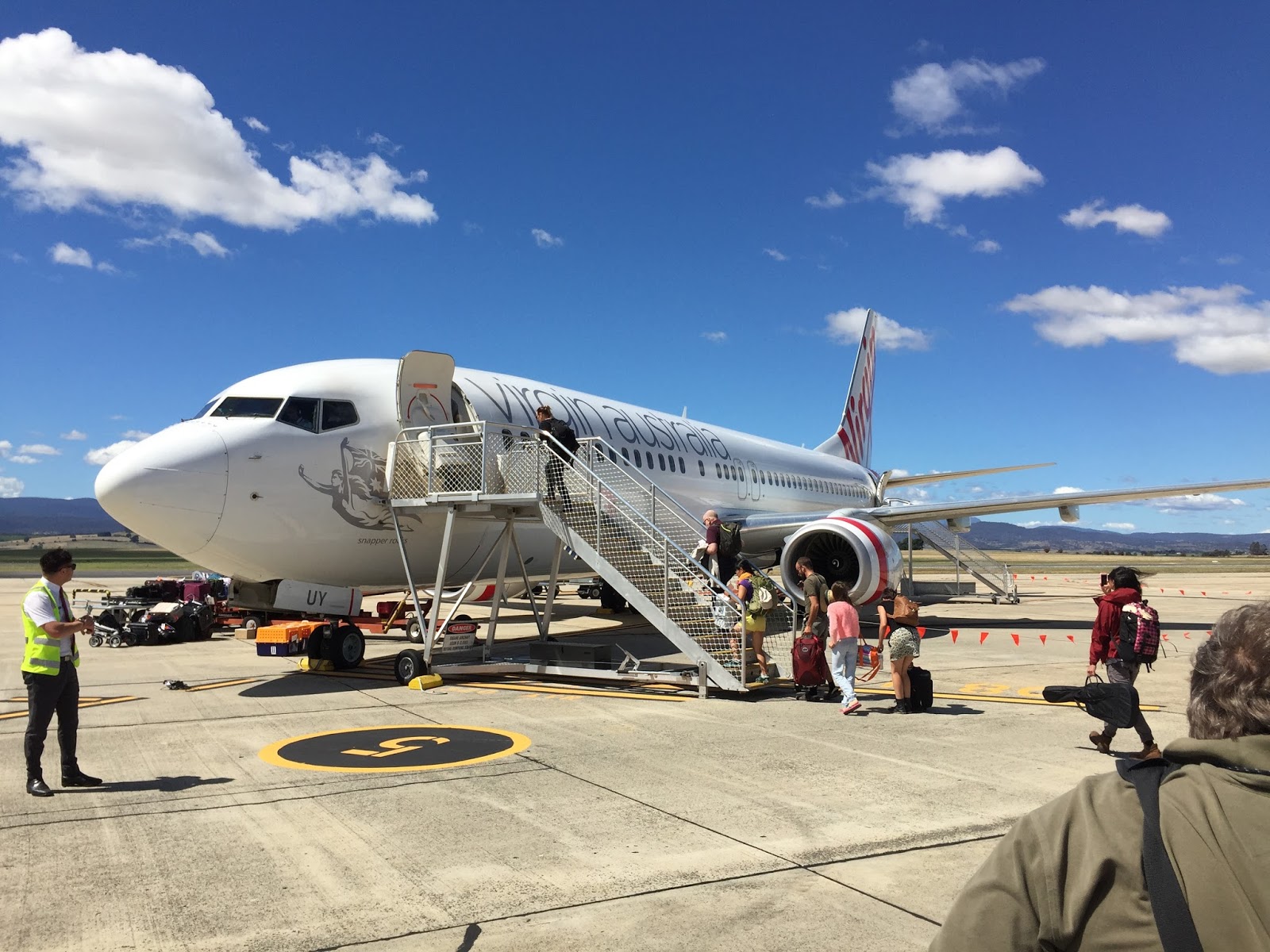
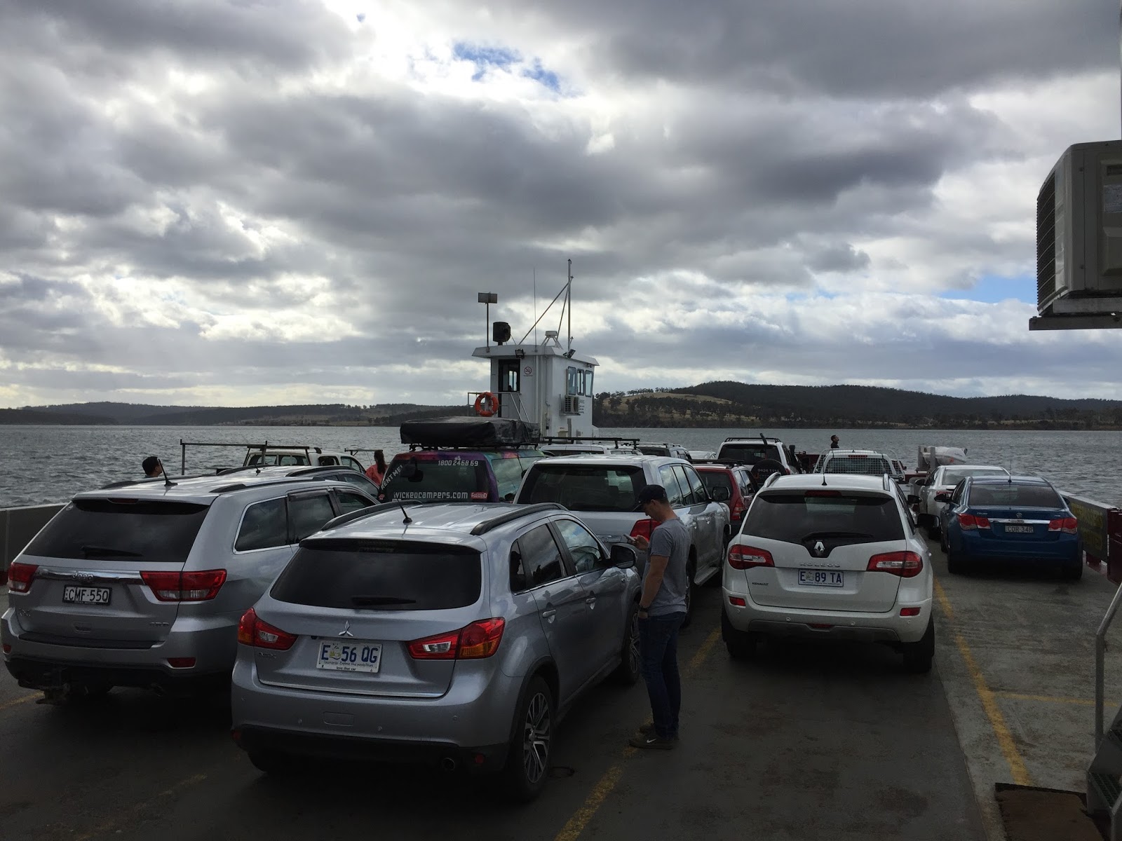
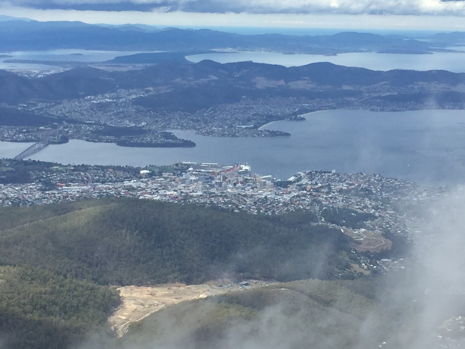
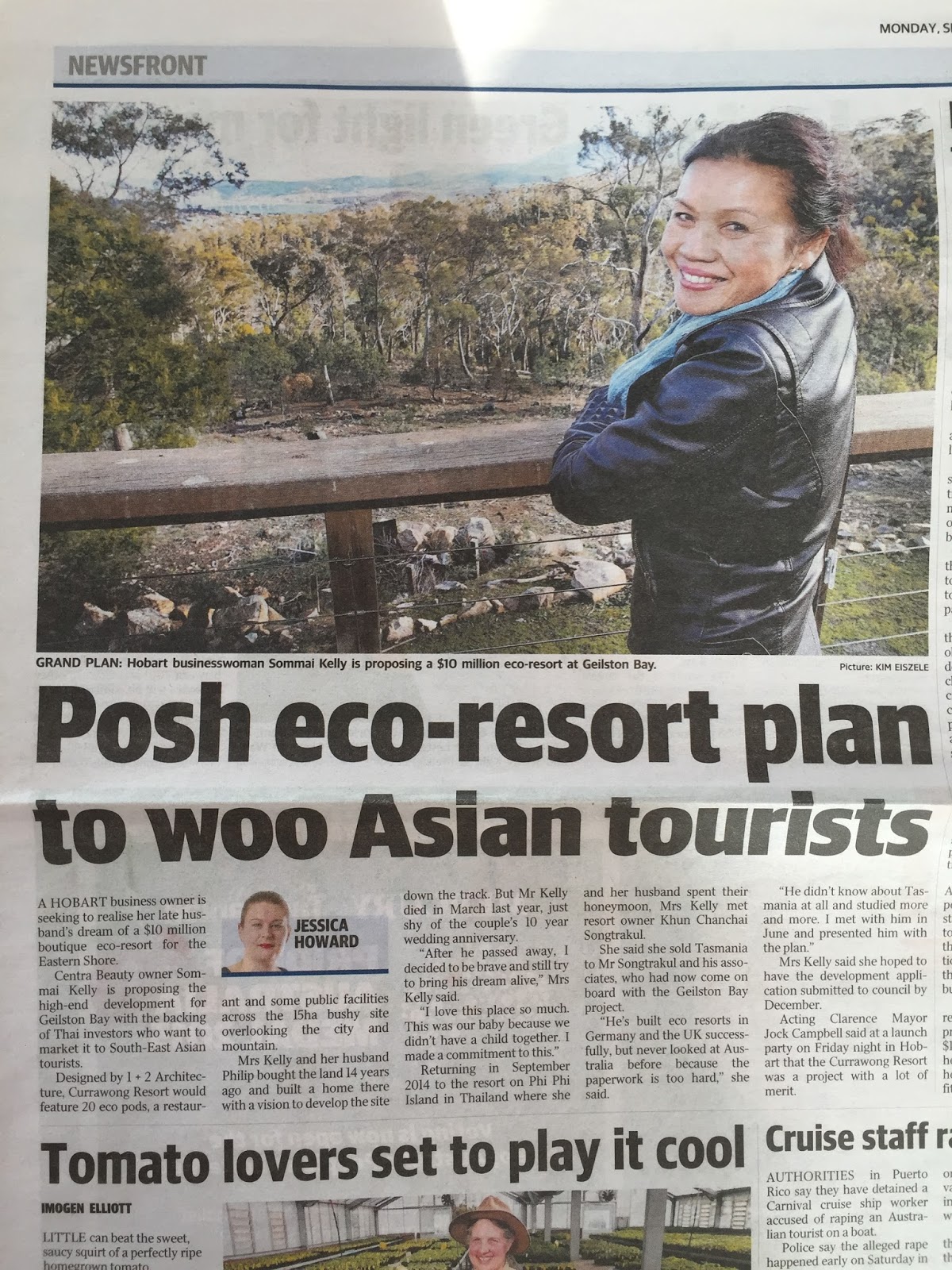
My day began with a huge, delicious breakfast prepared by my host Sommai. I ate quickly, jumped in the car and headed South to catch the ferry for Bruny Island (more below).  I had read it was about a 45 minute drive but had been told you can make it in 35.  I left a little before 9 so I assumed I probably would not make the 9:30 ferry but would have to wait for the 10.  However, I arrived at the entrance at 9:27 and they were just getting ready to start loading the ferry…score (or so I thought).

When I pulled up to purchase my ticket I found out they do not take credit cards (they take “tab” cards but I don’t think the US has that yet) and I did not have enough cash….ugh!  But the lady at the booth said, “there is an ATM about 100 yards ahead….you can pull down there, get the money, run it back to me, and they you may be able to catch the ferry”.  So I quickly pulled forward, got the money from the ATM, ran back to the booth (the lady was nice enough to meet me halfway :-), got my ticket, ran back to my car and pulled up just as the closed the gate behind me (this is like what, they 3rd time this has happened on this trip so far? ha ha).  So now I’m safely on the ferry heading to Bruny Island….
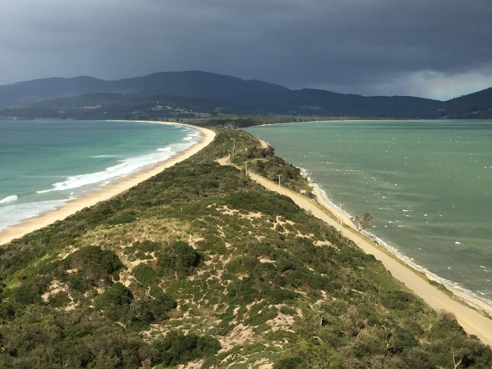
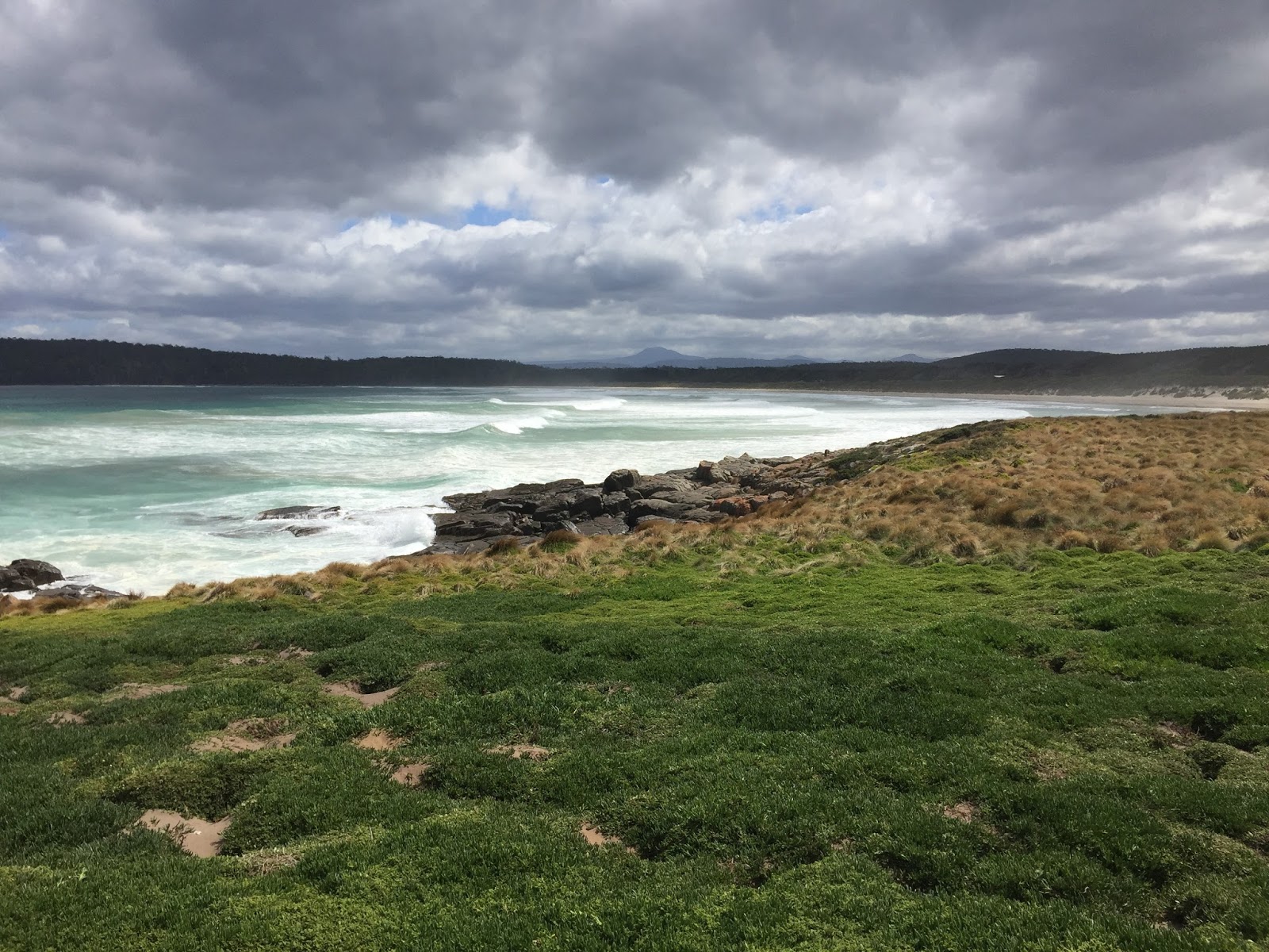
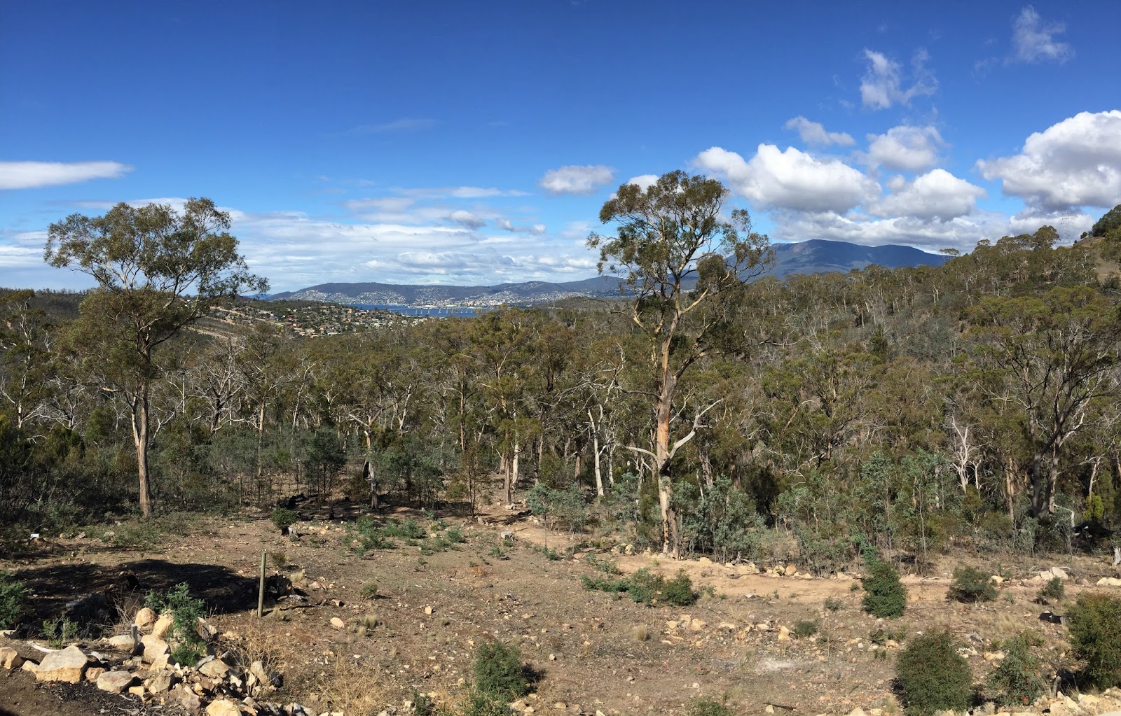
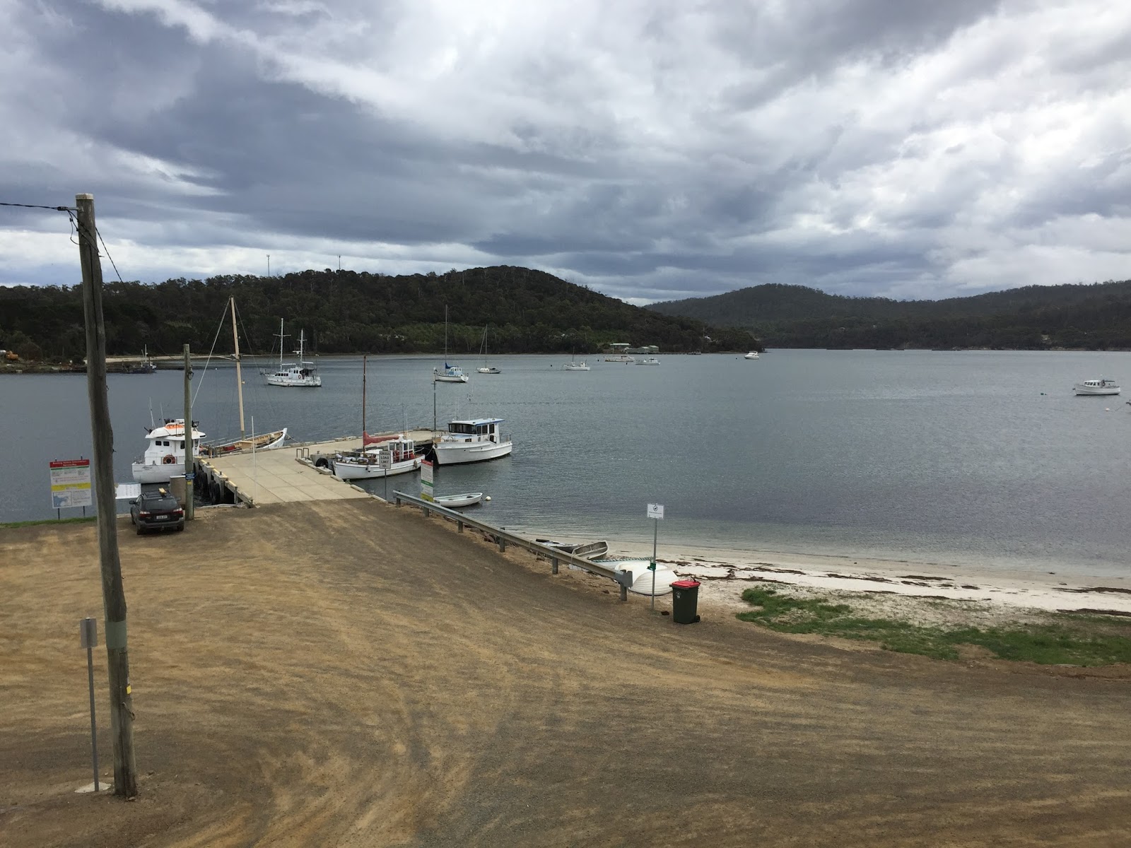
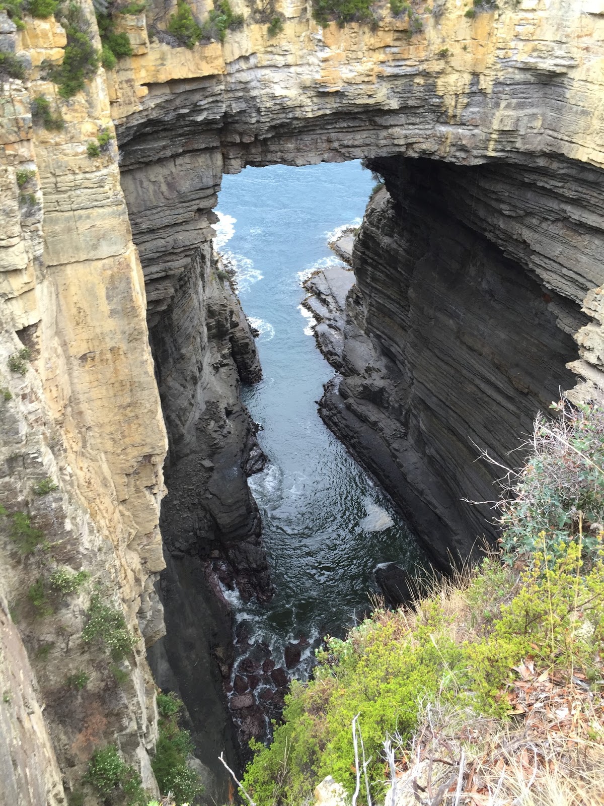
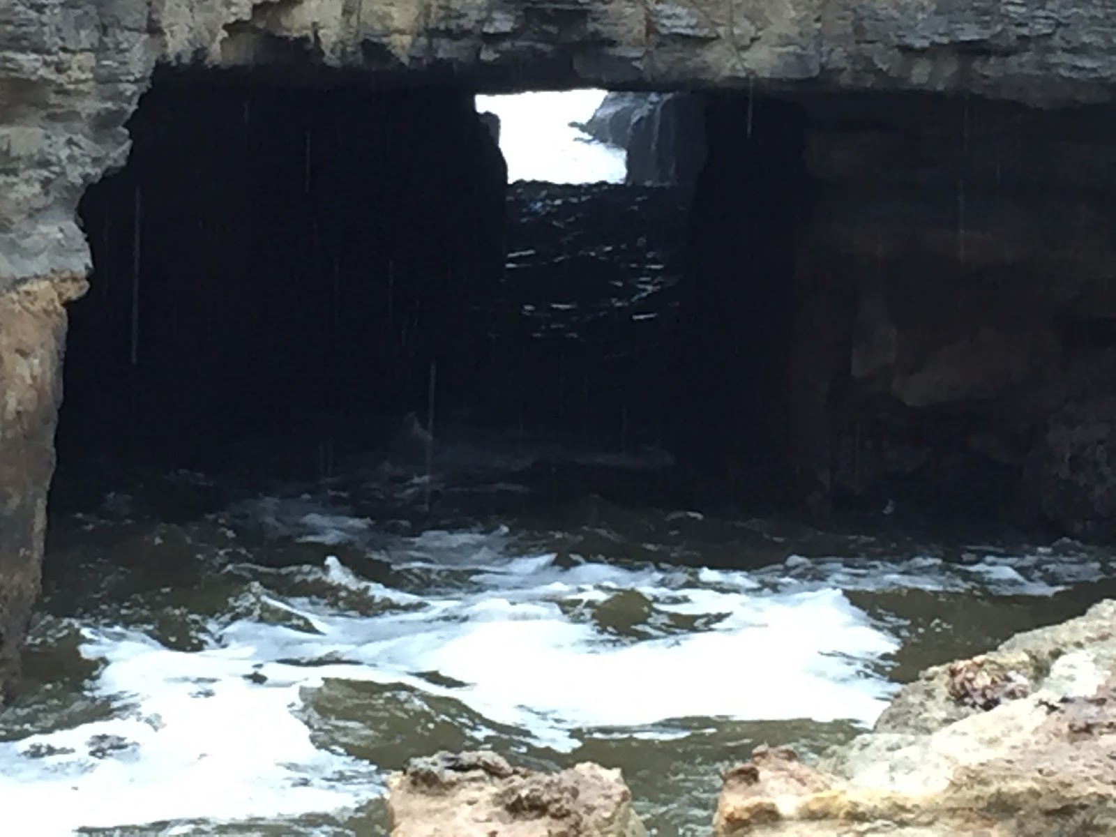
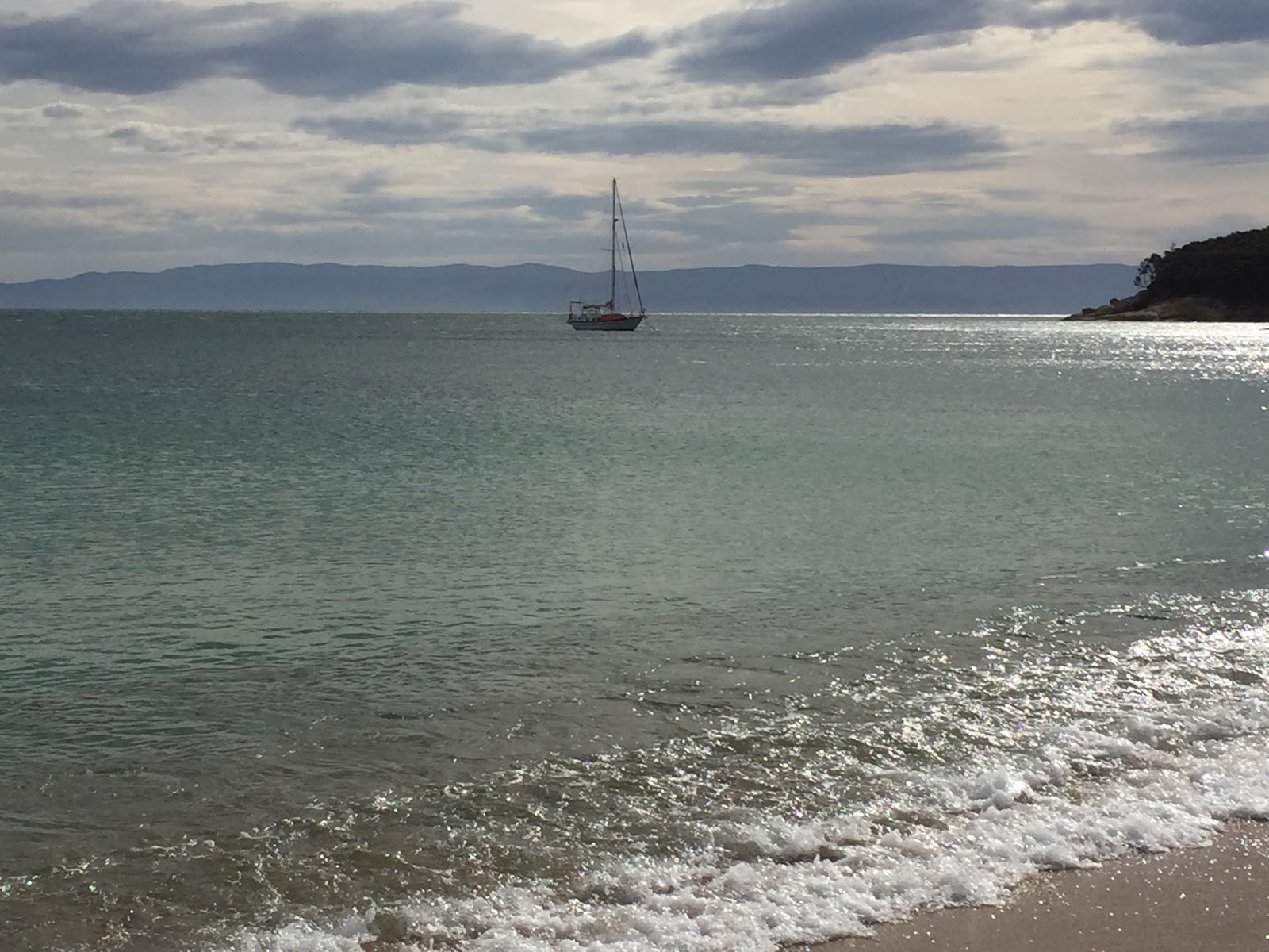
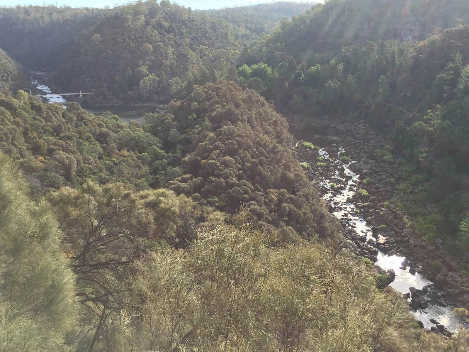
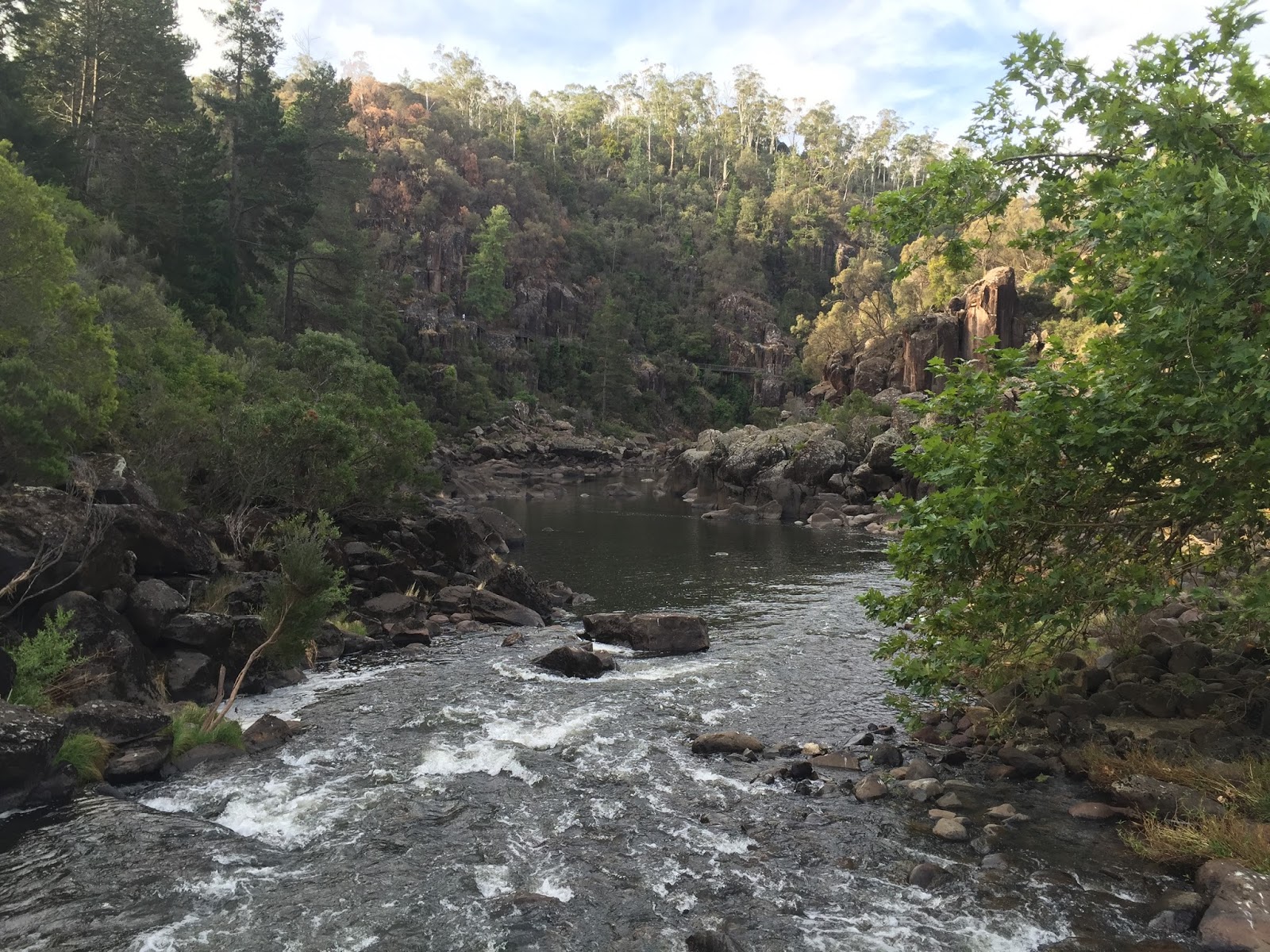
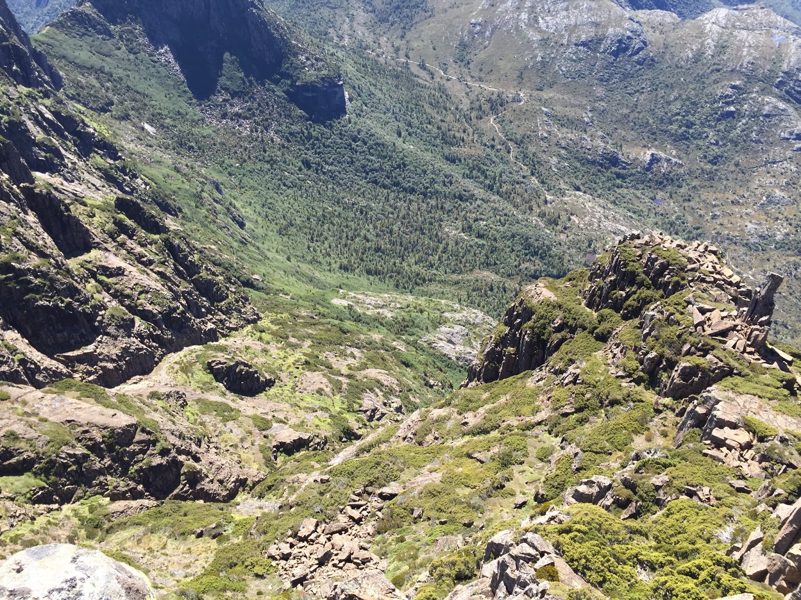
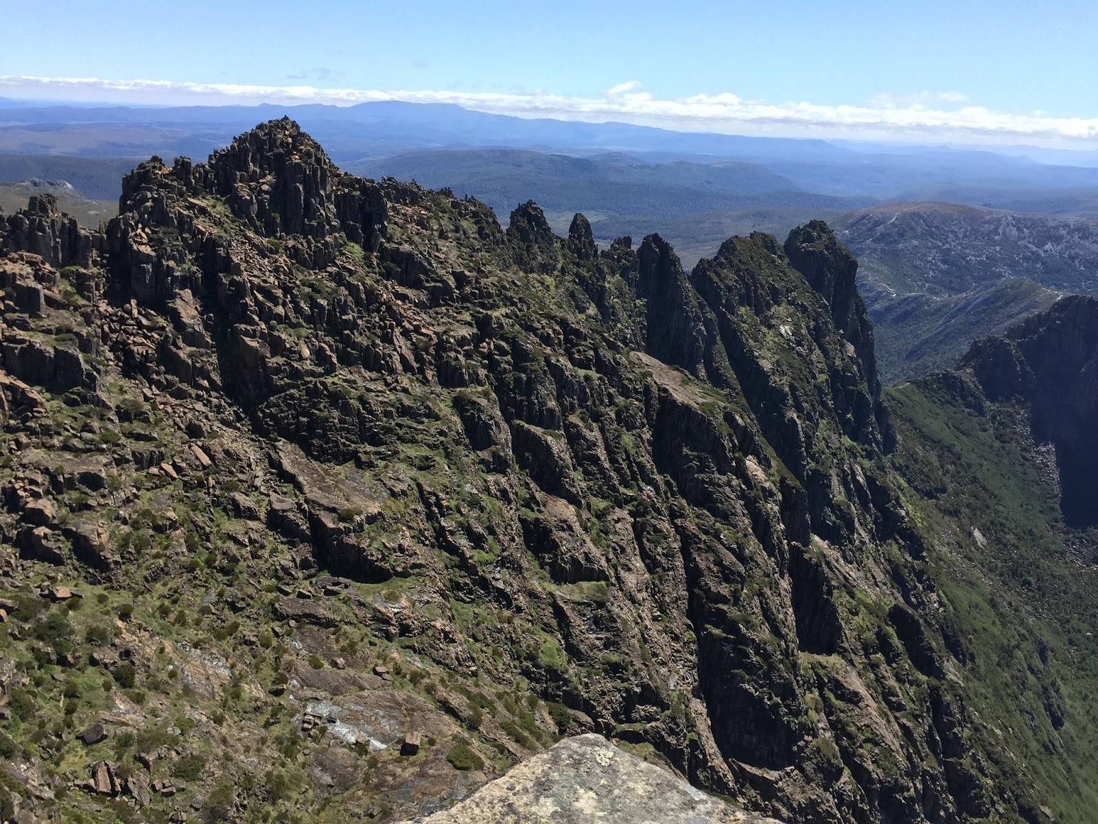
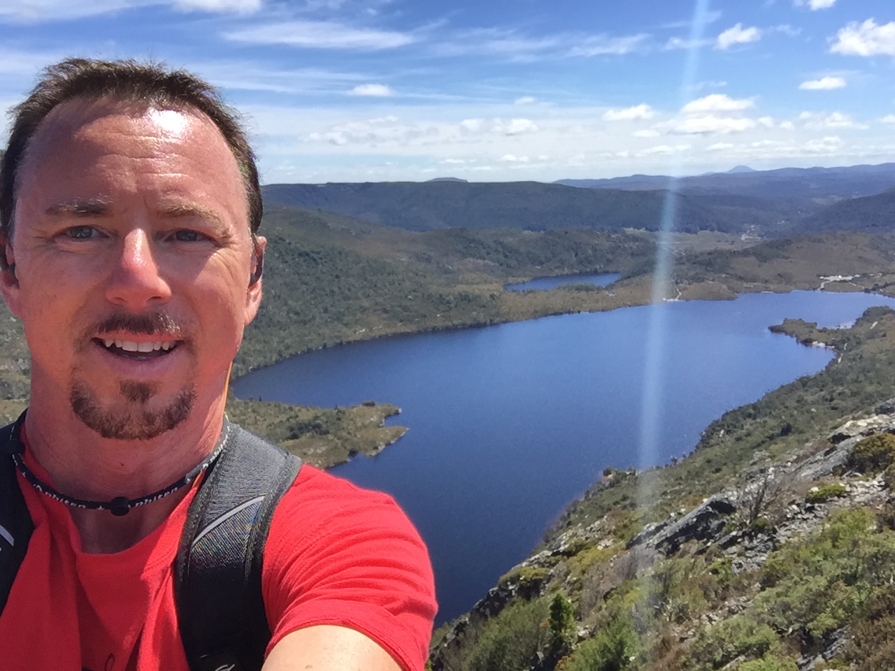
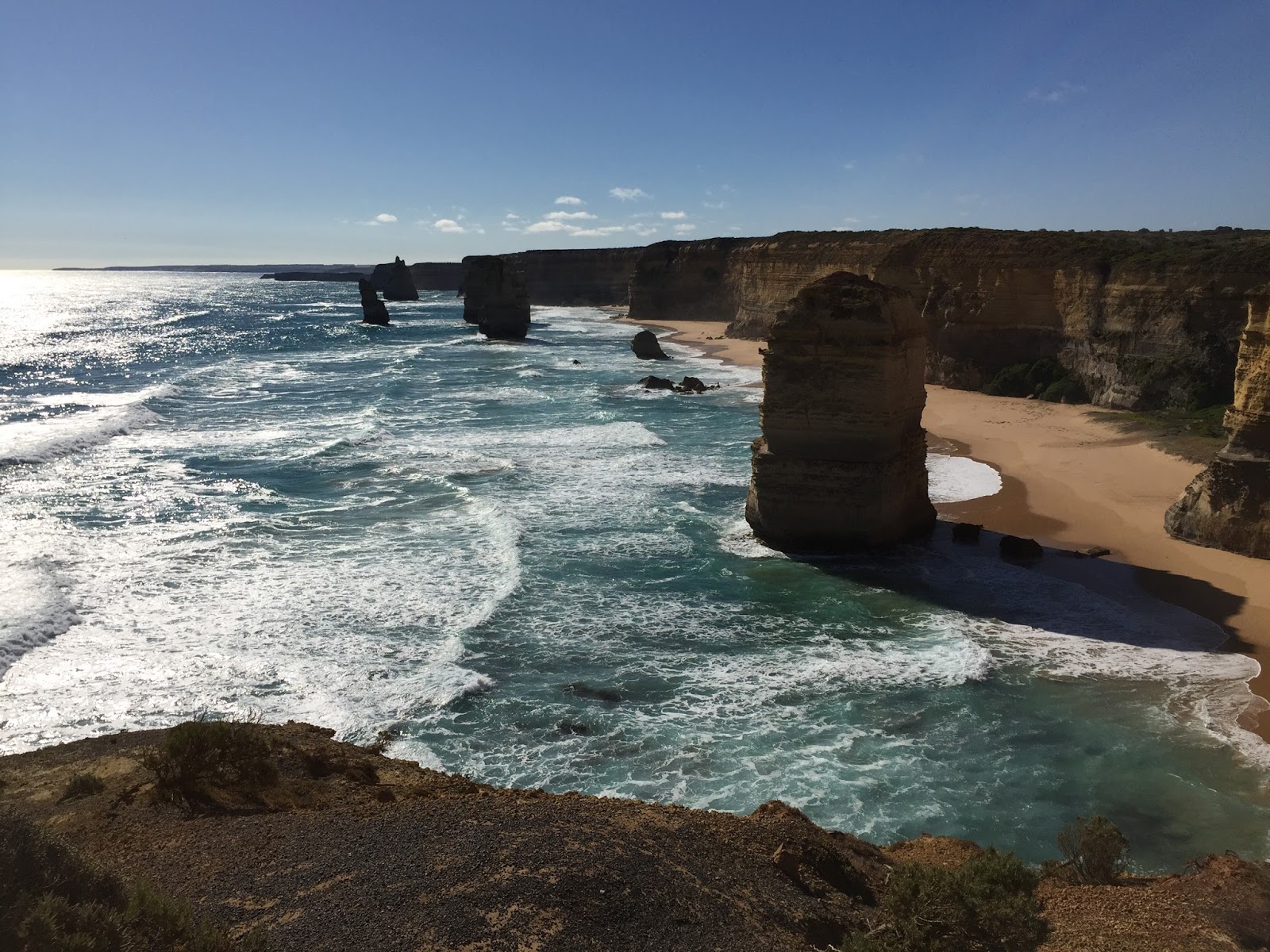
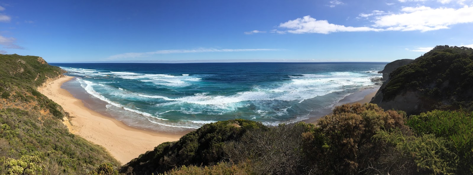
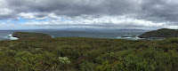
Bruny Island (GoogleImagesWeb Page) is an island off the south-eastern coast of Tasmania….or as Rick’s son Josh said, “so you went to an island, off of an island (Tasmania), off of an island nation (Australia)”….yeah, that’s it. 🙂  According to Wiki,  “Geologically, Bruny Island is actually two land masses – North Bruny and South Bruny – that are joined by a long, narrow sandy isthmus” (isthmus = “a narrow strip of land with sea on either side, forming a link between two larger areas of land”).  My first stop after reaching Bruny Island was the lookout at the “Neck” (the isthmus).  It was very beautiful and VERY windy.  Seriously, we’re talking tropical storm winds here….crazy windy.  But the view from the top of the dunes was well worth it…..

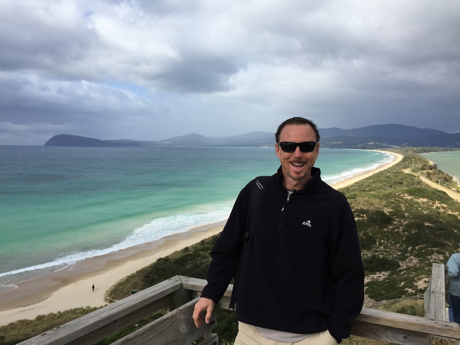
While I was standing at the top looking around I asked a young couple if they would take my picture.  As soon as I spoke they asked where I was from, as they could tell I was from the US :-), and we started talking.  His name was Tenzin and he was from Salt Lake City.  Her name was Aranya and she was from London. They had met while studying in NY and were both doing exchange studies in Melbourne.  After a few minutes they asked if I could give them a ride to the next small town beyond the Neck (Lunawanna).  I said sure.  I asked where they were headed and they said they were not sure.  They confessed that they hadn’t really planned the day very well and thought they would just walk around or bike around Bruny Island. The problem with that is that Bruny Island is over 100 km long (a little over 60 miles)….as Homer Simpson would say….D’oh! They had actually done pretty well to this point as they had taken a bus from Hobart, came across on the ferry without a car and a “nice older lady” had picked them up at the ferry and brought them to the Neck.  So I said, “I’m heading to the lighthouse at the southern tip and then working my way back up through the island and planning to catch the 6 PM ferry back….you’re welcome to ride along if you like”.  They were elated.  So off we went.  🙂

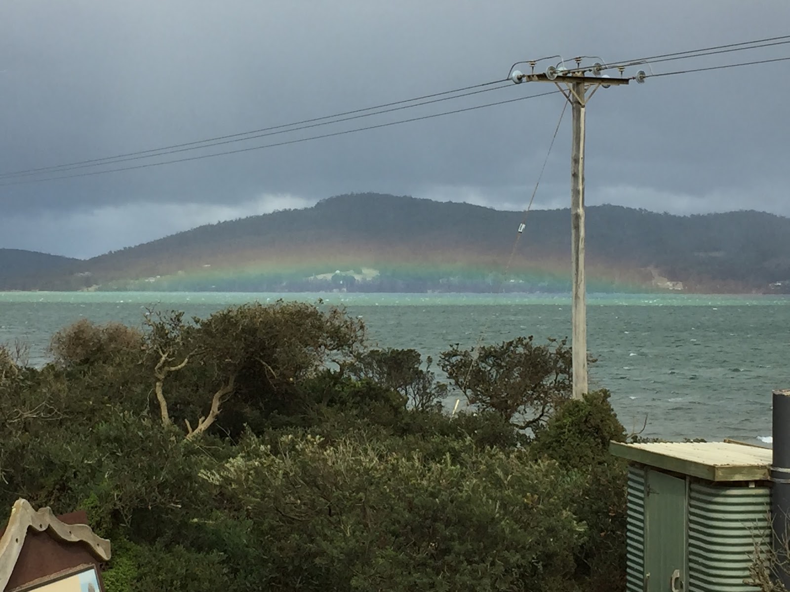
As we began to drive south a very cool rainbow appeared just above the ocean….

So as we began talking and getting to know each other we drove no more than probably 8 miles or so and saw another girl standing at the side of the road and looking for a ride. I stopped and she asked if we could take her to her job about 5 miles down the road.  I said, “sure, we’re heading that way and I still have one seat left” :-).  So I came to Bruny Island alone and within 15 minutes I had a carload. ha ha  These are exactly the kind of spontaneous things that happen when you travel (fellow travelers know what I mean) that I LOVE!  Like the overnight train I took from Vienna to Zurich one time with 6 people (from 5 different countries) crowded into a small room about 3 times the size of a toilet stall….it was awesome!

So our newest “carmates” name was Sophie and we could tell, before she told us, that she was from France.  She said she had been working at a winery on Bruny Island for the past 2 months. She said she was leaving in a few weeks to travel to Cairns (I will also be in Cairns around the end of March to dive the Great Barrier Reef).  We all asked her questions about Bruny and her experiences there. She said she loved it and had made some good friends.  It only took about 7 minutes for us to arrive at the winery where Sophie got out, thanked us for the fire and invited us to stop in later if we had time and do some wine tasting.  I told her we just might and headed south once again.

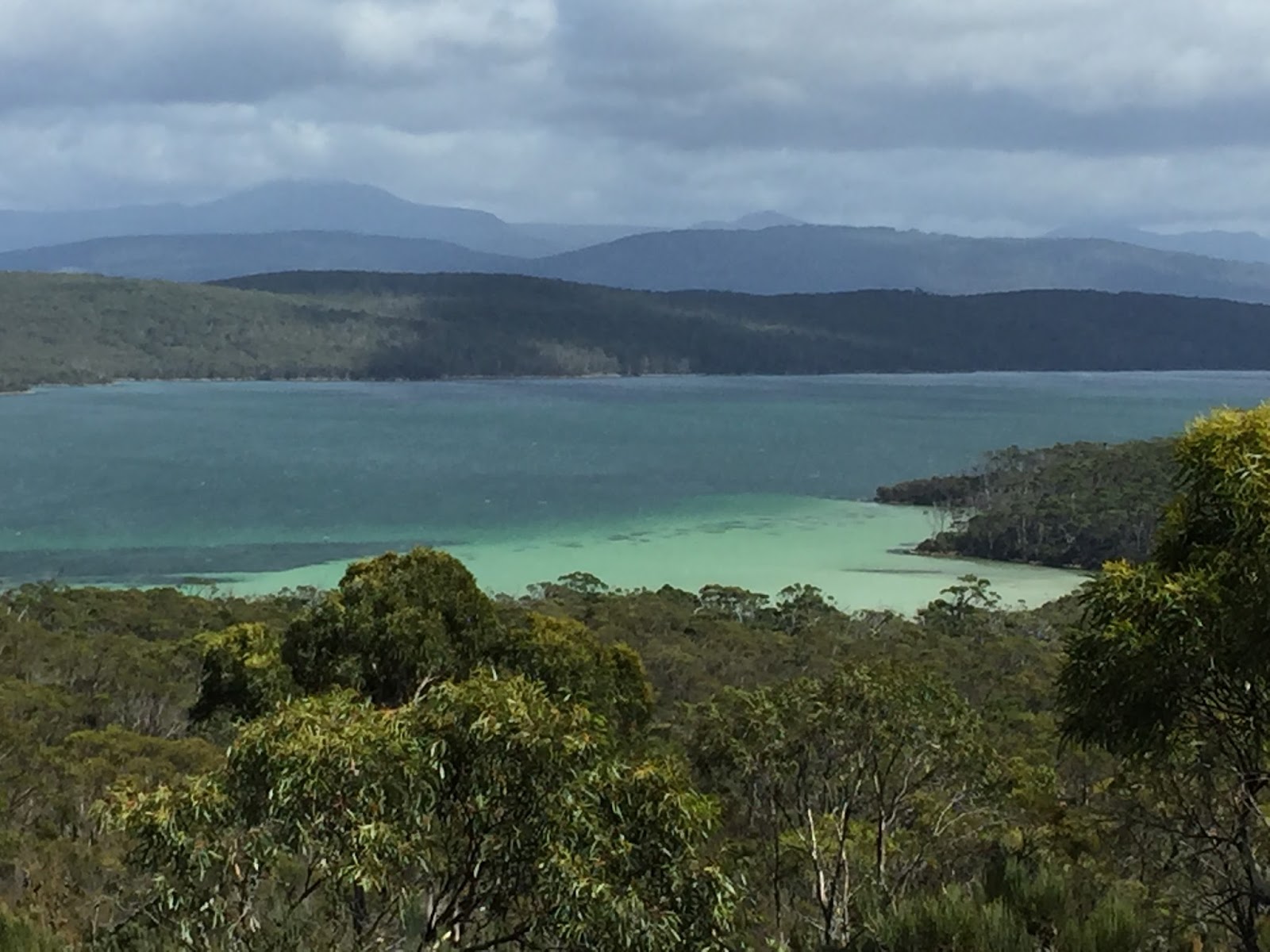
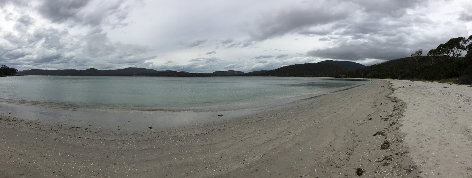
On our way to the lighthouse we passed a small bay where the water was just an amazing (#1) shade of green….

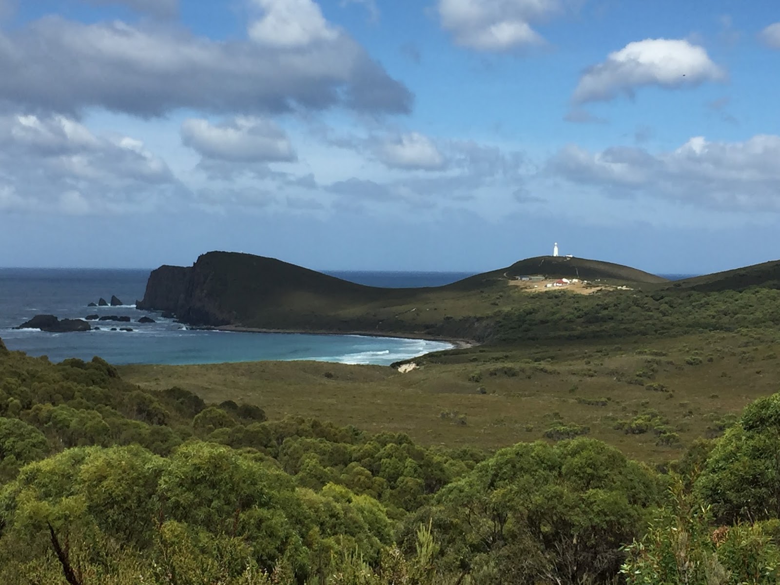
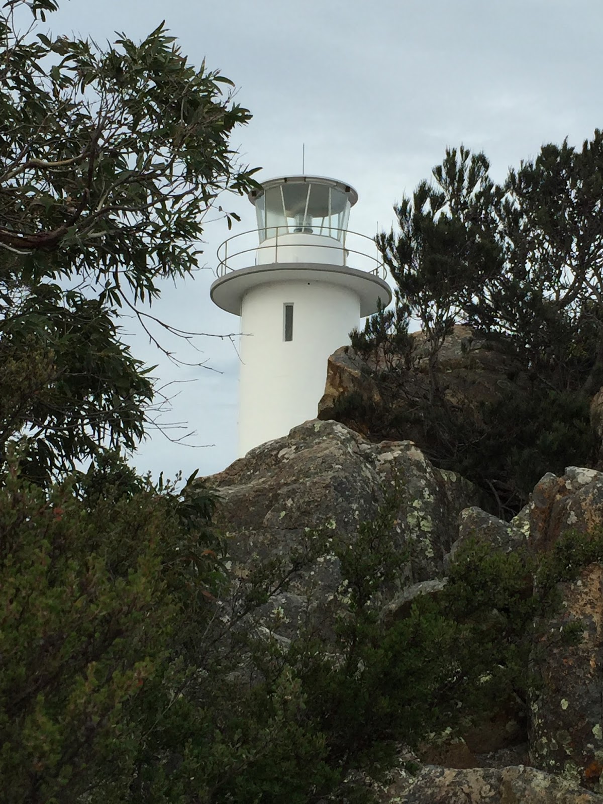
After about 15 more minutes of driving we topped a little hill and got our first look at the Cape Bruny Lighthouse.  All 3 of us literally said in unison, “WOW”.  The whole area was just unbelievably beautiful. We immediately stopped and started taking pictures….
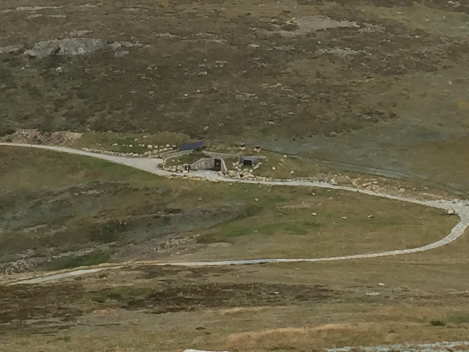
The Cape Bruny Lighthouse (GoogleWiki) was first placed into service in 1838 making it the second oldest extant lighthouse tower in Australia.  It was a beautiful site perched on the hill and glistening in the sun.

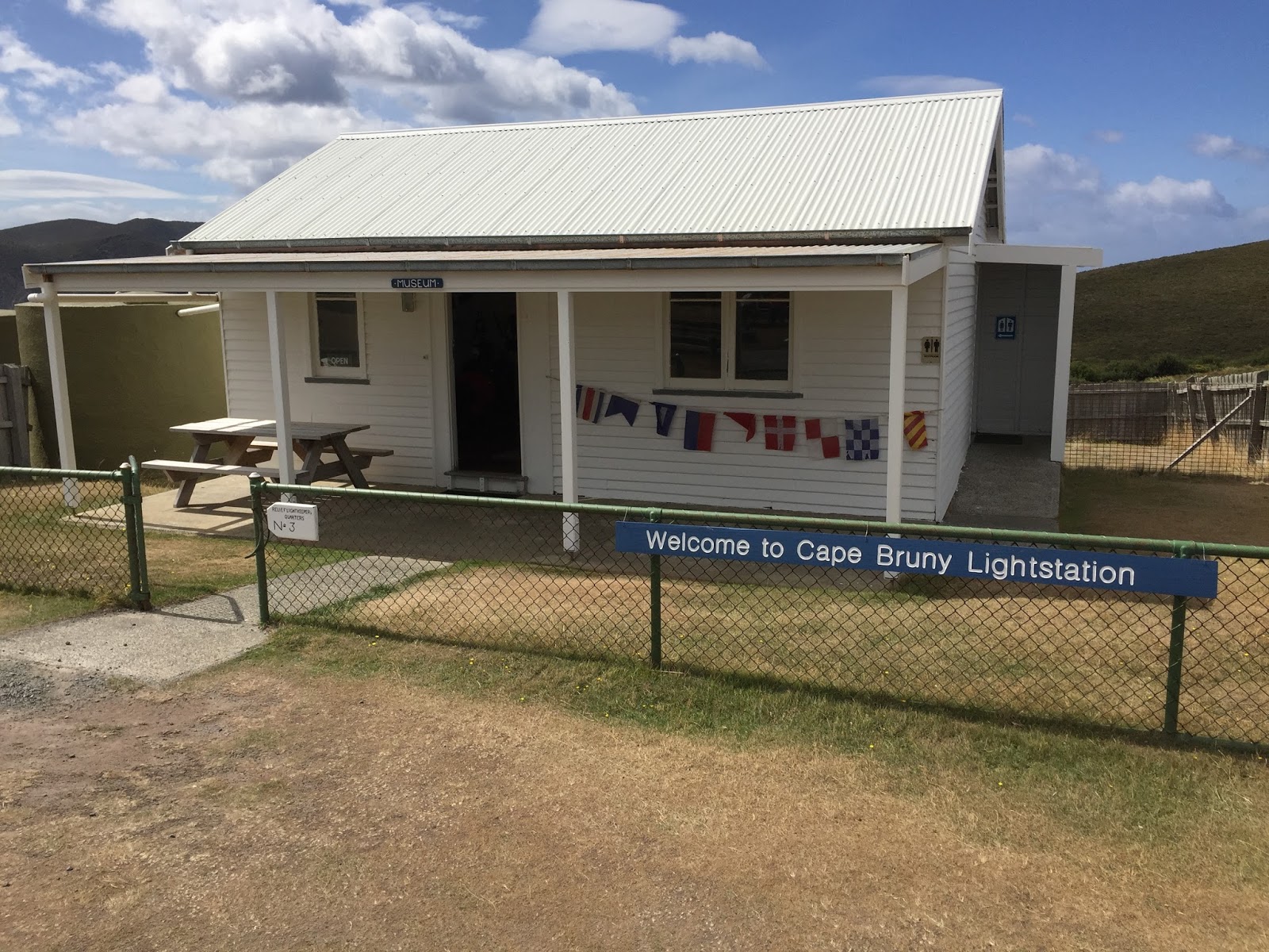
We drove up to the parking area and I took a few minutes to tour the small “museum” which used to be the light keepers residence.

This was kind of cool….the couple who signed the visitors book just before was from Knoxville, TN.  🙂
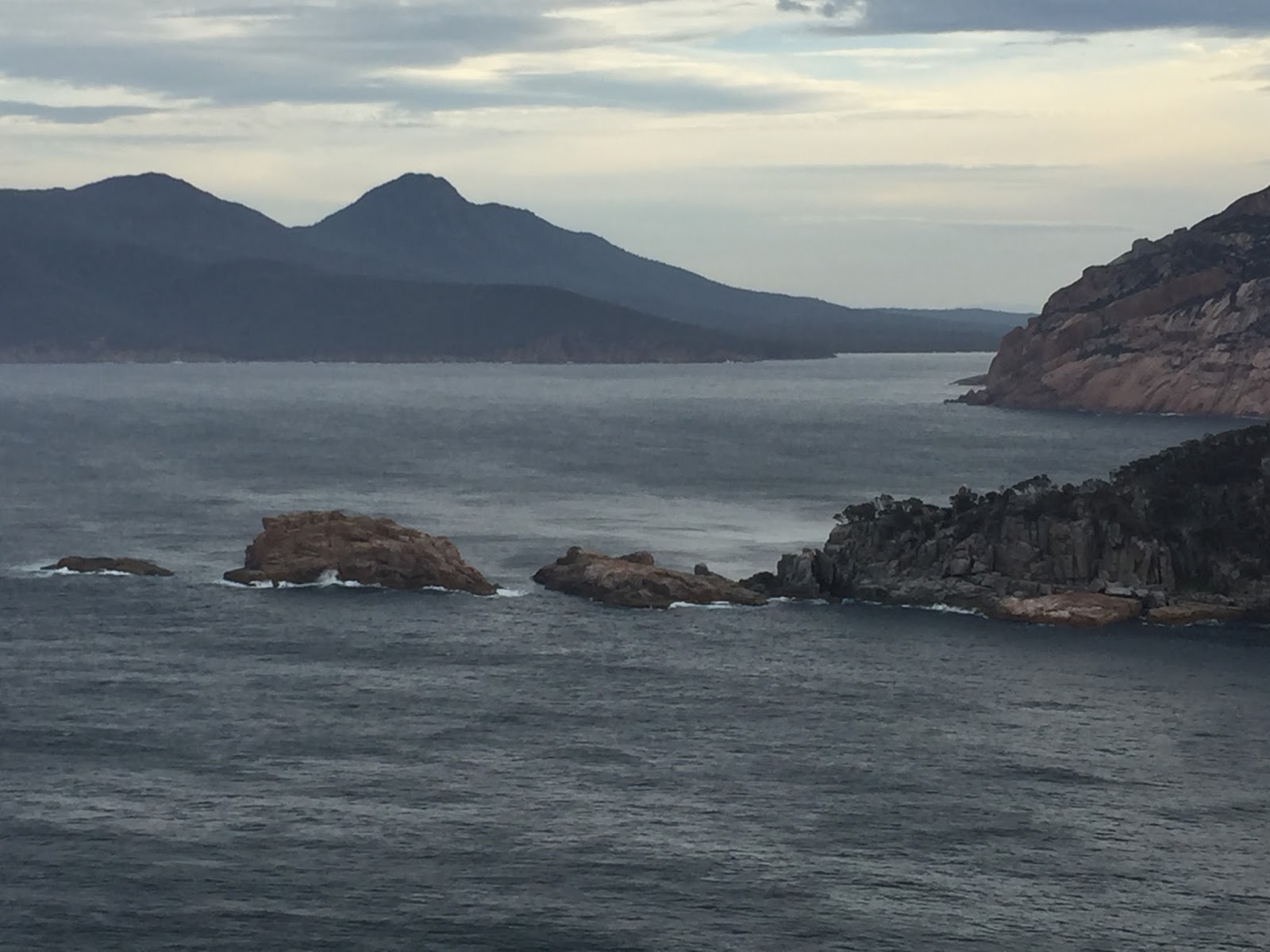
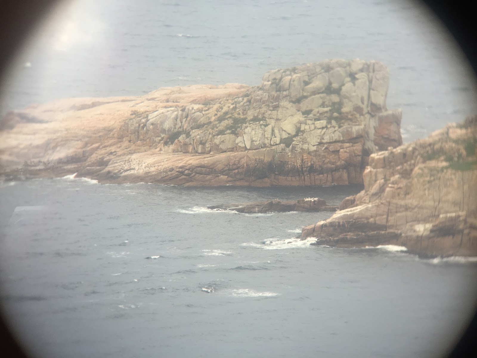
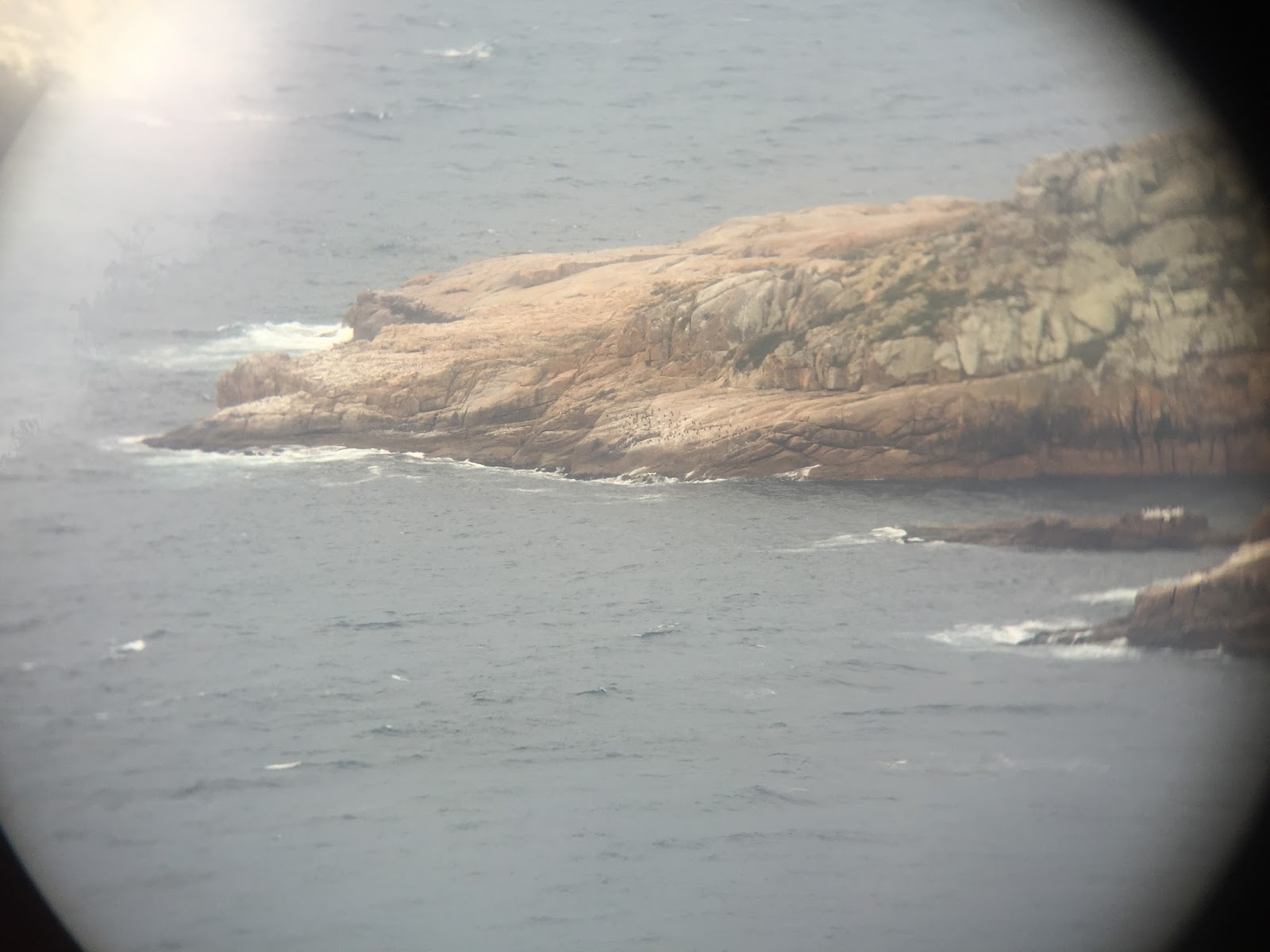
The view from the hilltop was stunning (a new adjective to add to the list :-)….


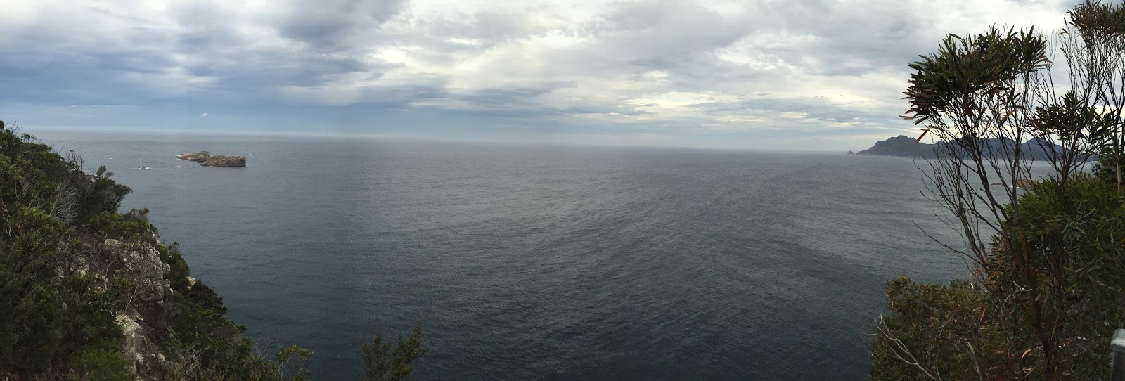
And it was really cool to me (a guy from the northern hemisphere) to stand there and look out over the Southern Ocean and know that the next piece of land was Antarctica. There is just something that is really cool about that to me.  I would love to go to Antarctica…but that will have to be another trip. 🙂

As some of you know I checked in on FB while standing beside the lighthouse (for some reason the best reception I had all day was at the point) and said that may have been my most southern point on this trip.  I said may because I was thinking that New Zealand was more south but I didn’t know which was closer to Antarctica. So that night I checked and the southern tip of New Zealand is further South; however, because of the shape of Antarctica the southern point of Tasmania is actually closer to Antarctica than New Zealand.  So there is your geography lesson for today. 🙂

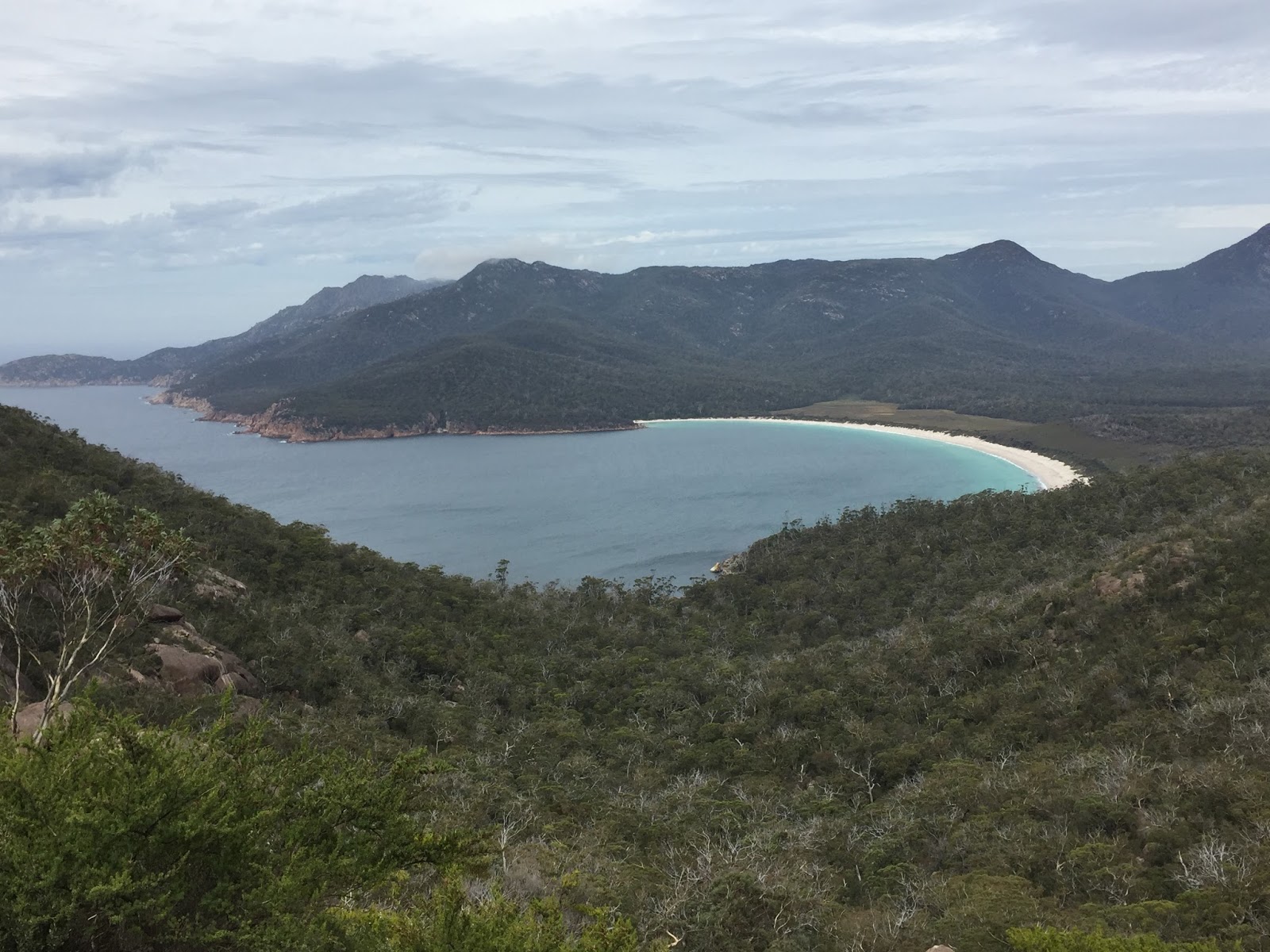
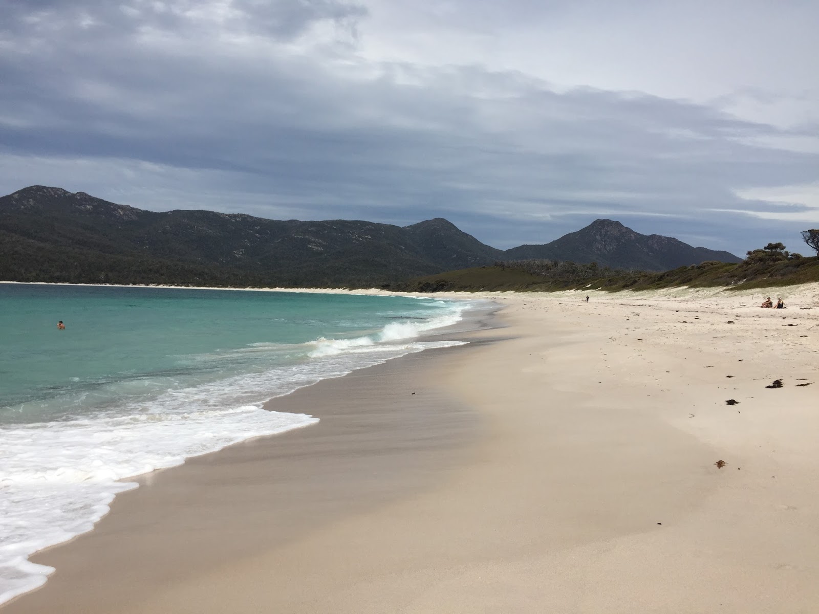
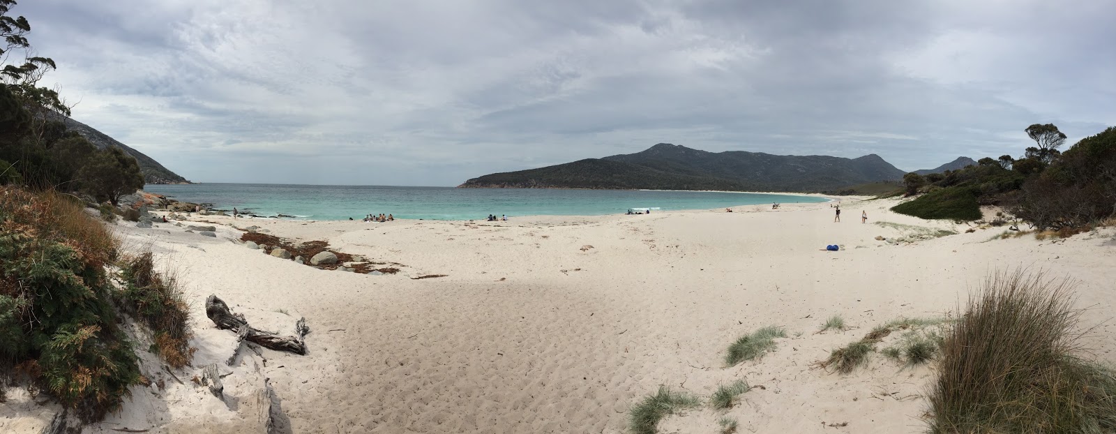
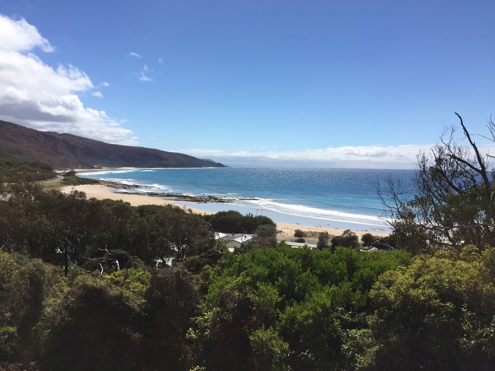
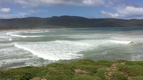
After a long visit we left the lighthouse and headed to a place I saw on the map called “Price’s Lookout” (of course I had to go there :-).  Price’s Lookout looks out over Cloudy Bay (Wiki).  Cloudy Bay is a large bay with big waves crashing over a long, gradual sloped beach.  Standing at the point and looking out at it I immediately thought, “this looks like a great place to surf” (admitting that I know nothing about surfing, :-).  Well, as it turns out each year Cloudy Bay plays host to the ‘Bruny Island Surf Classic’ – a Tasmanian surfing championship held on the island.  So I guess you don’t have to be a surfer to know good surfing areas when you see them.  🙂  Looking out over the waves I couldn’t help but to think of my good friend Rob and his brother Jim..the only “surfer dudes” I know.  🙂

Bruny Island
After a little hiking at cloudy bay we stopped back at the Bruny Island Premium Winery (Web Page), which is Australia’s most southern winery, and did some wine tasting.  They had a very nice Sauvignon Blanc but being more of a red drinker I liked the 2013 Pinot Noir Reserve.  So I bought a bottle for Rick and Linda…I hope they like it too.

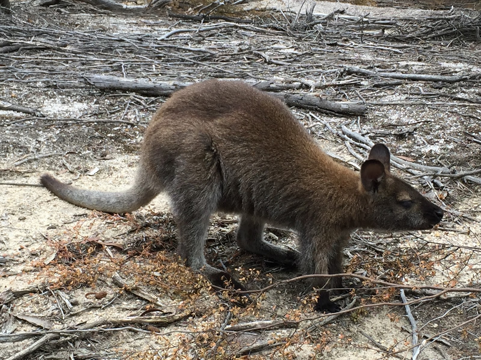
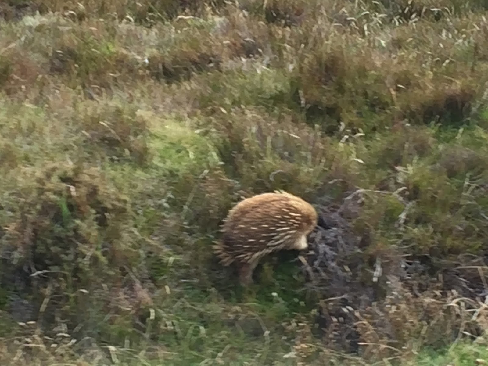
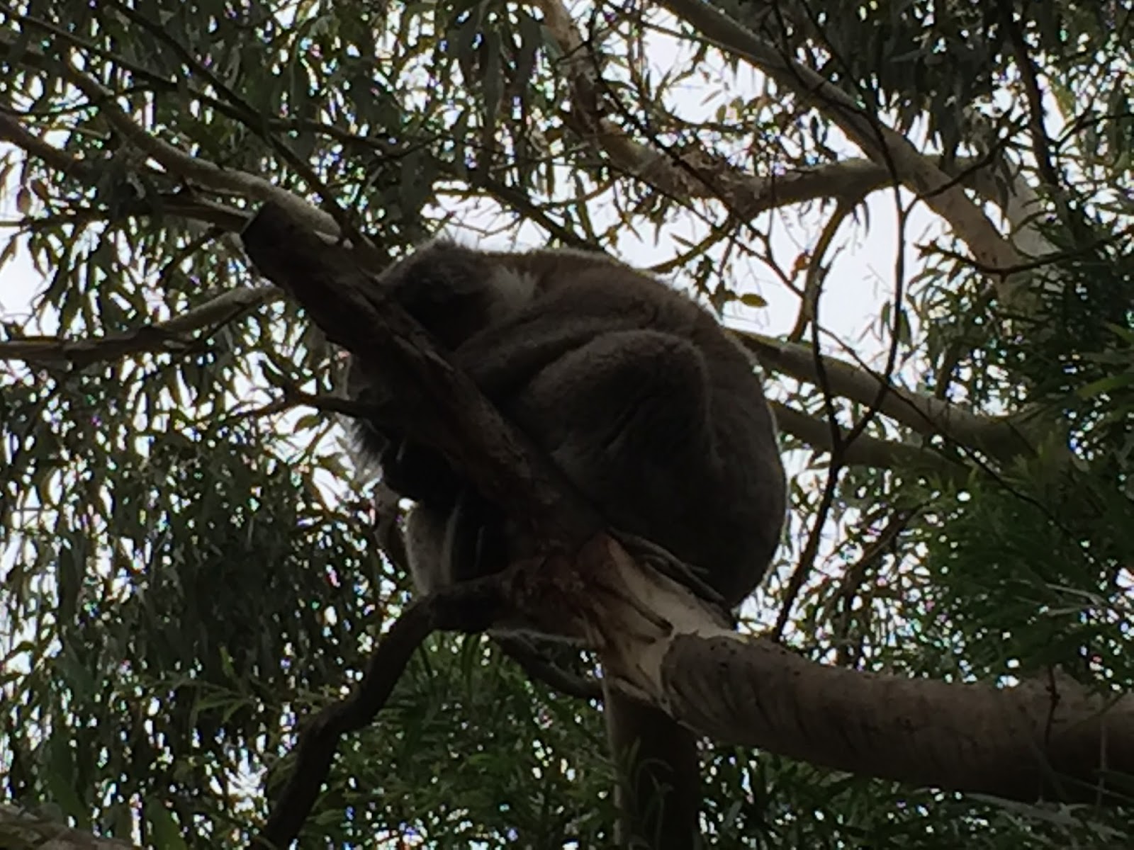
We said hello to Sophie and then left the winery and started driving back to the northern part of the island.  We drove back across the “Neck” and stopped to see if maybe any penguins had come out (they frequent this area) but unfortunately they had not.  They normally come out later in the day/evening and since the last ferry leaves at 7:15, unless you’re spending the night on the island (which we were not) you may not see them.  But it was worth stopping for.  We did see an echidna from the road but he disappeared into some thick brush before we could get his picture.

After touring the northern beaches we started to make our way back to the ferry.  In speaking with Tenzin and Aranya earlier in the day I found out that they were flying back to Melbourne later this evening from Hobart.  They were planning to take the bus back to Hobart.  I told them that I have to drive straight through Hobart to get back to the place I was staying so I would be more than happy to take them back to their place.  Once again they were very excited and appreciative.

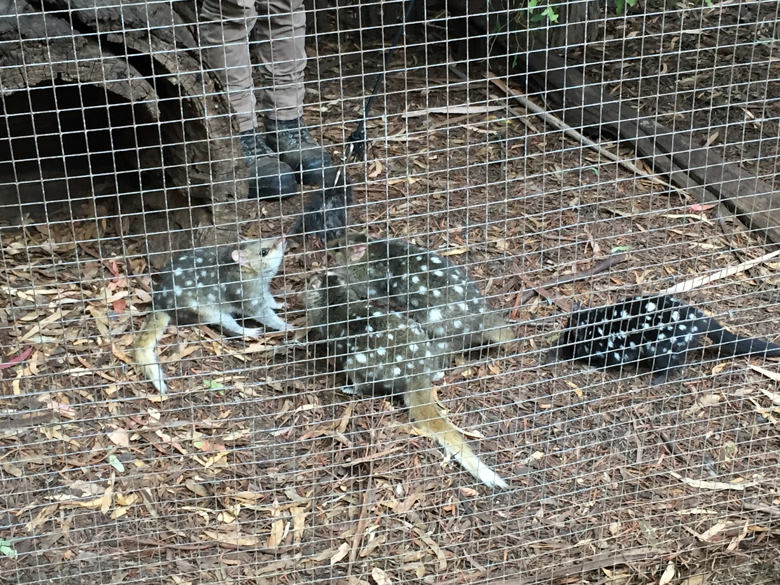
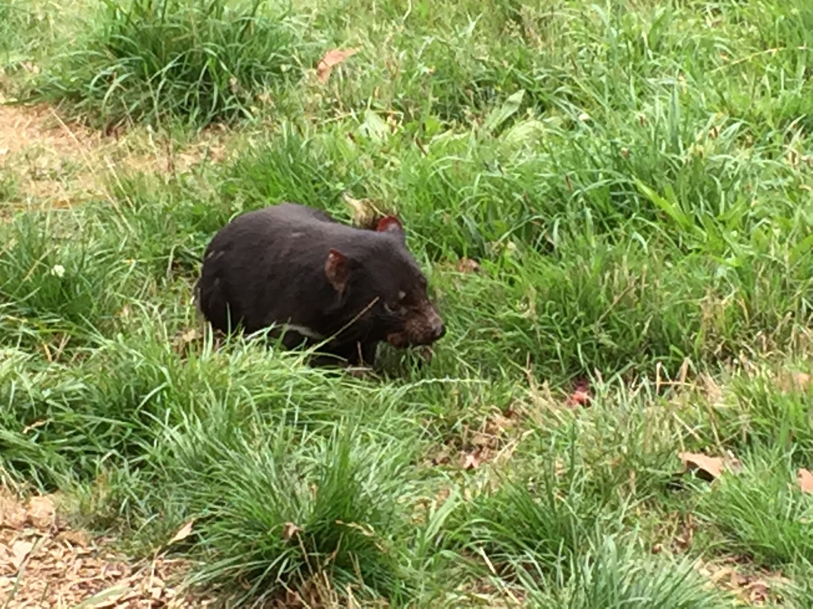
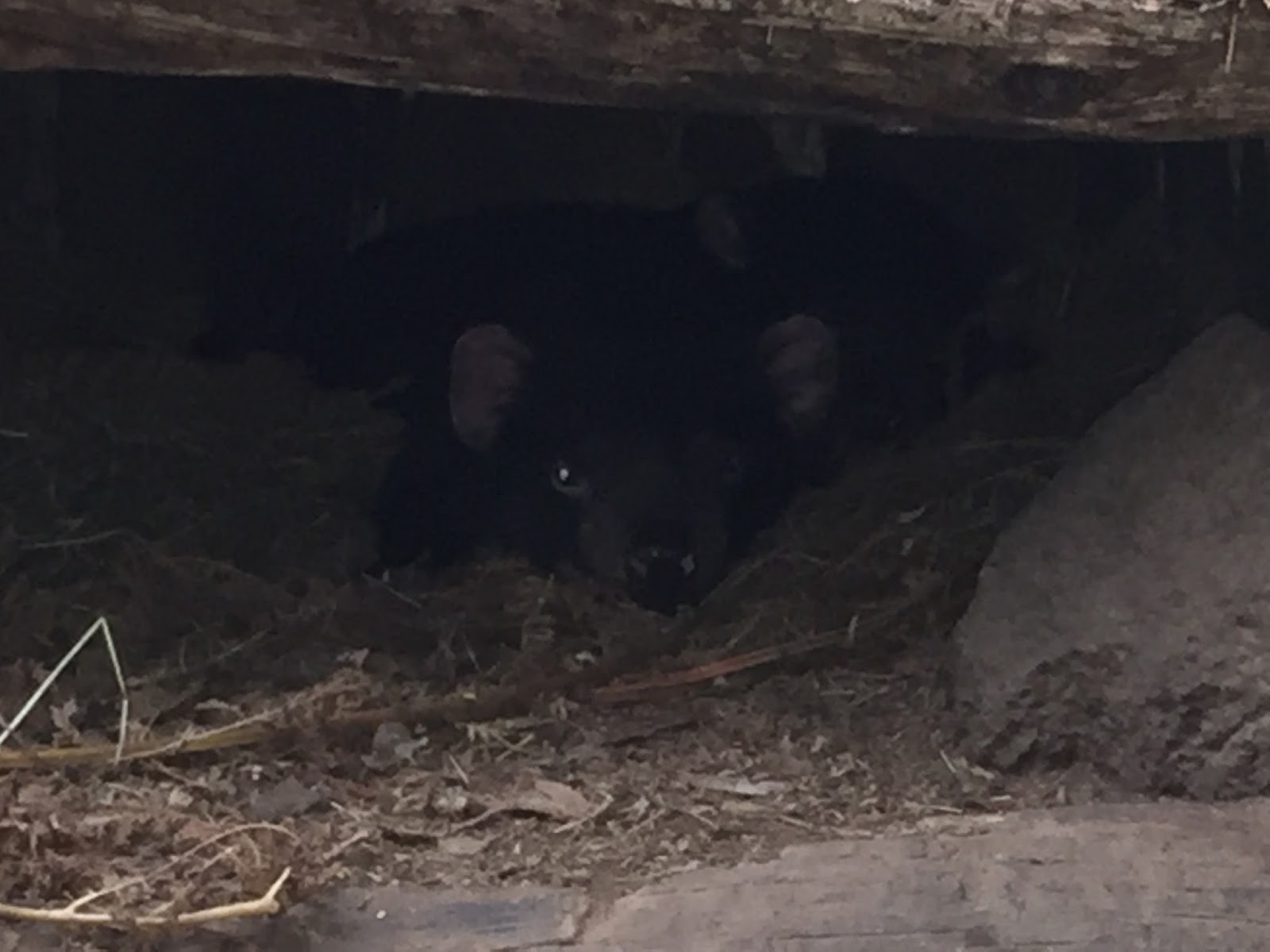
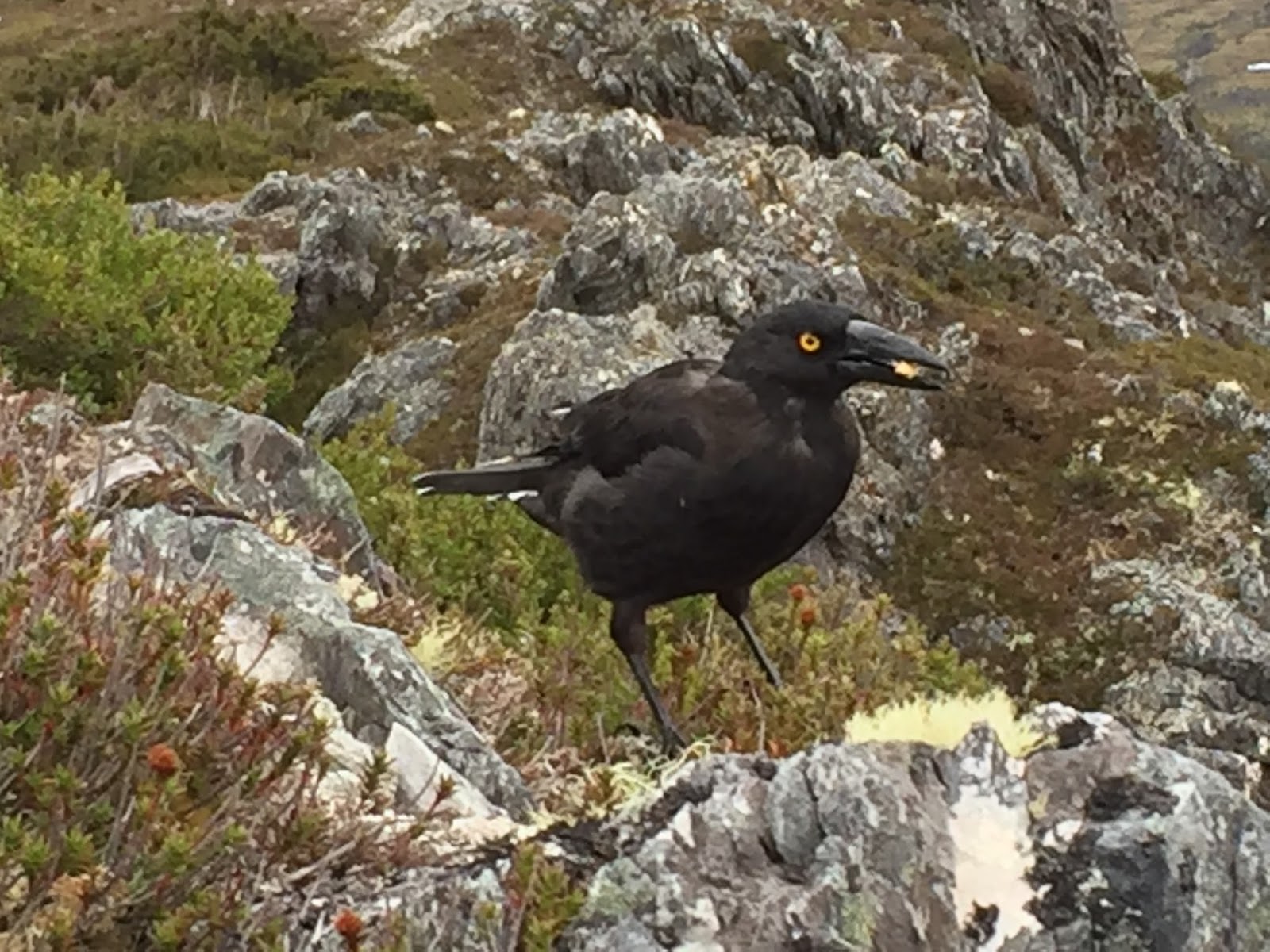
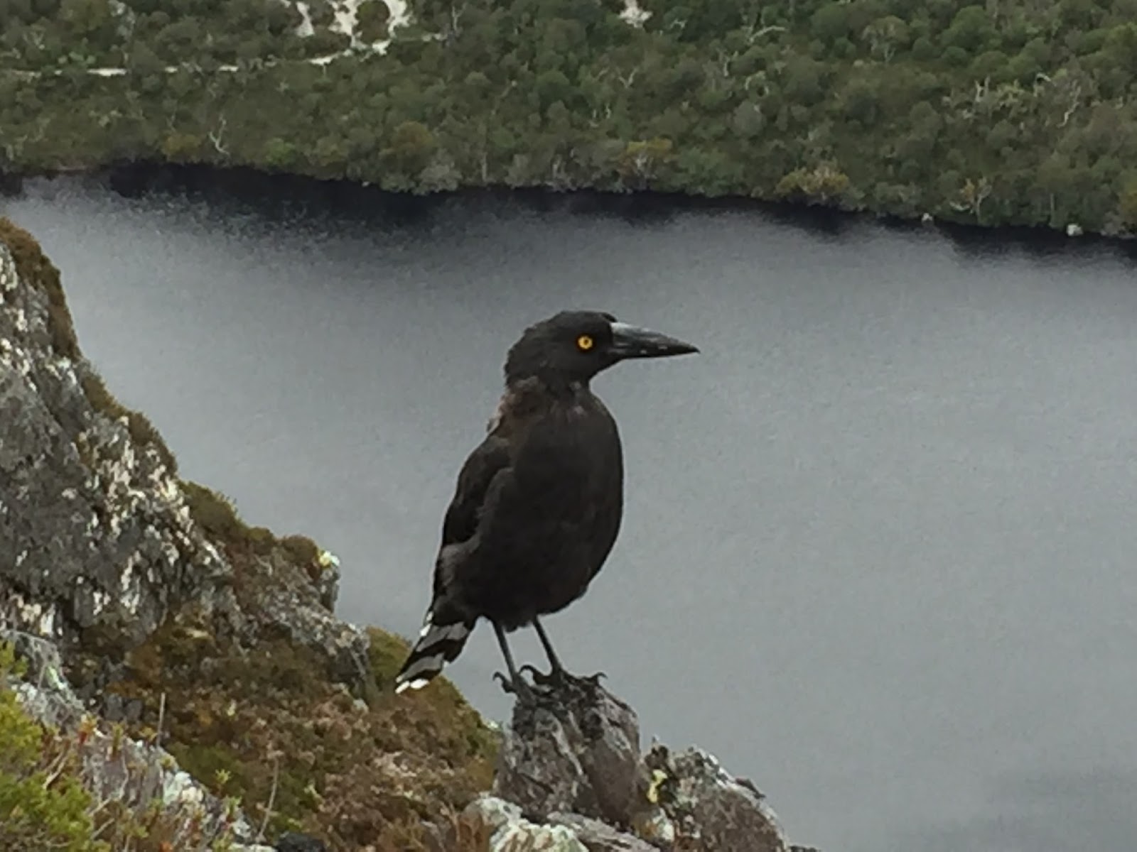
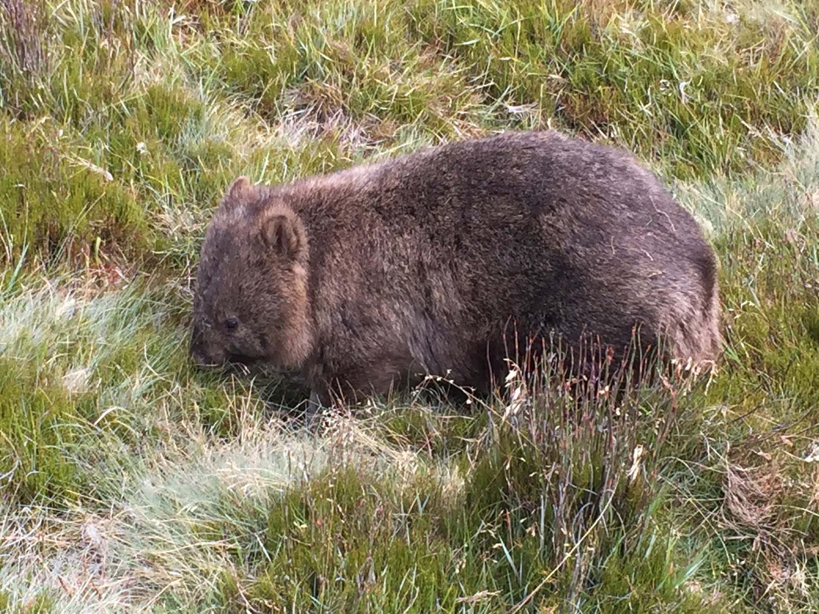
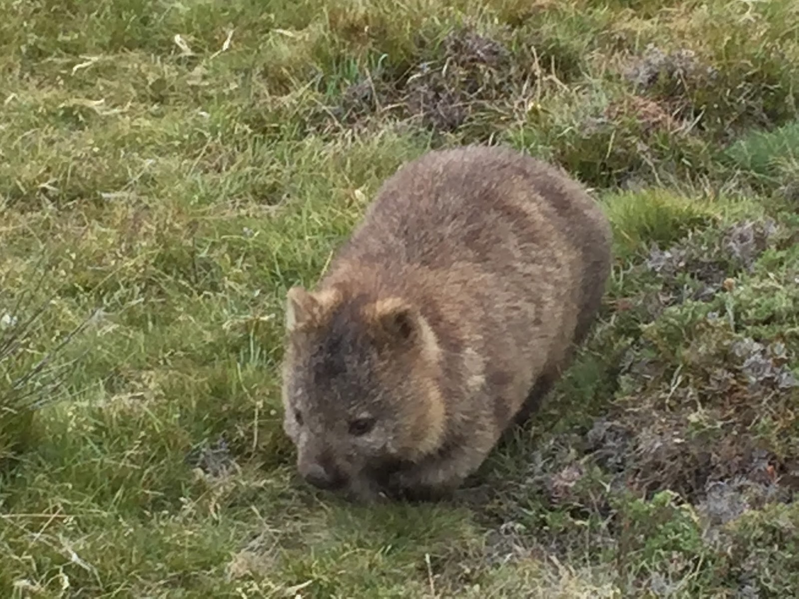
As we sat and waited for the next ferry we saw a black with white spots eastern quoll (Google) (see blog post from Day walk across the street in front of us.  We got out and tried to get a picture but it hid and we did not see it again. It was kind of funny because there was an Australian couple who had also seen it and were looking for it and they had no idea what it was.  I told them, “it’s and eastern quoll” and they were like, “how did you know that….we’re from Australia and we didn’t know what it was”.  I had seen them at the Devil habitat that I visit on Day 22 – Convicts and Devils.  Here are a couple of pictures I took that day….

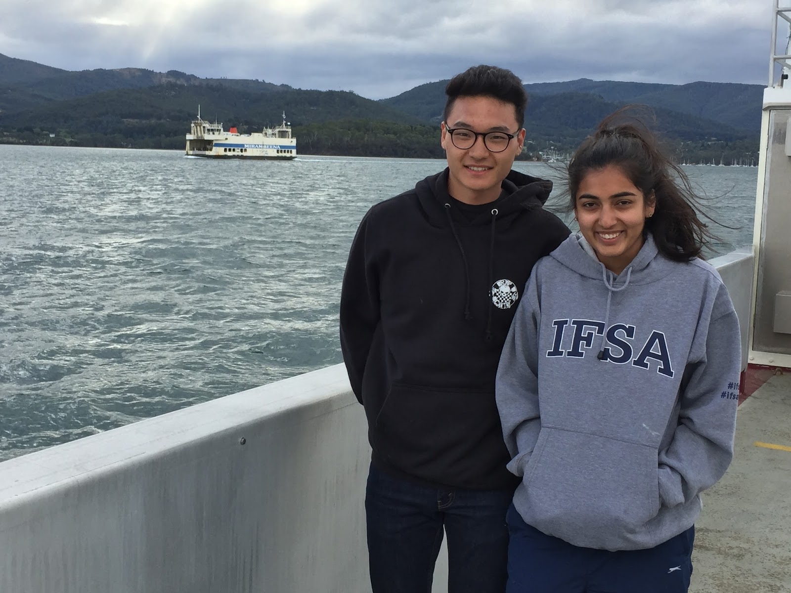
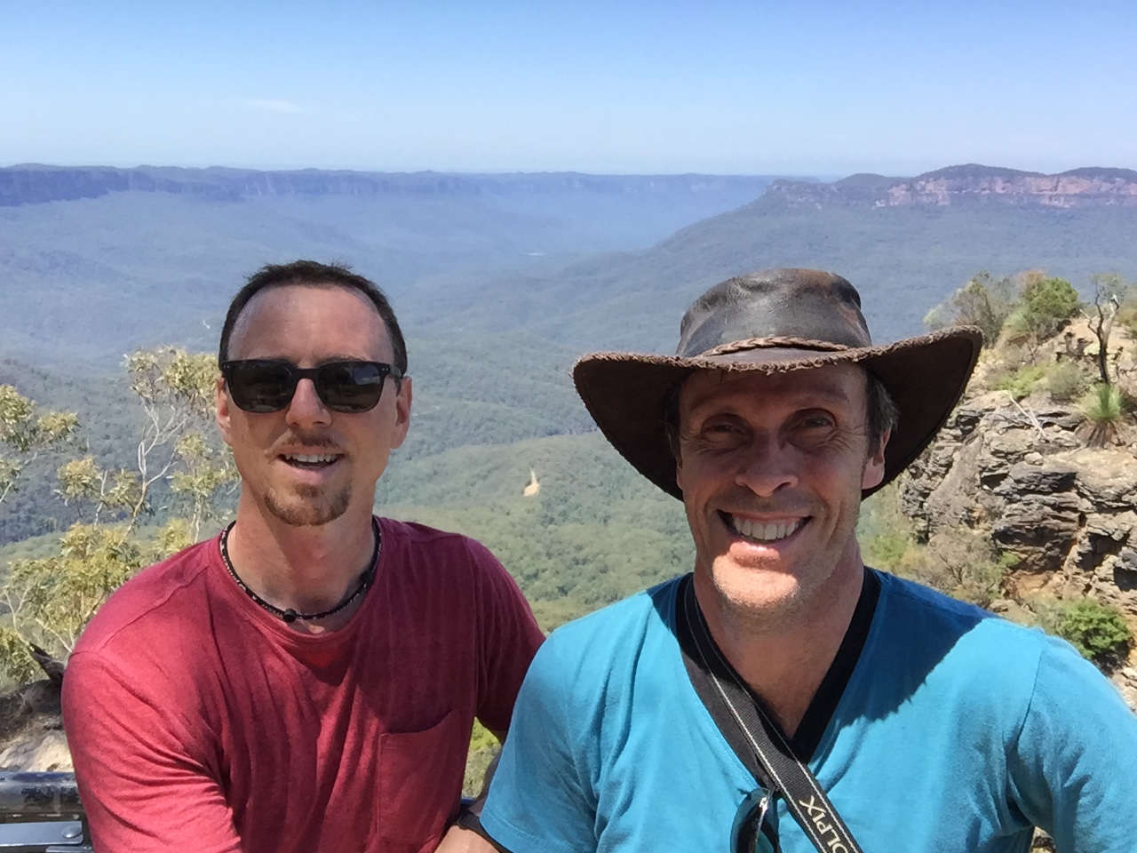
We loaded the ferry and during the trip we took a couple of pictures to remember our day together…

Tenzin (left) & Aranya (right)

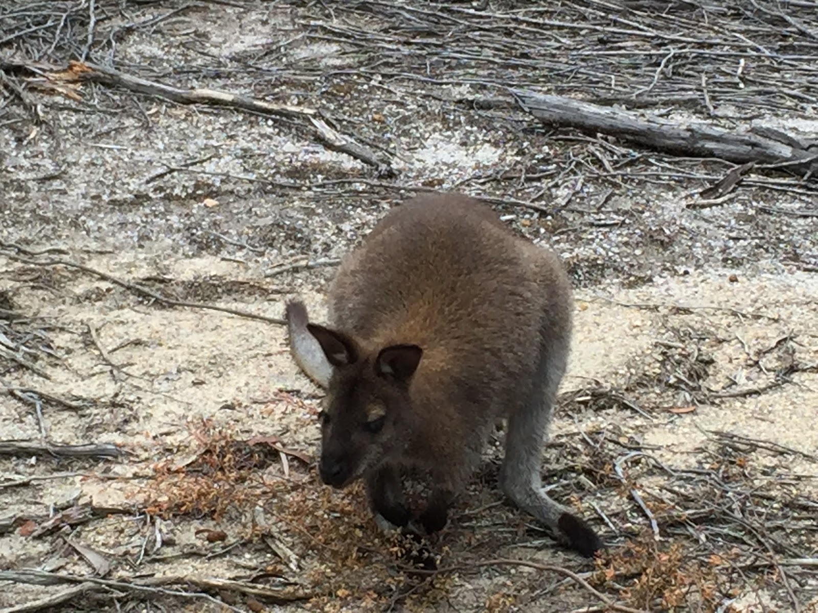
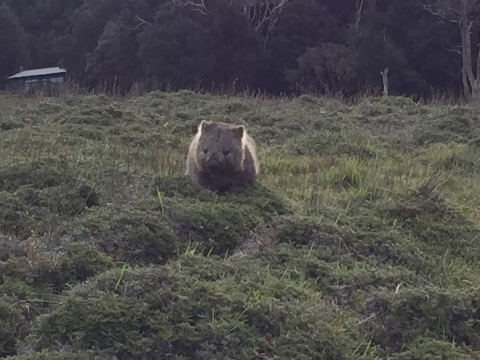
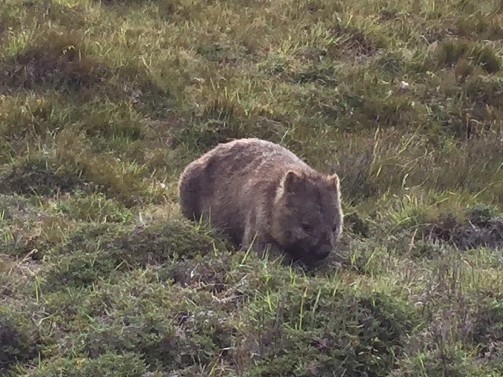
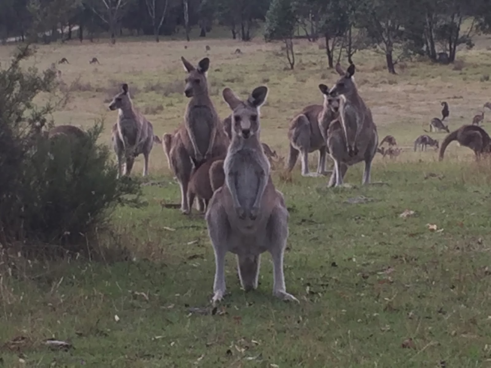
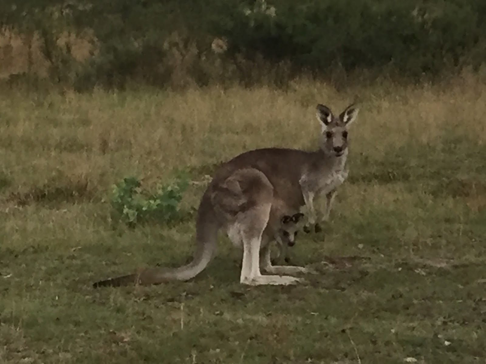
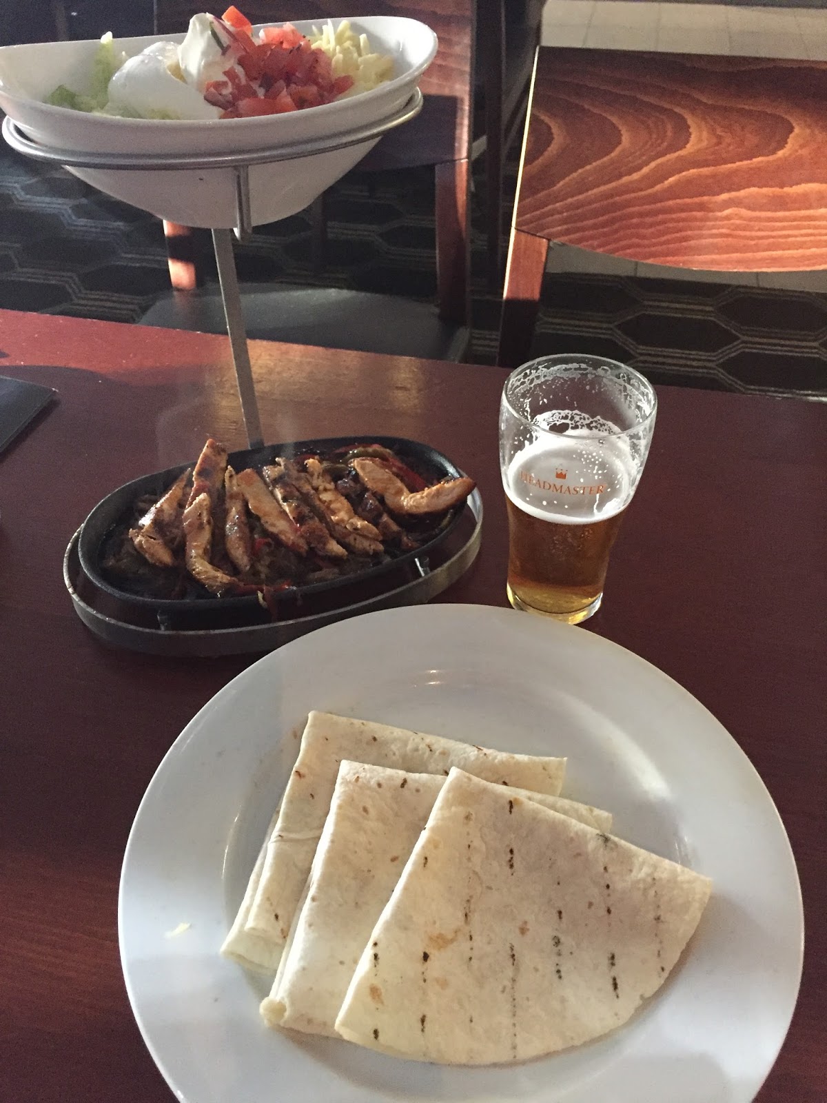
We drove back to Hobart, I dropped them off at their place and I headed back to my place to get cleaned up.  On my drive back to Hobart (from the place I was staying in the mountains) I saw well over 75 wallabies on the short 1 mile gravel road including one open field that had at least 50. It was really cool and I took it all in knowing that I would not see this again once I returned to Sydney.  I went back into Hobart and had another nice dinner (Thai) and listened to some more great music from a male/female duet.

Where Am I

My day began with a wonderful breakfast prepared by my host Sommai and some great conversation with her and the couple from Melbourne.  From the front deck Sommai has a great view of Hobart (see below).  After breakfast I spent some time catching up on yesterday blog (Convicts and Devils) and deciding on how to spend the day. My intention for the day was to travel to Bruny Island (more on that tomorrow) but I decided that it would be better to do that with an earlier start tomorrow.

So with the first decision of the day completed (what not to do) I turned my thoughts to what I would do for the day and quickly decided that I would do some things in and around Hobart and my first destination…the top of Mt. Wellington (another mountain top…surprise! :-). So I packed up and headed out.

Mt. Wellington (Google.Images) is a 4000’+ mountain just outside of Hobart. I’m not sure if there are trails to hike to the top but given the time I had I chose to drive to the top.  The steepness, distance and number of very sharp turns reminded me of the drive up Pike’s Peak in Colorado Springs (for my CO friends). The drive from Hobart to the top took about 30 minutes.  About halfway up I realized that I had not come prepared for this.  Since I had been moving from place to place almost everyday I was used to having all of my stuff in the car with me. However, since I was staying in the same place for 3 nights in Hobart I had unloaded everything…including my fleese and rain jacket….and this proved to be a mistake for today. In center city Hobart it was mostly sunny and around 70 degrees.  Another very nice day. However, at the top of Mt. Wellington it was rainy, cloudy and around 48! So as i climbed out of my car in my short sleeve t-shirt and shorts I got a few funny looks from the other folks running around in their arctic parkas and rain suits (ha ha).  Oh well, what are you gonna do?

So I ran down to the observation platform and snapped off about 10 pictures. Luckily there was an observation building about 100′ from the deck so I went in to try and get the feeling back in my fingers and toes (ha ha).  While sheltering from the rain and cold I took the time to read the history of the mountain.  It was pretty interesting. Just after I finished reading the information there was a break in the rain so I ran back down to the platform, quickly snapped off some more pictures, ran back to my car and started the decent back into Hobart.
When I got back to Hobart I stopped for a quick lunch and then headed over to the MONA (Museum of Old and New Art) (GoogleWeb Page).  MONA is the largest privately funded museum in Australia.  Now I have to admit that I prefer modern or traditional art to contemporary art; however, I can appreciate some contemporary art and did not want to miss this opportunity to see this collection. It was an interesting collection in a very interesting building. It’s 4 stories and you actually come in at the top which is ground level.  You then proceed down a spiral walkway to the bottom floor and make your way back to the top with different sections dedicated to different collections.  I enjoyed my time at MONA and I’m very glad it was on “the list”. 🙂 
After that I ran back by my place to change and then headed into Hobart. I spent some time walking around the business district and harbor area and made my way to an area called Salamanca (Google) where I had a very nice seafood dinner of salmon, scallops, prawns and a fish called blue-eye. I had never had blue-eye but it was delicious!. Salamanca is an area kind of like Manayunk (for my Philly friends) with nice restaurants, shops and pubs but it is famous for the market held each Saturday. S After dinner I checked out 3 of the pubs that each had acoustic music and decided on one called Jack Greene’s.  The guy playing there was good and played a good mix of music. I sat for about an hour and then decided it was time to call it a night and drove back to the place I’ve been staying.
I don’t think I’ve told you about the place I am staying in Hobart have I?  It’s a very nice private home on 40 acres of wooded land in the mountains just outside of Hobart called the Currawong Guesthouse (Web Page).  Currawong is the name of the species of birds found through Australia (it was actually the type of bird that I posted on Day 18)  My host is a wonderful Taiwanese woman named Sommai. She and her husband purchased the property and built the house 14 years ago with a plan to one day create a 5 Star “Eco-resort”.  Unfortunately her husband died of cancer 2 years ago; however, she decided to honor him by keeping the dream alive and is actively working to secure the investment money to break ground by next Jan.  She told me all about her plans and showed me the architectural drawings, financial proposal she created and a couple of articles that have been written about her and the land. 
The drawings look amazing 🙂 and I am so excited to follow her progress.  She was a fantastic host and I am fully confident that she will be successful. She invited us (me and the other couple) to come back and stay with her as special guests (those who stay with her now) when the resort is complete.  I look forward to staying with her again someday.   
So back to the drive home….to get to Currawong you drive about a mile on a gravel road back into the mountains.  During my 1 mile drive back to the house this evening I counted 14 wallabies, and I’m sure there were many more that I did not see. Although it’s clear that they have a population issue (like deer in PA) I still find this very cool. 🙂  I ended the evening as the day began looking out at Hobart from the front deck….

Where Am I

My day began in the small village of Swansea (Google) located across the Great Oyster Bay from Freycinet National Park (day 21 blog).  After breakfast I headed south along the coast heading toward Port Arthur on the Tasmanian Peninsula (Wiki).  During breakfast my host mentioned a “short cut” through the mountains…..

….but she said it’s not always well maintained so she could not speak to the condition of the road or whether it was even passable without a 4 wheel drive (which I do not have). Of course I didn’t hear anything she said after “mountains” so away I went. 🙂
It was very remote, with of course no cell coverage and I only passed 2 cars (4 wheel drives) in the 25 miles or so between the highways, but I was really cool getting off the beaten path and seeing some country that few get to see.  The only time I got a little concerned was when I came to this after about 15 miles…..
Fortunately there was a temporary bridge a little further down so I was able to continue and after 25 more minutes or so I was back on the highway and on to Port Arthur.
The next stop was a place called Tessellated Pavement near Eaglehawk Neck.  The Tessellated Pavement (WikiImages) is a very interesting nature rock formation that looks like individual blocks or pavers.  

As I walked along and looked at each “individual” block I couldn’t help but think that millennium before EP Henry came along God was already using “pavers” in His creation.  🙂
After stopping in Port Arthur for a quick lunch I dropped by the most famous site in the area called Port Arthur Historic Site (GoogleWeb Site).  

This site was built in 1830 as a prison to house many of the worst convicts that were transported to Australia from the UK.  It was chosen because of it’s remote location and was considered inescapable. Unfortunately, I didn’t have enough time to do the tour so I looked around, read the information and moved on.  
From there I continued on a loop toward White Beach and Nubeena through Koonya and back to Eaglehawk Neck.  I made several stops along the way to view beautiful beaches and small village harbors…

On the way back to Eaglehawk Neck I stopped at a place call the Tasmanian Devil Unzoo (Web Site).  After getting grief from not yet having seen a Tasmanian Devil and giving up on seeing them in the wild I decided to stop and check it out.  It was a nice little “unzoo” and I watched the devil feeding (they are nasty little devils when it comes to food…hence the name :-). I would definitely have preferred to see them in the wild but this was nice and informative and part of the money goes to their preservation which I like to support as they are getting more and more rare with the devil cancer killing large numbers. Anyway, although they can be nasty little creatures I think they are cute in their own way….

IMG_3525

I left the Unzoo in a pouring rain and then briefly stopped at the Tasman Arch, The Devil’s Kitchen and The Blowhole (Tasman Peninsula).  They were each pretty cool in their own way….

I then drove for about an hour to just outside of Hobart where I will be staying for the next 3 nights. When I arrived my host Sommai made an awesome dinner for me and the young couple from Melbourne who were also staying.  We had a wonderful conversation over dinner and it turns out that he is a professional musician (guitar).  Pretty cool huh?

Where Am I

Ok, I know you’re getting tired of hearing it so I’ll say today was a day that starts with and “A” ends with a “g” and has a place you can get lost in the middle. 🙂  It began with a 2 hour drive from Launceston (where I stayed with a great host in a great little place) to Freycinet National Park (link) in Southeastern Tasmania.

Even though I arrived at the park later than expected (what’s new huh) I was still planning to do the longest hike they have over 3 mountains becuase….well, becuase it’s there. 🙂  So I grabbed a trail map and hit the trail.  Before I even started up the first mountain I saw my first walibee for the day (pictures below) so I knew it was going to be a good day.  The first part was a good climb up to the Wineglass Bay overlook.  This was my first view of arguably the most famous beach in Tasmania and I have to say it didn’t disappoint….

I took a few minutes to take it all in, checked my map and was back on the trail. I knew covering the ground I had to cover to complete this hike (before dark) was going to be a challenge and I therefore needed to keep moving and moving fast.
The next part took me down a pretty steep trail (no where close to Cradle Mtn.) and straight into Wineglass Bay.  After a while I passed a trail sign and knew I was getting close when all of the sudden the trail just opened up to this massive bay with white sand as far as you could see and cyrstal clear water pounding the sand.  Even being a “mountain guy” I was totally blown away by the beauty of it…..

I immediately knew I had no choice but to take off my hiking boots and socks and feel the sand, and waves, on my feet…it was just too inviting. I found a place to lay my stuff but before I could take my boots off I saw a waliabee to my left.  I walked over and took a some pictures and videos as I watched him peacefully move about…just 25′ from the waves coming to shore.  It was so cool.

Once I turned my attention back to the ocean I took off my boots and socks and headed for the water.  At first it seemed a little cold but after a few seconds I realized it was not too cold at all.  I started walking down the beach and the next thing I knew I was 1/2 mile or more from where I had started…and there was still a long way to go on this beach.  I turned around, walked back, grabbed my stuff and copped a squat on a huge rock to eat some lunch. And while I was sitting there something interesting happened…and a few of you (who know me well) may be proud of me for this. 🙂  I started debating with myself as to whether I should continue with my original plans or just hang out here for a while and chill.  Now anyone who knows me (well) knows what I would almost always do in this situation.  Here was the conversation going on in my mind)…
So one side of me (probably the analytical left brain 🙂 said, “I have a plan. There is a great trail to hike and 2 more mountains (did you hear me say mountains!) to hike.  Of course you have to keep going!” But the other side of me said, “Look in front of you. You’re going to have to basically run for the next 5 hours to complete that hike….or, you could sit here for an hour or two and just enjoy watching and listening to the waves come to shore and relax”. “RELAX…WHAT?  There is a trail right over there and I can see the 2 mountains from here.  Relax!  Are you out of your mind…mind? 
So which side won you ask…..well to make a long story short, my name is Stephen Price and I am a recovering hikaholic. 🙂  I sat on the rock, ate my lunch and relaxed.  And after a while I got up and walked to another rock further down…and I sat, and I relaxed.  And I ended up spending almost 2 hours sitting and relaxing as the waves came to shore and the wind blew and it was great! Hmmm, maybe I’m on to something here….nah! ha ha
Knowing I still had a 2 hour walk to get back and it was already 4:30, I took some more pictures (it was all so beautiful that I took a ton of pictures…you can see them on the “View Photos” link when I load them later today), packed up and took off to Hazard Beach.
Hazard Beach is about a 25 minute walk from Wineglass Bay on the opposite side of the peninsula. Hazard Beach is very beautiful (see photos below) but different than Wineglass. Hazard Beach is long but not curved and the beach is more gradually sloped so the waves are not a big.  But it was very beautiful and peaceful….

The return trail actually follows Hazard Beach for about 20 minutes and once again I could not resist the urge to take off my boots and socks so I did. At the end of the beach trail I put my boots back on and headed back into the woods. Although the sign said it was a 2 hour walk to the parking area I figured it would take about 1:15.  Along the way I saw 2 more wallabies and stopped to take some more pictures and videos.
I made it back to my car in 1:15 as expected, took off my boots, put on my flip flops or thongs as they call them here 🙂 and, thinking my adventures were over for the day, began my 45 minute drive to where I was staying for the night. But as I started out of the park I saw a sign for the Cape Tourville Lighthouse to the right.  It didn’t say how far but I figured I’d check it out if it was close (it was already 6:30) so I took the right turn.  I never saw a sign saying how far it was but I could see on my GPS I was only half way after 5 minutes or so. Not really wanting to spend too much time on this I almost turned around (I pulled into a lot) but decided to keep going….and boy am I glad I did.  
When I finally arrived at the lighthouse you could not see it from the parking area.  I got out and followed the signs and walked for 5 minutes or so and I was thinking, “I don’t have time for this” when all of the sudden I walked around a tree and BAM, there was the ocean about 200′ below and you could see the mountains and the bay inlet to Wineglass and it was amazing (you know I couldn’t go a whole day without saying it :-). For the second time today I was totally blown away.  To make it even better they had constructed a wooden walkway that extended out over the rock cliff so you were had a completely unimpeded view of the ocean…and straight down as well….

I walked about the corner and it just seemed to keep getting better.  I read all of the signs and they were very informative about the area (you can see the signs on the View Photos link on the right).  When I came to the last viewing area the one of the signs pointed out 2 small islands just off the coast.  It said that, for some unknown reason, these tiny islands have the largest concentration of bird species (proportionately) of any island in Tasmania where they breed during certain times of the year. From where I was standing I could not see any birds but I was quite far away. Fortunately they had a pair of those mounted binoculars and when I looked through them I could clearly see penguins on 2 of the 3 islands…and that was cool!  I tried to get some pictures from my phone looking through the binoculars and they actually turned out fairly well….
I stood and looked at the birds and penguins for a few more minutes and then backtracked to the car because I just didn’t want to leave this place.  I thanked God for His creation, for sharing it with me and for not allowing me to turn around earlier.  🙂  I LOVED this place.  I stood for 10 minutes or longer just staring out at the sea and watching the interesting wave patterns and I saw a dolphin swimming way down below. It was a magical site and a perfect way to end another great day….but wait there’s more (and if you buy now we’ll through in a second set of crap that you don’t need! ha ha).  As I was driving back to the main road I saw another walibee so I took more pictures. 🙂
All in all it was another great day in the land of Oz.

Ok, so I wasn’t actually “lounging” in Launceston, I just thought that sounded good :-), but it was a somewhat intentional “rest” day between hiking Cradle Mountain National Park (the past two days) and hiking Freycinet National Park (the next two days). Yes, contrary to popular belief even I have my limits. ha ha

It actually worked out well as the day began cloudy with a lite rain. So I spent the morning writing yesterdays blog, communicating with a few folks, doing some laundry and chatting with my Airbnb host Philippa over a cup of coffee.  As anyone who travels knows a big part of the experience is meeting people from different cultures and backgrounds and sharing conversations with them.  We talked about Launceston, our dogs and her cats, her children, her brother who is a professional musician (guitar) in Hobart, her upcoming trip to the Blue Mountains (day 11) and a few other things before she had to leave for work. She left me with everything I needed to head out to Launceston, which I did after I finished hanging out my laundry (it had cleared and was sunny at this point).

I drove into city center Launceston (GoogleImages) and just spent some time driving and walking around and checking things out. It’s a nice town and it was fun just to street “hike”. Launceston is the home of Boags brewery (Google).  I considered a tour but knew I wouldn’t have time so I headed to the Launceston Cataract Gorge park (WikiGoogleImages).  It’s a river gorge that was formed by the South Esk River, the longest river in Tasmania.  The interesting thing about this park is that it is just a couple of minutes from the center of the city so it’s a mix of natural rugged beauty with the river, rock covered cliffs and trees and urban dwelling with a community swimming pool, hiking/running trails and a chairlift (don’t know what’s up with that).


As I walked the trails on my “day of rest” I was passed by several runners and I just couldn’t resist.  I hadn’t planned to run but I did have my running shoes so….off I went.  🙂  I did a short run and crossed a bridge to the other side of the gorge.  This was the steeper side so I decided to hike to the high ridge to get a better view of the gorge from above (pics above).

So after a pretty good day of “lounging” around Launceston I checked out some local restaurants on Google and decided on a place called The Jailhouse Grill where I had a delicious cajun salmon with (of course) a Boag’s draught.  🙂

As I read the menu I came across one dish that made me think of my hunter friends/family Toby Wyatt, Steve Allen and Josh Henson.  Here’s a dish for you to make….although you’ll have to go further than eastern NC, SC or GA to hunt one of the ingredients :-)……

Where Am I

Hello everyone.  Before I get started on today’s adventure I just wanted to take a moment and say how very much I am appreciating all of the blog & FB comments, emails, texts and FB messages I have been receiving from so many.  It’s so cool (in today’s world) to be able to stay so connected with everyone back home.  It is really encouraging to me to hear so many say how much you are enjoying the blog, pictures and videos and to receive the encouragement to keep them coming.  As I’ve said before, my main purpose in doing this blog was to have my friends and family share in my adventures and based on the feedback I’ve received so far it seems to be successful. So thank you all for coming along and sharing this adventure with me and for adding to this awesome experience!

I got up early today as I was anxious to hit the trail. The weather forecast was supposed to be sunny, but as we all know you can’t always trust the forecast so I have to say I breathed a big sigh of relief when I walked outside and saw nothing but clear blue skies….YES!  What a difference 24 can make in the weather huh?  So I knew immediately we were heading to the Cradle Mountain summit.

I ate breakfast, loaded up and drove the 20 minutes to the Dove Lake (Google) parking area. Dove Lake is beautiful (Images) and even though I had taken several pictures here yesterday I just had to take some with the sun shining…..

From there I stuck out on the Dove Lake Circuit heading to a steep connecting trail called the Lake Wilks Track.  They have signs like this on 3 of the steepest tracks (what we would call trails) in the area…..all of which I just had to do of course (please don’t tell my mother, ha ha)….

As I climbed the steepest part of this track I could not help but to recall a hiking trip me and my friend Walt Fromm took to the Adirondack mountains in upstate NY a few years ago.  I was thinking how the state of NY could learn a few things from Australia about how to help people climb sheer rock faces (Walt knows what I am talking about) as they install anchored chains so you can pull yourself along…..

I made it to the top and connected to the Face Track which (as the name implies) traverses the face of Cradle Mountain.  After about 25 more minutes I connected to the Summit Track, took a hard left and started straight up.  The first 1/2 mile or so was basically just a steep trail straight up the side of the mountain.  This was just a prelude for what was to come….

After about 1/2 mile the “trail” turned to the right and we started to climb over gigantic boulders. It was steep but we were moving across the mountain (vs. straight) up and heading around to the other side…..

Once we got around to the backside it got really fun as we turned straight up!  At this point we were literally rock climbing, only without the “safety” of ropes.  🙂  It was at this point that I came upon two couples.  From what I could tell they were not together….other than suffering through the climb together. 🙂  For those who rock climb or hike you know there is no way to capture the steepness of a mountain with picture. It’s one of those things in life that you just have to experience for yourself (I’m sure some are thinking, “uh, no I don’t”, ha ha) but I took a couple of pictures along the way to try and capture the moment…

Trail “markers”

Fortunately most hikers are not like Philly drivers so they don’t have a problem letting faster hikers pass (my friends in Philly know what I’m talking about, ha ha).  So after about 15 more minutes of intense rock climbing I finally made the plateau and was thrilled to see that I had the whole place to myself! I walked for about 2 minutes to the summit and was absolutely blown away by the view! WOW!!!!  Absolutely one of the best summit views I have ever experienced.  No clouds or haze whatsoever.  Everything was clear as far as my eyes could see in every direction.  I just stood in amazement for 3 minutes and thanked God for such a magnificent creation and for allowing me to experience it. And then I whipped out the iPhone and started snapping away.  And although I fully know that pictures could never fully capture what I was looking at some of them were still pretty amazing….

After taking a ton of pictures and a video (all of which can be viewed by clicking “View Photos” on the right), I found a nice spot to have some lunch and enjoy the scenery.  After having the place to myself for about 20 minutes one of the other couples joined me at the top.  But I never saw the other couple at the top.  My Airbnb host last night congratulated me for the summit and said that most people do not make it to the top so I guess the other couple must have turned back short of the summit.

After about an hour at the top I finally forced myself to leave.  I didn’t want to leave the top because it was so beautiful but I knew I had a 2:30 hour hike to get back to the car and then a 2 hour drive to Launceston where I was staying the night.  So reluctantly I started back and as expected the decent was every bit as challenging (in some ways more) than the ascent.  I made it back down the Face Track in about 35 minutes, took at right and headed to Hansons Peak.  From there it was a very steep decent to the Dove Lake Circuit track and back to the parking area.

On the hike out I briefly stopped at the Hanson Peak hut and saw these two quotes written on the walls and thought they were cool….and true….

And even though I had already taken over 50 pictures I could not help but to capture a few more before leaving this beautiful area….

So goodbye to Cradle Mountain National Park.  If you’re ever in Australia and have time this is a must see!

Where Is Stephen

When I last left off I was sitting at a cafe’ in the Melbourne port waiting to catch the ferry for Tasmania.  I’m happy to say that I made the ferry on time (those who know me well know that is an accomplishment in itself 🙂 and I made it to Tasmania with no issues…so welcome to Tasmania!
Before we jump into Saturday let’s finish Friday night on the ferry. I’ve taken several cruises and a few ferry’s in my travels so I knew what to expect. The first 2 hours were smooth sailing with cell coverage…it took 2 hours to leave Melbourne harbor. 🙂 I had a very nice dinner in the restaurant and just sat, sipped my mini-bottle of Shariz and enjoyed the view.  But once we hit the open ocean…well, the boat stared rockin’ (literally). 🙂 I don’t know what the seas were (height) but we were pitching and rolling nicely.  It made for some good times watching everyone “try” and walk around (including me) but hey, it’s all part of the fun of traveling. 🙂
After dinner I relaxed in one of the lounges where they had a lady playing guitar and singing a wide variety of music.  She was good and I couldn’t help but to think of my good friend Candy Creamer. Candy, if you ever get tired of teaching I’m sure you can move to Melbourne and make a good living playing the rear lounge on the Spirit of Tasmania. 🙂 I turned in around 11:30 and rolled back and forth in my bunk with the pitch of the boat (I’m not kidding) for a few minutes before falling asleep.
The ferry ride from Melbourne to Devonport Tasmania takes about 11 hours and arrives in Devonport at 6:00 AM. For those who may not have experienced an overnight ferry or train (done that a few times in Europe) they start the day very early by making a “loud” announcement 45 minutes before the arrival. They are on a strict schedule and therefore need to get everyone off ASAP after they arrive. 15 minutes before the announcement one of my suite mates (who I never met) got up, showered and left. Then right on schedule, at 5:45 AM (those who know me know I don’t do well with anything before 8) they made a 10 minute announcement about unloading the cars, unloading passengers, what you can and cannot bring into Tasmania, blah, blah, blah.  I of course rolled over and went back to sleep for another 30 minutes. 🙂 
So to make a long story short (well, I guess it’s too late for that huh :-), I got up, showered, deboarded, got my rental car, spent 30 minutes trying to figure out how to turn on the NAV/media system (seriously), got brekkie (what Aussians call breakfast) at McDonald (along with 3/4 of the other people I came across with), stopped at Woolworths (remember from an earlier post that is a grocery in Oz) to get some snacks for hiking and food for dinner (more on that later), stopped at McDonald’s again for a second cup of coffee (Australian’s actually prefer McDonalds coffee to Starbucks) and finally got on the road for Cradle Mountain National Park. Whew, what a morning. 🙂
The drive to Cradle Mountain was only about 1:30 hours. It was a nice drive and I learned that the people in this area apparently take pride in having creative mailboxes. 🙂  I saw something else on my drive that was interesting…..my cousin Megan had asked for a picture of a Tasmanian Devil and unbelievably I actually spotted one on my first morning in Tasmania….
All kidding aside, i may have mentioned this before but unfortunately the Tasmanian devil population in Tasmania is decreasing at a rapid rate due to a mouth cancer epidemic. They have no idea what is causing it and (currently) no cure for it.  So they are getting harder and harder to spot in the wild. 🙁
I arrived at the park and very anxious to hike I paid my entry fee and jumped on the shuttle to Dove Lake (GoogleImages). On the ride up I read the map and selected my hike for the day.  I decided not to do the Cradle mountain summit today as it was very cloudy, cold and misting most of the day (my Scottish ancestors would call it, “A fine soft day”) and the mountain was covered with clouds all day….so I’ll do it tomorrow.
Today’s hike was great!  I started with a very challenging trail called the Marions Lookout Link Track. It is the most direct route to Marions Lookoutbut it is steep enough in several places that they have installed a chain to pull yourself up (Walt Fromm, NY state could learn a few things from Australia :-). I made it from the shuttle stop to the top in around 35 minutes and the view was awesome…

After that I continued on to the Kitchen hut at the base of Cradle mountain and turned right and continued on to Crater Lake overlook where I stopped to have lunch. From this point you are basically looking straight down on Crater Lake and it is beautiful…

While I sat eating my lunch and enjoying the view (and trying to stay warm) I had a new friend join me.  Turns out that he, like me, really likes peanuts….

After “we” finished “our” lunch one of us flew away and the other continued the hike (I won’t spoil the ending by telling which one did what 🙂   Ok, it was me who continued the hike (I never was good at keeping secrets, just kidding).  Although most of it from this point was downhill I still had several miles to go.  I passed 3 or 4 more very beautiful lakes and walked through an area that looked like a tropical forest where the birds were chirping away….

Shortly after that I entered a large field and could see the shuttle stop far in the distance. I thought my day’s “adventure” was over but God decided to save the best for last. As I was walking through the field I came across a man taking a picture of something that I could not see.  As I came closer I realized it was a wombat (GoogleImages)! It was very cool. If you do not know a wombat basically looks like a giant groundhog (to me anyway) but much cuter in the face.

I began speaking with the man and it turns out that many wombats frequent this field about this time of day to graze. So we walked slowly looking for more.  As we walked we talked about travels. He is from Canada, is retired and he and his wife basically spend Oct.- Mar traveling every year to get away from the Canadian winters.  I told him about my situation and he said that he did the exact thing back in his career. He took a 9 month severance package and traveled, rather than going straight to another job.  He said it was one of the best things he ever did and it worked out great for him. He encouraged me to continue to pursue this “dream” and trust that things will work out (hmmm, I’ve heard that before).  We only spoke for 10 minutes or so and then went our on ways but needless to say it was a pretty cool conversation.

So while I was walking along several more wombats came to the field and began grazing and I managed to get some really cool pics and videos…

I spent about 30 minutes watching them and then walked to the shuttle stop. Again, I thought my adventure was over for the day, but I was wrong again because during the shuttle ride we saw two Wallabies (a smaller version of the kangaroo, Images) and an Echidna (Wiki,Images).  These were the first Wallabies and Echidna I have seen on my journey….

As I was trying to get a picture of this little guy he all of the sudden just dropped down and rolled over and started scratching.  Unfortunately it happened so quickly that I was not able to get the beginning but it was so funny (you’ll hear everyone on the bus laughing in the beginning).  You can also hear the very Australian bus driver speaking in the video…G’Day Mate! 🙂

Day 18 - Cradle Mtn day 1
When we arrived back at the visitor center I drove 100 meters to the Discovery camp grounds and checked into the “bunkhouse” for the evening.  For $33 AUD ($25 USD) you get a bed in a 4 person shared room and access to a kitchen for cooking (hence the dinner food referenced earlier).  After finding my room I cooked/ate dinner and had some great conversations with an older gentleman from England, a young girl from Germany and a young guy from Brisbon AU who has been in the Cradle Mtn. area for almost a month.

All-in-all I think my first day in Tasmania was a roaring success!  Tomorrow we climb to the summit!

Where Am I

My day began as many of them begin now by having breakfast with my Airbnb host. This time it was a very nice lady named Rosemary who lives in Port Melbourne.  As I ate my breakfast of muesli and coffee Rosemary went out of her way to make sure I had everything I needed for my day in Melbourne….

I had to take my rental car back so she made sure I had the directions.  She gave me a tram pass and made sure I knew how to use it and where to catch the closest tram from the rental car agency.  She gave me a map of Melbourne and showed me where I should get off the tram and what I should see in my brief time in Melbourne.  Armed with everything, I finished yesterdays blog and headed out into the city.
My first stop was in center city Melbourne.  Like all other big cities on a Friday morning there was a lot of hustle and bustle and a lot of energy.  I made my way up and down the streets just checking things out for a while and stopped to have some lunch (sushi!).  After lunch I headed for an area called Federation Square.  This is the area in Melbourne on the riverfront that hosts a lot concerns and events.  It’s also the area that has the sports complexes including the arenas where they host the Australian Open tennis tournament each Jan. Personally I’m not a huge tennis fan but I could not pass up the opportunity to stop and take some pictures for my tennis loving friends like Candy, Cathy and Michelle.  

After that I took a long walk through the  royal botanical gardens (Google).  They were really nice with a large variety of plants from all over the world.  I walked around the area some more and came across the Shrine of Remembrance (Google).  This monument was built as a memorial to the men and women of Victoria who served in World War I and is now a memorial to all Australians who have served in war.  I was impressive and very nicely done.

The top of the memorial was a great place to snap some photos of downtown Melbourne….

And that was my whirlwind tour of Melbourne. I am now sitting at an outdoor cafe at the Melbourne harbor having a Carlton Draught and using the cafe’s wi-fi to post this blog before boarding the ferry for the overnight trip to Tasmania….


I have heard and read that they will not allow you to board if you are not on at least 45 minutes before they sail.  It’s now 55 minutes before we sail so I guess I better say good bye for now.  See you in Tasmania!

Where Am I

Today began early as I was anxious to tour everything the Great Ocean Road had to offer.  I started by sipping my coffee in the sitting room at the b&b where I stayed the night.  This was my view to begin the morning…..

After my coffee I packed up and drove about 10 minutes to Apollo Bay to find some breakfast.  Apollo Bay (GoogleWeb) is a nice little town with several cafe’s and shops and (I believe) the largest town on the Great Ocean Road.  I had a nice breakfast at an outdoor cafe and had a good chat with a very friendly, and funny, Australian “bloke” sitting at the next table.

After breakfast I backtracked (which I normally hate) to Kennett River.  Kennett River is known as one of the best (if not the best) places in all of Australia to see koala’s in the wild.  It was just luck (or maybe a little help from above 🙂 that I just happened to stay 15 minutes from Kennett River the night before.

As I mentioned in my FB post yesterday (for those on FB), even before I left the US people were asking me for pictures of koalas. I had been told and read seeing them in the wild was getting more and more difficult as the particular eucalyptus trees they feed on are dying off for some unknown reason.  So after doing some research I learned that Kennett River was the place to go.

I had also read that the best way to see them was to get out of the car and hike the road into the mountain and knowing how much I love to hike….no problem. 🙂  So I took off up the Gray River road not knowing what to expect. For the first 1/2 mile I saw only a couple. Then in the next 2.5 km (1.5 miles) or so I counted 24 more!!!  I was soooo excited!  I even saw two trees that had two of them….which I witnessed was not always good (check out the video on the “View Photos” link to the right). Anyway, it was so very cool!

I was amazed at how high some of them were.  Most were sleeping as the the eucalyptus leaves they feed on offer very little nutritional value so they conserve energy by sleeping up to 20 hours a day (sounds like a few people I know, ha ha….just kidding).  Mostly they lay in the forks of the big trees with their arms wrapped around the trunk but some of them where way up in the small branches…sleeping.  I read that they do something fall from the trees and after having seen them in the wild I can easily see why.

Here is a very small sampling of what I saw today. You can see many more by clicking the “View Photos” link on the right.  I don’t know how the formatting will work with theses as picture formatting on Blogger is quirky at best.  We’ll give it a try and see what happens.

I spent roughly 2.5 hours just hiking in the forest with my head straight up in the tree tops and I honestly could have stayed there all day.   The only regret I had from the day was that I didn’t have a better camera.  Most of them were so high in the trees that it was difficult to photograph them.  If I would have had a good camera with a telephoto lens I could have taken some unbelievable pictures.

I also took some pretty dramatic videos (yes, even of creatures that barely move 🙂 but videos take much longer to format and insert and now that I’m traveling everyday I barely find time for this.  You can view all videos by clicking the “View Photos” link on the right.

When I was finally able to pull myself away I turned my attention to the beautiful cliffs, beaches and ocean that was right in front of me….

I headed south on The Great Ocean Road passing the place I stayed last night and Apollo Bay on my way to Otway National Park (Google), The 12 Apostles (Google), The Arch (Google), London Bridge (Google) and several other places….

I drove from Kennett River to Port Campbell.  From their I turned inland and did the 2:45 drive to Melbourne where I stayed for the evening.

Where Am I

So today was a transitional day and I spent most of it in a car on the M31. I began my day in Albury with a nice breakfast with my Airbnb host Brian.  I briefly met his wife Sally the night before but she had already left for work by the time I woke.

After breakfast I spent some time booking my flight to New Zealand and taking care of some other travel “business” (I like my new line of “business”, ha ha), then it was off on the open road.

Sadly there was not too much to report from today.  The drive, although a bit long (close to 6 hours) was pleasant.  The last 1.5 hours was definitely the best as i traveled the Great Ocean Road from Geelong to Sugarloaf (my destination for the evening).  Unfortunately I arrived in the area after dark so I did not get the fantastic views that this road offers; however, because it was night and there are very few idiots (seriously) who travel this crazy, winding road after dark I pretty much had the road to myself.  So it was time for Stephen to “play”.

Being from the mountains and having grown up with crazy, winding roads I LOVE to drive them.  Of course the only small potential downside was the 300′ cliffs the plunge straight into the Southern Ocean…but that’s all part of the challenge.  🙂  This drive reminded a lot of driving Hwy. 1 in Northern California.

Anyway, long story short I arrived at my room around 10 PM safe and sound.

Where Am I

Ok, so I’m fairly confident that at least some of you (especially those of you in the US NE) are getting a little tired (ok maybe a lot 🙂 of hearing me say how amazing it is here (in the 80 degree weather) but I’m really having a hard time thinking of other superlatives to describe it….so maybe you can help by leaving your “superlatives suggestions” in the comment section.  🙂

Today I planned to drive from Canberra to the Mount Kosciuszko National Park and hike the highest peak in Australia….Mount Kosciuszko.  The Airbnb couple of stayed with in Canberra told me about a great 21k (13 miles) loop hike to the top and I was really looking forward to it.  Unfortunately I had to take care of a few things before I left so my day began a little slower than I wanted and I didn’t end up arriving at the park until after 1.  As a result, I didn’t get to take the longer hike but took a shorter, but still totally awesome, 7.5 mile hike to the top.

The mountains around Kosciuszko reminded me of the mountains in the Scottish Highlands (for those who have traveled to Scotland or have watched Braveheart).  Most of the Kosciuszko area is above treeline, very rocky but extremely beautiful….

It took about an hour and twenty minutes to hike to the top.  Along the way I met arguably one of the most amazing (wow, I do use that work a lot huh? 🙂 and interesting people I have ever met….a girl named Nuran.  She is from Australia and has worked for the Red Cross doing natural and man made (wars) disaster relief for 16 years.  She recently returned from a long term deployment in Nepal where she had been since last years devastating earthquake.  In her time with the Red Cross she has served in places like Haiti, Mogadishu, Afghanistan, Papua New Guinea and Iraq.  She leaves in a few weeks to go back to Afghanistan and expects to be called to Siriya in a few months.  Through her time in all of these remote places she has had many illnesses like Malaria and Dengue fever (among others) and has worked in multiple war zones. Through it all she has managed to maintain a positive attitude and not to become cynical, hard hearted or numb to the pain and suffering of those in need.

Of course the obvious question (to most I think) is, why does she do it?  Her response was short and confident….I go to serve the victims of these tragedies because they need help.  She said, “many times my being there can make the difference between someone living and dying”……WOW!  I asked her how she felt when she went to these places, was she scared or nervous and she said not really, she focuses on the people she is serving and does not think about all the other things.

We spent almost 5 hours hiking and talking about her experiences and life in general and I at the end I found myself wishing the mountain had been taller so we could have spent more time talking.  I always say that there are no coincidences when it comes to God.  I firmly believe that He places people and circumstances in our lives at the right time, with the right things we need to hear, say or experience and I firmly believe he did that yesterday.  Maybe for me….maybe for Nuran….maybe for both….but certainly for a reason….definitely for a reason.

When we reached the top it was cold!  Of course, not Philly in Feb cold :-), but it was in the mid 40’s with a strong wind that probably made it feel like the mid 30’s.  But man-oh-man was it breathtakingly beautiful!

Having “conquered” the summit there was one last thing that I needed to accomplish.  My Airbnb hosts from Monday told me that no visit to Kosciuszko would be complete without a stop at Australia’s highest toilet (Web Page).  So, as they say, “While in Rome”. 🙂

I left Kosciuszko and began my 3:30 hour drive to Albury where I would be staying for the night. As I drove out of the park just before dusk I was keeping a sharp eye for Kangaroos as I had been told they are bad to run in front of cars at this time of day (like deer in PA).  Also, I had not yet seen a Kangaroo on my journey….but that would change soon.

I rounded a corner and caught a glimpse of one off in the bush.  About 200 yards further there was a gravel road that led to a camping area.  I took the road hoping there were other Kangaroos in the area. I drove for about 500 yards and saw 4 more grazing in a field.  I was very excited.  I tried to take a some pictures but the sun was shining right in my eyes and the pictures would not take.  So I drove about 200 more yards just to see if there were any more and “BAM”, I come to a field with at least 100 grazing and hopping around.  I couldn’t believe what I was looking at.  It was sooooo cool!

I spent the next 30 or 40 minutes taking pictures and videos and just watching them, watching me. 🙂 Here are a few but I took a lot more pictures and videos that you can see by clicking on the “View Photos” links to the right. I got some great pictures and videos as they came really close to the car (about 4′ away).  A couple of my favorites were the pictures of the mothers with their Joey’s in their pouches (see below), the two videos of them “boxing” (fighting I suppose) and the video when they all started running across the road all around me.  At first I didn’t know why but then I saw 6 Emu’s running across the field (you can briefly see them at 21 seconds on the video).  I tried to catch them to take some pics and videos but they were so fast that they were gone before I could get to them.

I finished the day/night with a 3 hour, white knuckle (watching out for kangaroos) to Albury.  Again, I know you’re probably getting tired of hearing this but this day seriously may have been the most amazing day yet of a completely amazing trip.  More to come as I head to the Great Ocean Road tomorrow.

Where Am I

My morning started out crazy as I was rushing around like a madman packing, eating breakfast, showering and running out the door to make the bus to manly where I had a rental car reserved.  I’m happy to say that the bus ride went off without a hitch and I was at the rental car agency in less than an hour.  After signing the form and initially in the 27 places I was told to initial (come on man….it’s 2016 and we’re still going through this antiquated process to rent a car?!?!

So after spending 5 minutes trying to figure out why my iPhone wouldn’t pair with the Bluetooth system in the car (oh the things we spend our time on nowadays :-), I left the parking lot for my journey south.  
As I wrote on FB today, it’s been a few years since I’ve driven on the right side of the car and the left side of the road (Guy DeBellis I’m sure you remember our first day in Scotland…I can’t recall has our travel ban to Scotland been lifted yet :-), but it came back to me quickly. The only thing that kept getting me was I kept turning on the windshield wipers when I want to do a right/left turn signal because they’re reversed from the US (different sides of the steering column).

 Anyway, I had a good drive down from Manly to Canberra and arrived around 3:30.  I headed straight for the Parliament building as I knew it would be closing soon.  Walking around the Australian capital building was really cool.  The government was not in session so the public pretty much had free reign in the place.  Going up on the “roof” was very cool.  I say “roof” because it’s covered with grass on both sides and basically blends into the hillside….

  
As mentioned above, since the legislation was not in session I was able to walk into both the House and the Senate chambers and take pictures in both…
House of Representatives 
Senate Chambers

It was also pretty cool to see one of the original copies of the Magna Carta at this building. A guide told us that it was purchased in the early 1950’s and brought to Australia.  I’ve also seen the one in the National Archives in Washington many years ago. I believe our guide today said there are only four known copies in existence today….I’ve now seen two.  🙂

After leaving the Parliament building I drove about 15 minutes to a place called Mount Ainslie. On Mt Ainslie you can view most of the city of Canberra and get a good, birds eye view, of the geometric design/layout of the city…..

After that I drove about 20 minutes outside of town to Queanbeyan (GoogleWiki) where I was staying for the evening at the home of a very nice young couple.  After a great dinner at a nice place called the Royal Hotel (Google)….
I spent some time speaking with Carlie and Ricky.  A few years ago they took a whole year and traveled around the world (totally cool).  They’ve also both spent quite a bit of time traveling in the US.  They are into the outdoors (yeah baby) and gave me some great advise for my hike tomorrow….uh, later today now (I gotta go to sleep).  They’re a really nice young couple and I only wish I had more time to spend getting to know them more.  Oh well, maybe next trip.  😉
Where Am I
* Remember you can see many more pictures by clicking the “View Photos” links on the right. *

* Also remember to subscribe below to receive email updates when new posts are made *

I began my day by attending the church service at C3 (C3 Church C3 Facebook) in Oxford Falls again.  Their regular pastor spoke this week about the 2016 vision for the church.  He referenced one of my favorite passages from Philippians 3:12-14 and used it to support the idea of focusing on the “one” top priority thing in 2016.  I really appreciated the service again this week and really like this church.  If you’re ever in the Sydney area I highly recommend it.

After church I ran a few errands as I needed to pick up a few things in preparation for “hitting the road” tomorrow and returned home for lunch.  I spent some time researching places to stay on Airbnb and basically trying to figure out where I was going.  🙂

Later in the day, after it cooled down a little (it was 88 today), I took a run from Rick’s house, beside Winnererremy Bay (Google Maps) up to Church Point (Google Maps, Images).  I had a great run. The bay is beautiful and there are some really nice houses, and boats, in this area….

And I couldn’t resist this one because the little boy playing in the water with his dad was just too cute. 🙂  His bleach blond hair reminded me of my cousins little boy Brantley Stephenson.

Toward the end of my run I stopped at a park bench, in a park by the water just to sit and take it all in. In a few minutes I was joined by a man named Jerry and his black American Lab Jed.  We sat and talked about dogs in general and what great dogs Labs are as Jerry and Jed played with his tennis ball.  We talked about traveling and he told me about his trip through the US many years ago (Jerry, not Jed :-).  When I mentioned I was heading to Tasmania next week he told me his son (James) works at the Hobart Yacht Club and said I should stop by and ask him if he knows Jerry and Jed.  🙂 We sat and talked for probably 20 minutes and had a great conversation. Before I left I asked if I could get a picture of him and Jed and he happily agreed….

Jerry and Jed

Once I returned to Rick’s we had a wonderful dinner of salmon, veggies and salad and Linda pointed out a king parrot in a tree just off their deck (see below).  I have not yet gotten used to seeing parrots and cockatoos flying around in the wild but I saw several cockatoos during my run and another parrot this after noon.

And of course Alaska (the cat) saw the parrot too and wanted to eat him….uh,check him out…..

Where Am I

Today (Saturday) Rick and I visited an area called The Blue Mountains National Park.  After taking his oldest daughter (Zara) to her job and Woolworth’s and his wife Linda to her office, we were on the road.

Blue Mountain National Park (GoogleImagesWiki) is an area about 2 hours West of Sydney.  This is where many people from the Sydney area go for mountain activities (hiking, mtn biking, rock climbing, snow skiing, etc.).  The area reminded me of a smaller Grand Canyon but much more dense with trees…mostly eucalyptus.  Although the mountains are not significantly high (highest peak is 1,215 meters (3,986 ft)) the park is quite beautiful with its dramatic landscape with many cliffs and a few waterfalls…

The best way to see the most of the Blue Mountain area in a short day hike is to go to a place called Scenic World (Web Site).  Scenic World is kind of like doing the “touristy” things at Niagara Falls. It has a gondola (with a glass bottom) that takes you for a short ride across the valley and “The steepest incline railway in the world”…..

We rode the train down to the valley and I have to admit that it was pretty cool.  I don’t know of any way to capture the steepness of something on film but it was incredibly steep….over 50% incline.  And for those of us who ski steep slopes (Rob & Kusha), you know how steep that is.

Once we were in the valley we began a 6 km (I think) that culminates with a climb up the Giant Stairway (Giant Stairway) which I think is basically the equivalent of climbing a 70 story building.  We purposefully chose to go this direction just to do the Giant Stairway and it did not disappoint. Rick and I managed to do it with only a couple of brief stops to catch our breath but it was very challenging.

The highlight of the Scenic World area is a series of steep cliffs called The Three Sisters (The Three SistersImages).

We finished the hike with a couple of mile walk along the Prince Henry Cliff Walk (Cliff Walk) where we stopped often to take in the great scenery and snap a few selfies….

Rick was a great sport but by the end of the hike I kind of get the feeling that he may have been getting a little tired of all the selfies (ha ha) …..

We finished out day in the Blue Mountains with a ride back across the valley on the tram.  I tried to get a picture of the waterfall through the glass bottom but it didn’t really go that well….aside from the kids foot that turned out great. :-)…..

 All in all it was a great day with great weather and a great friend.  What more could you ask for?

Where Am I