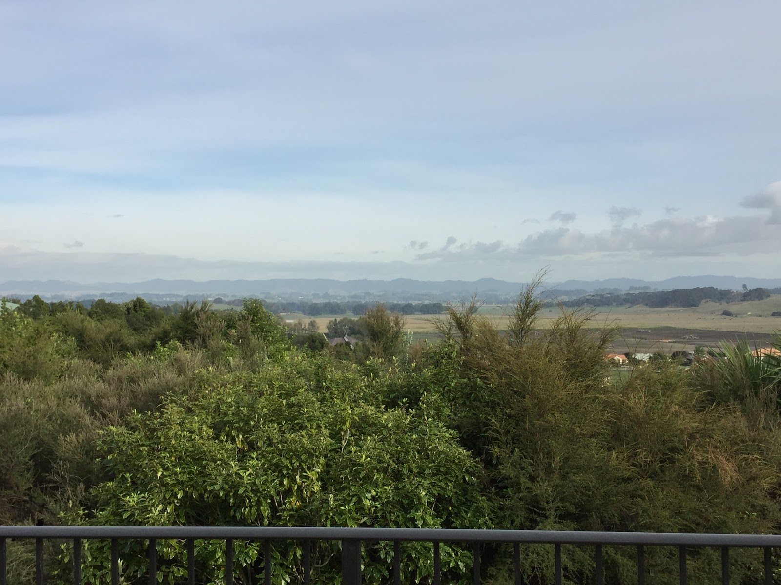
After a good sleep I woke to an empty house (not uncommon at Airbnb). I had made reservations for 11:45 before going to sleep and only had a 45 minute drive, so I leisurely made breakfast, sat on their amazing deck with a great view of Hamilton and ate and took a shower, said goodbye to Rocco (their sweet little dog) and hit the road. I sooo wish I would have had more time to spend with Sue and Garry. They were such great people and I thoroughly enjoyed being around them. I truly hope I have the opportunity to meet with them again someday.

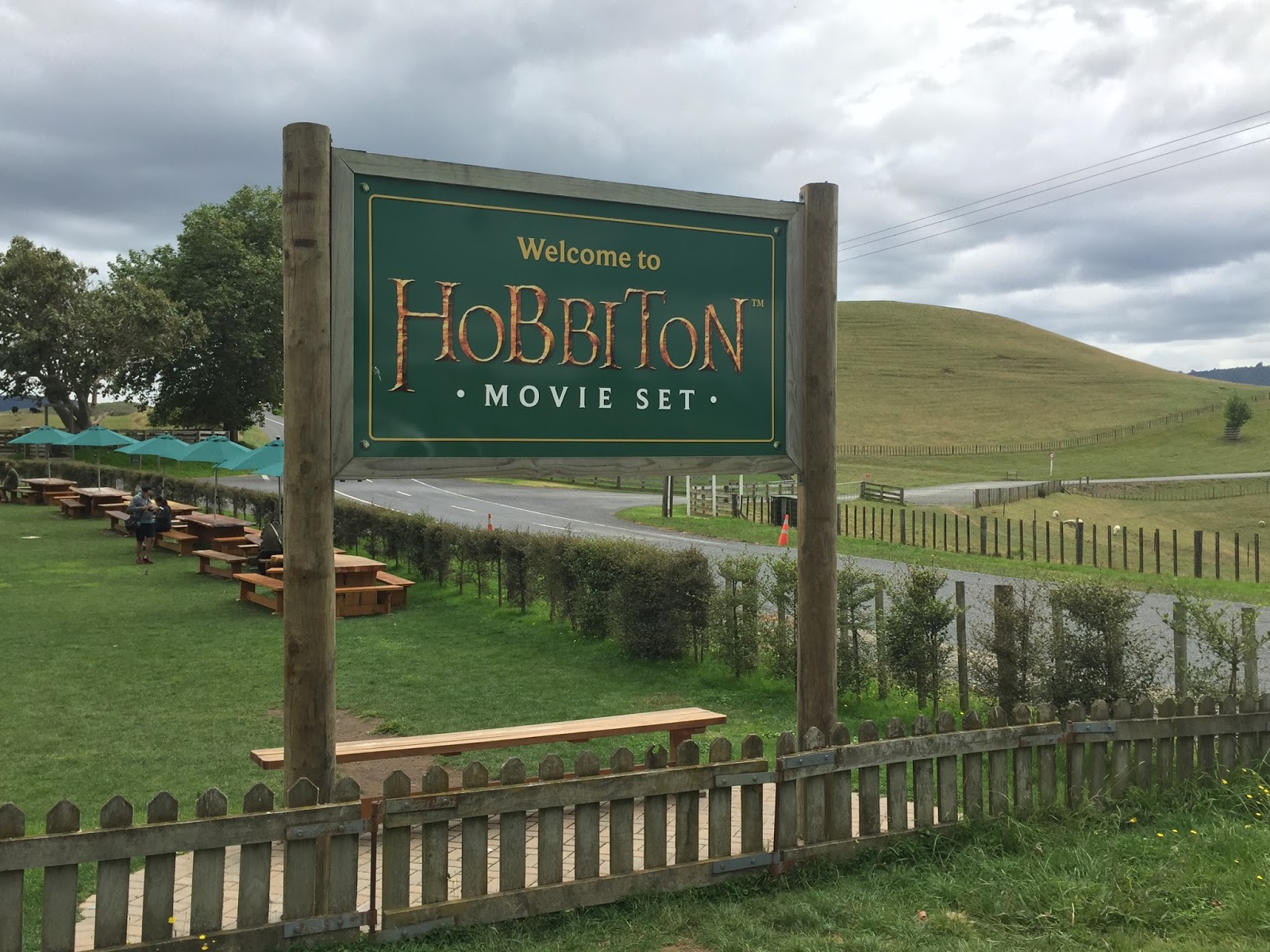
So my reservation was for a place that I kind of had some mixed emotions about visiting. On the one hand I thought it could be kind of fun….on the other hand I thought it might be kind of hokey and I had read several reviews to substantiate both views. At the end of the day it worked out that I was traveling within an hour of it so once again I decided, “what the heck….why not”.

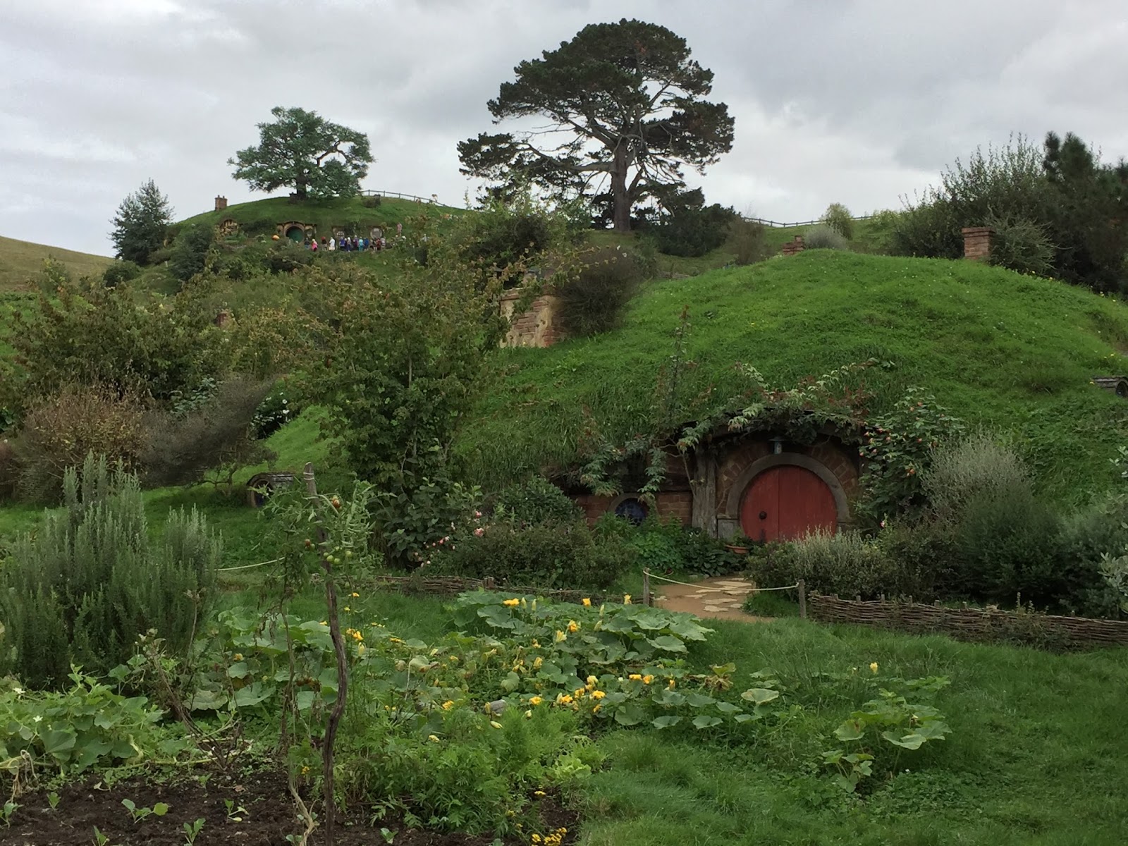
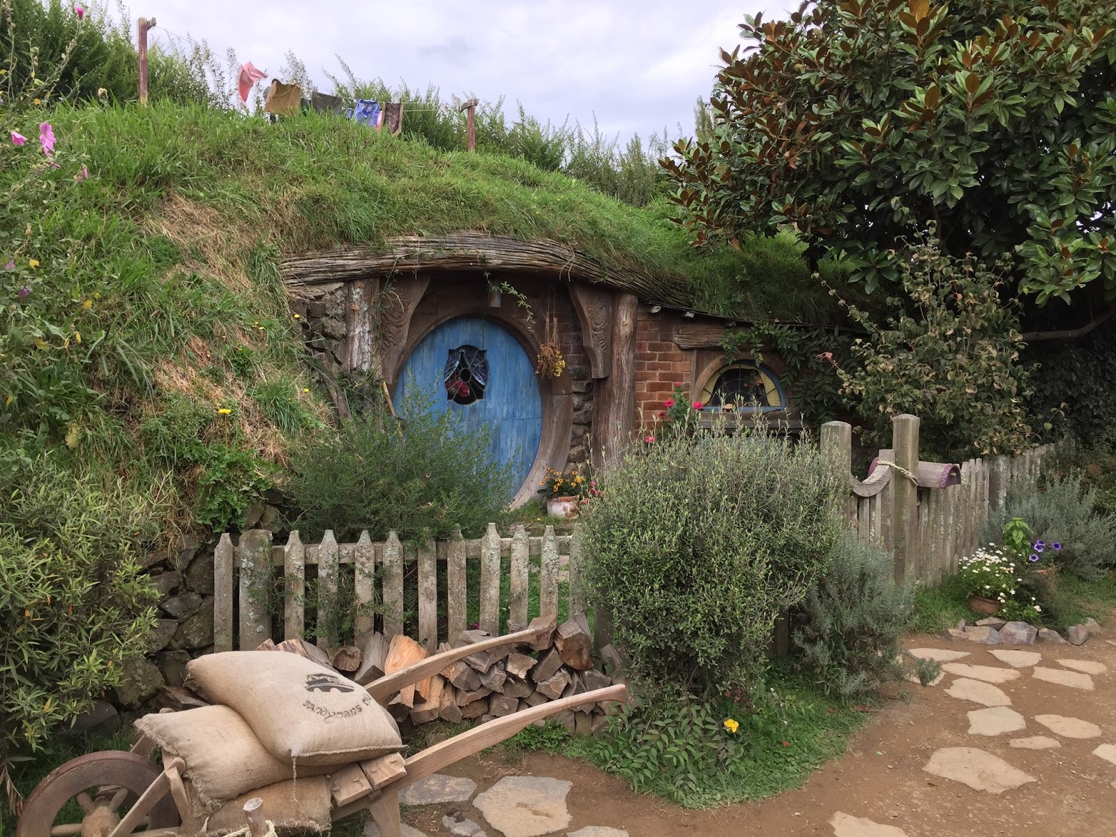
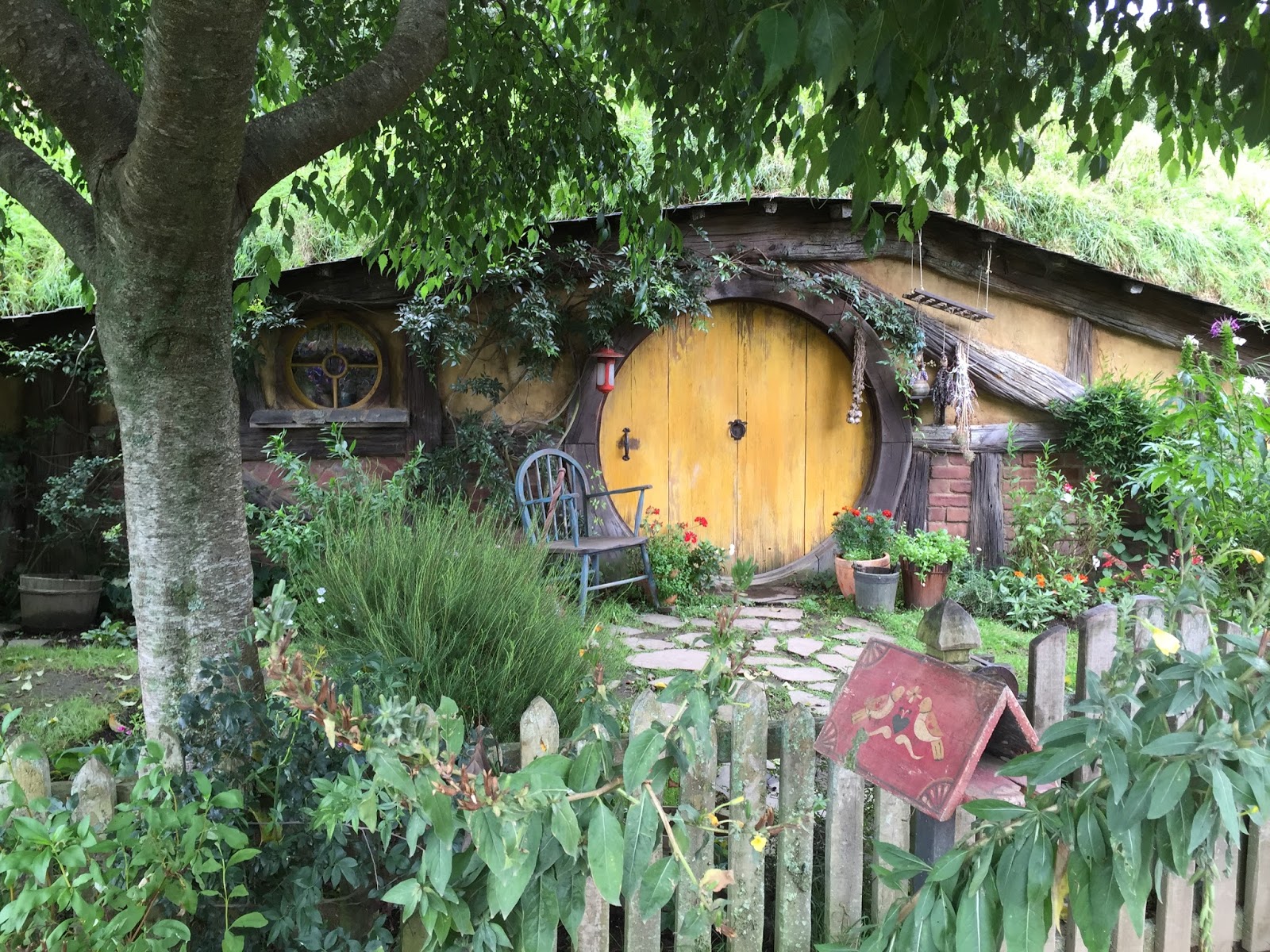
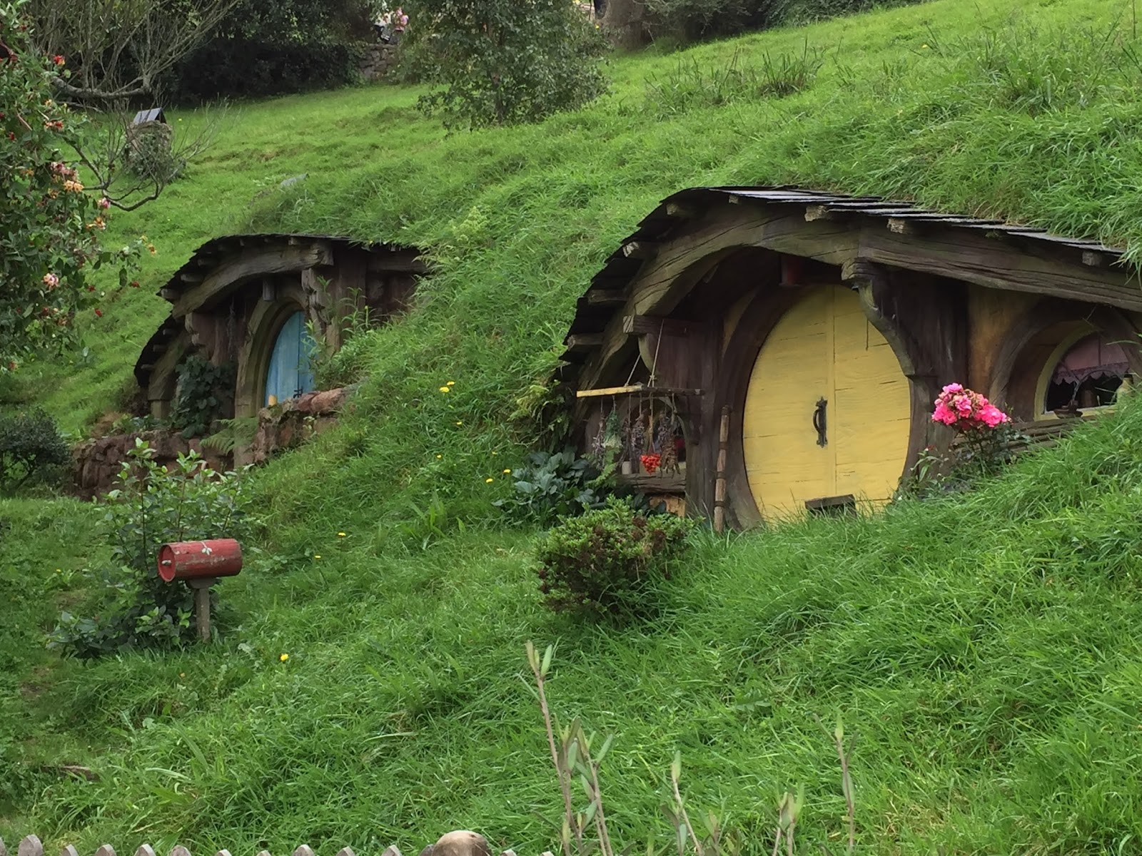
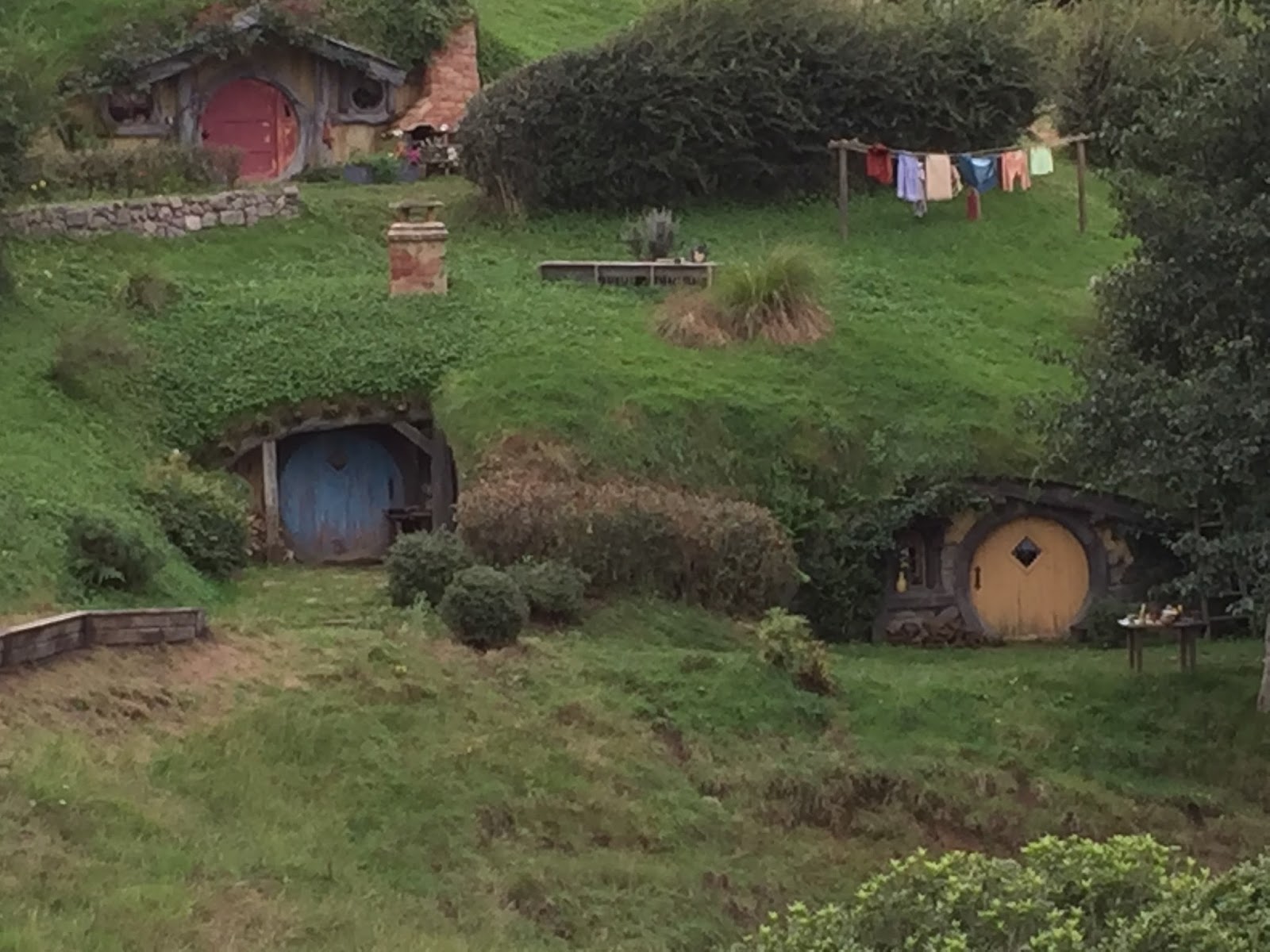
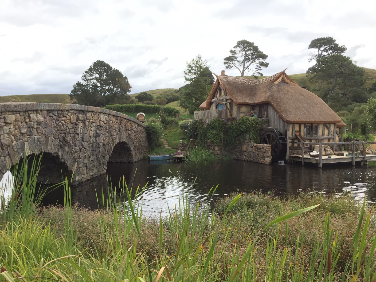
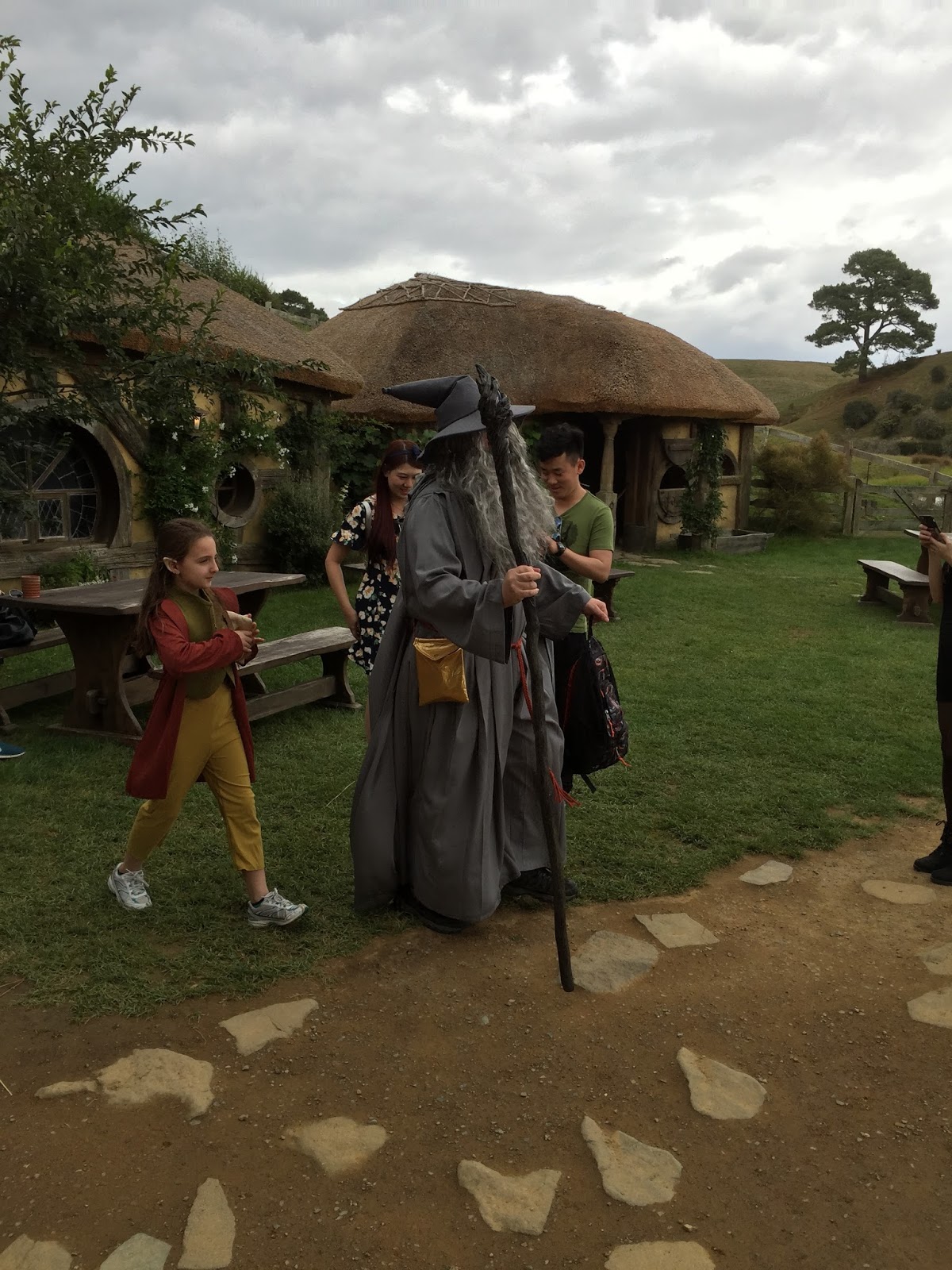
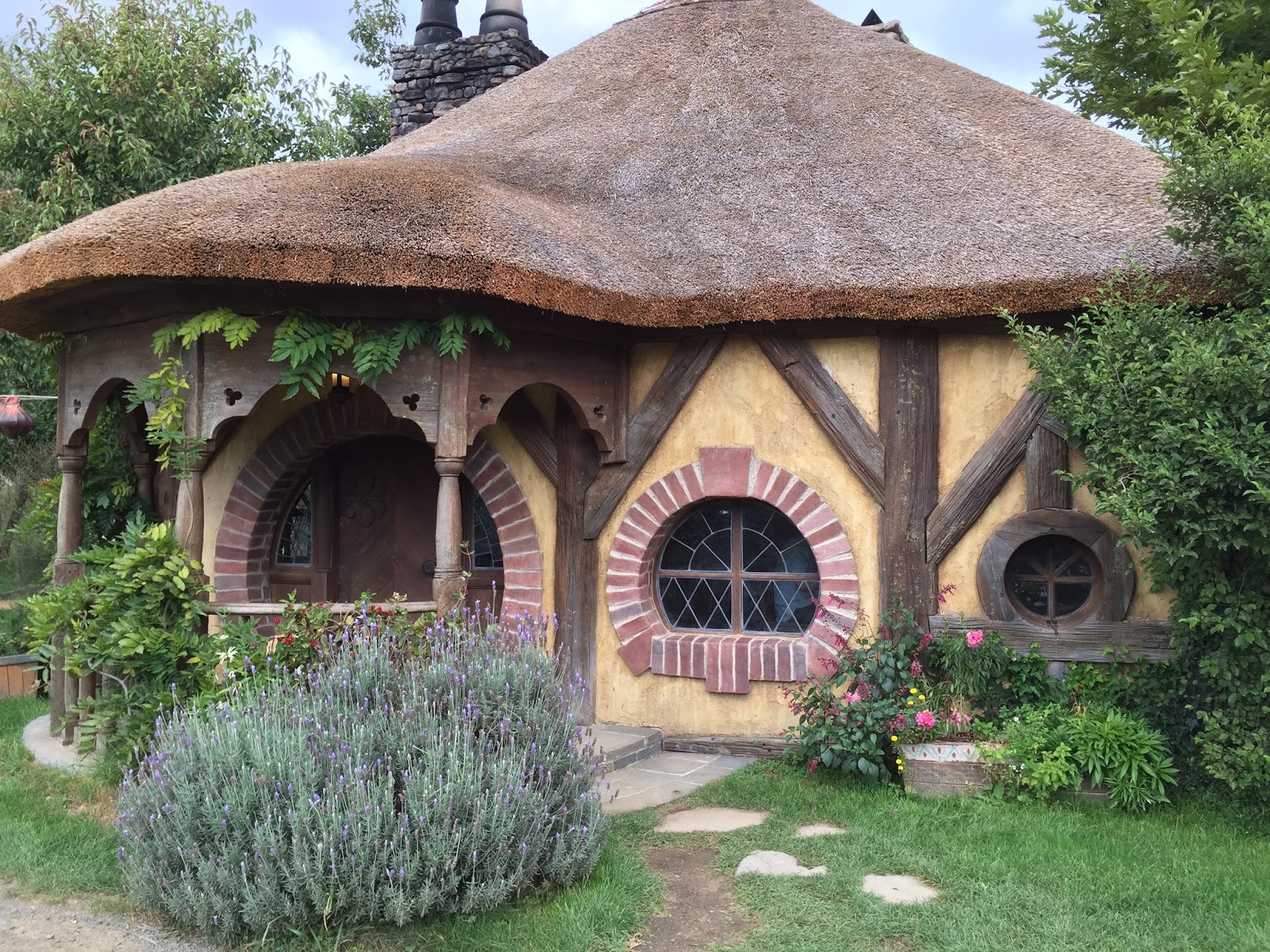
As we walked through The Shire our guide continued to provide information. Here are a few of the things she told us (that I can remember):
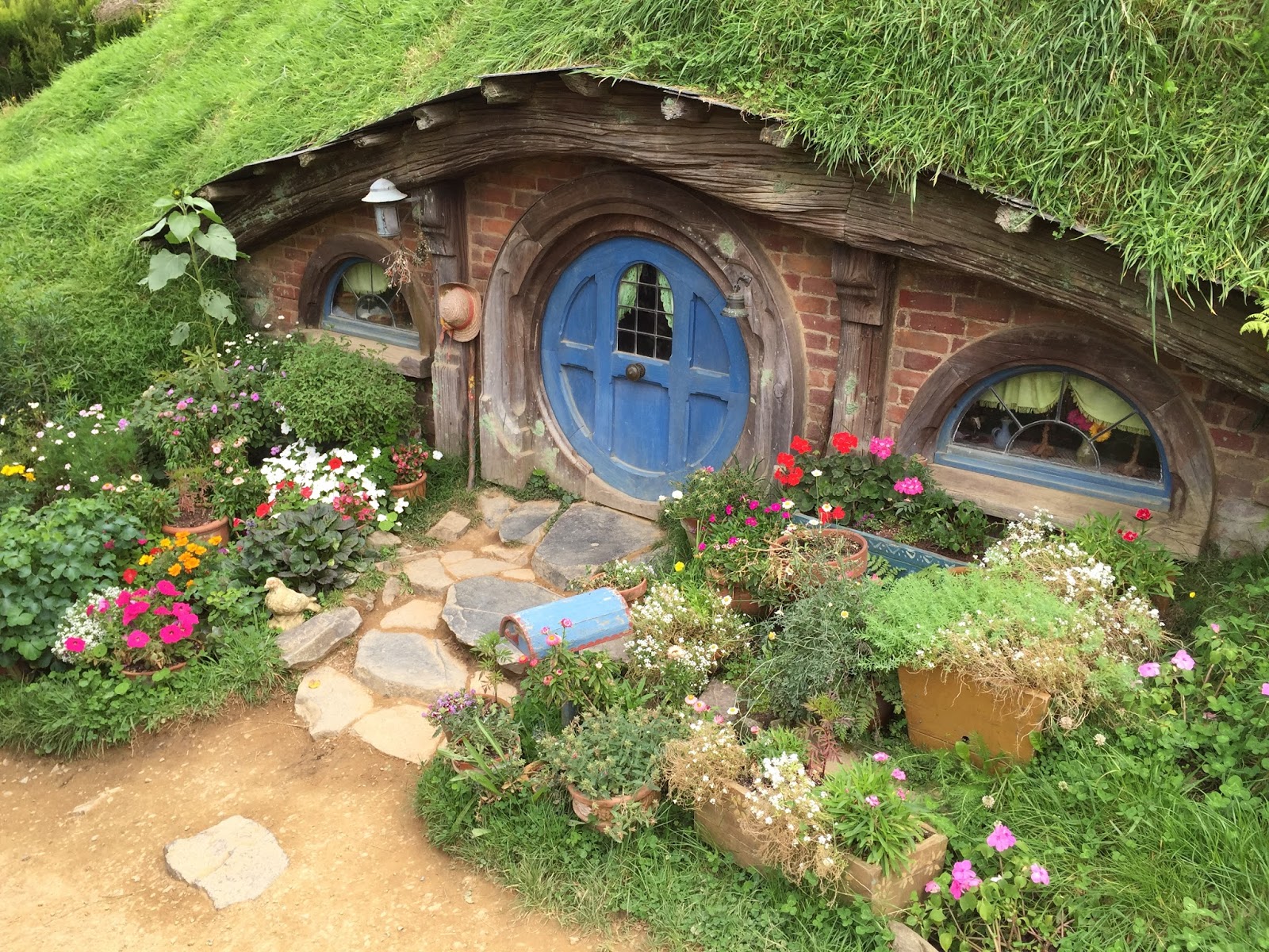
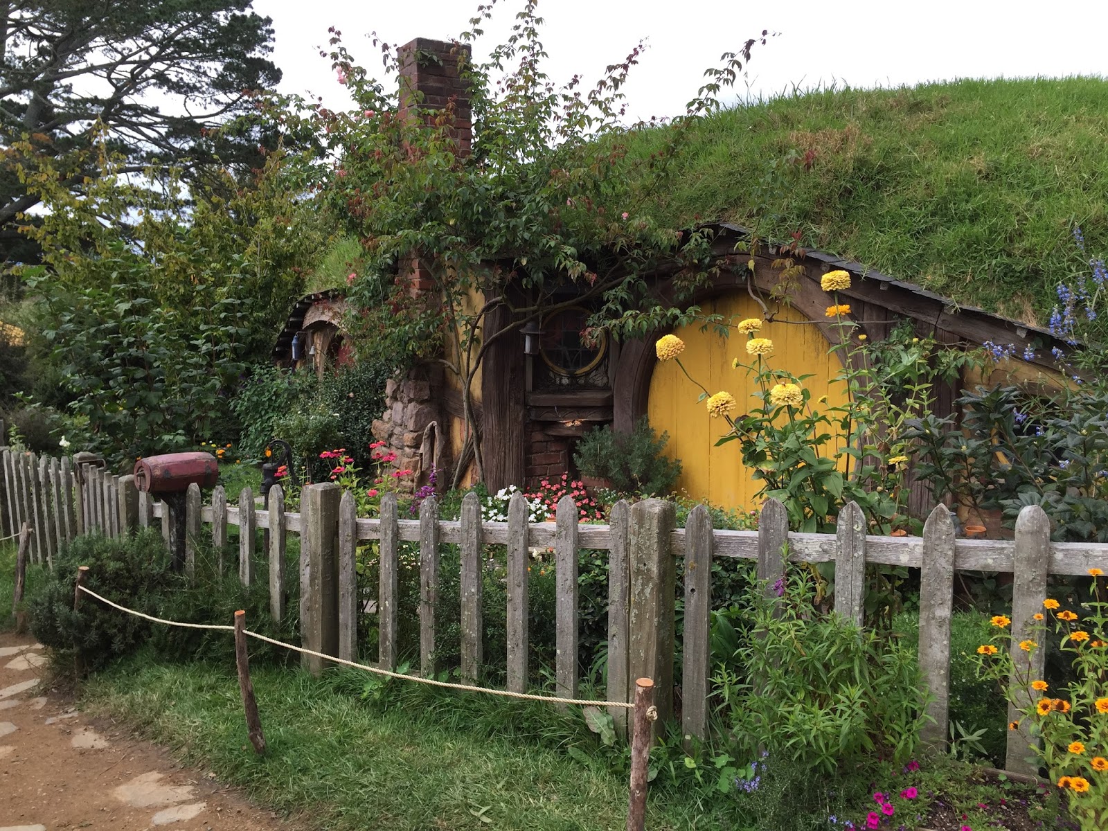
- The set was originally constructed for the LOTR series using temporary materials and was completely dismantled and removed after the filming. The current set was constructed for the Hobbit series and was constructed using permanent materials.
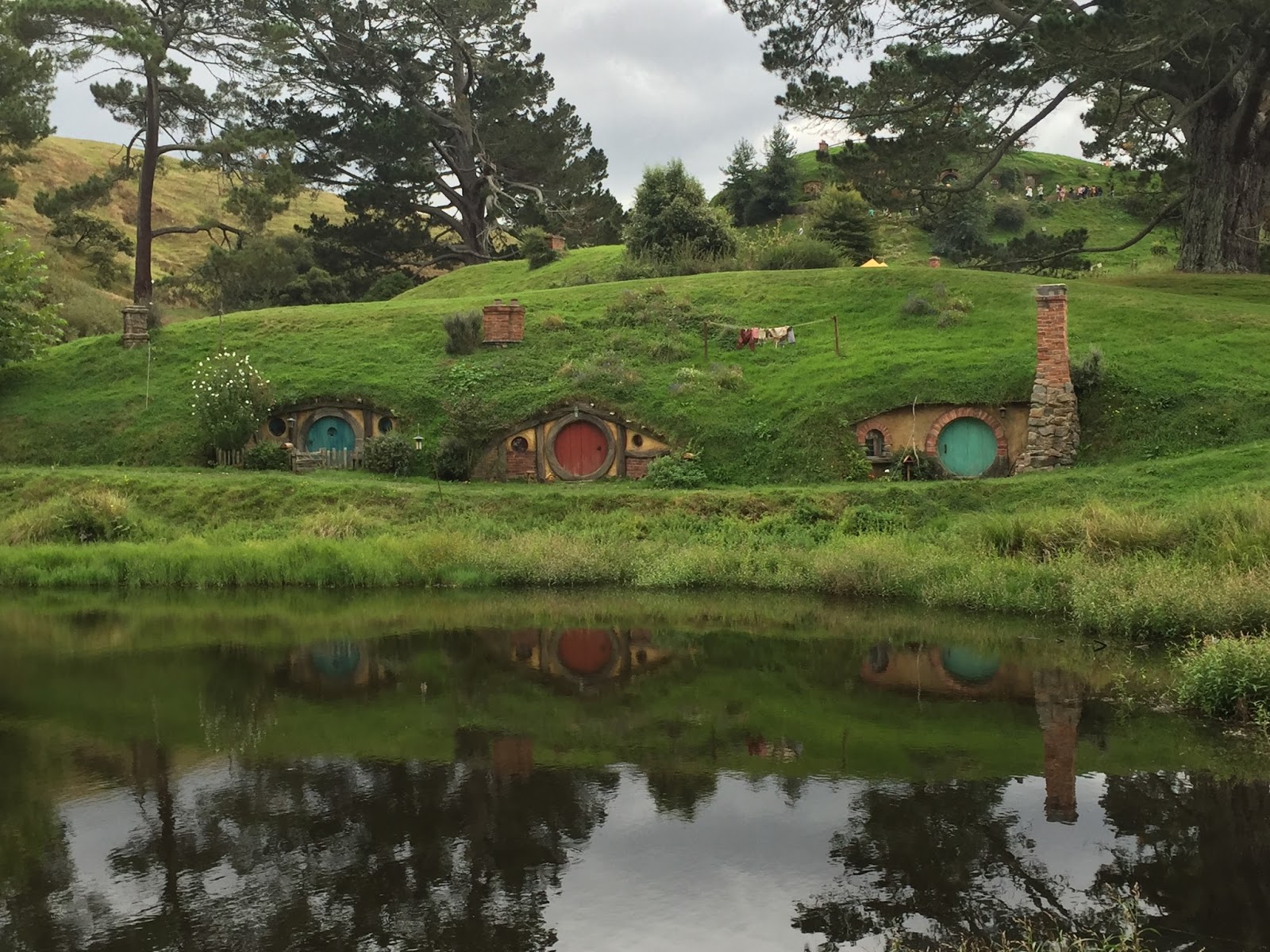
- There are 44 hobbit “holes” in The Shire
- There is nothing inside the holes (the inside scenes were filmed in a studio in Wellington…sorry)
- With the exception of a couple the holes they are only large enough to allow the doors to open so the actors can “appear” to walk in/out
- There are 3 different “scales” (heights) of holes in Hobbiton so they could allow some actors to look smaller (the hobbits) or bigger Gandalf while filming
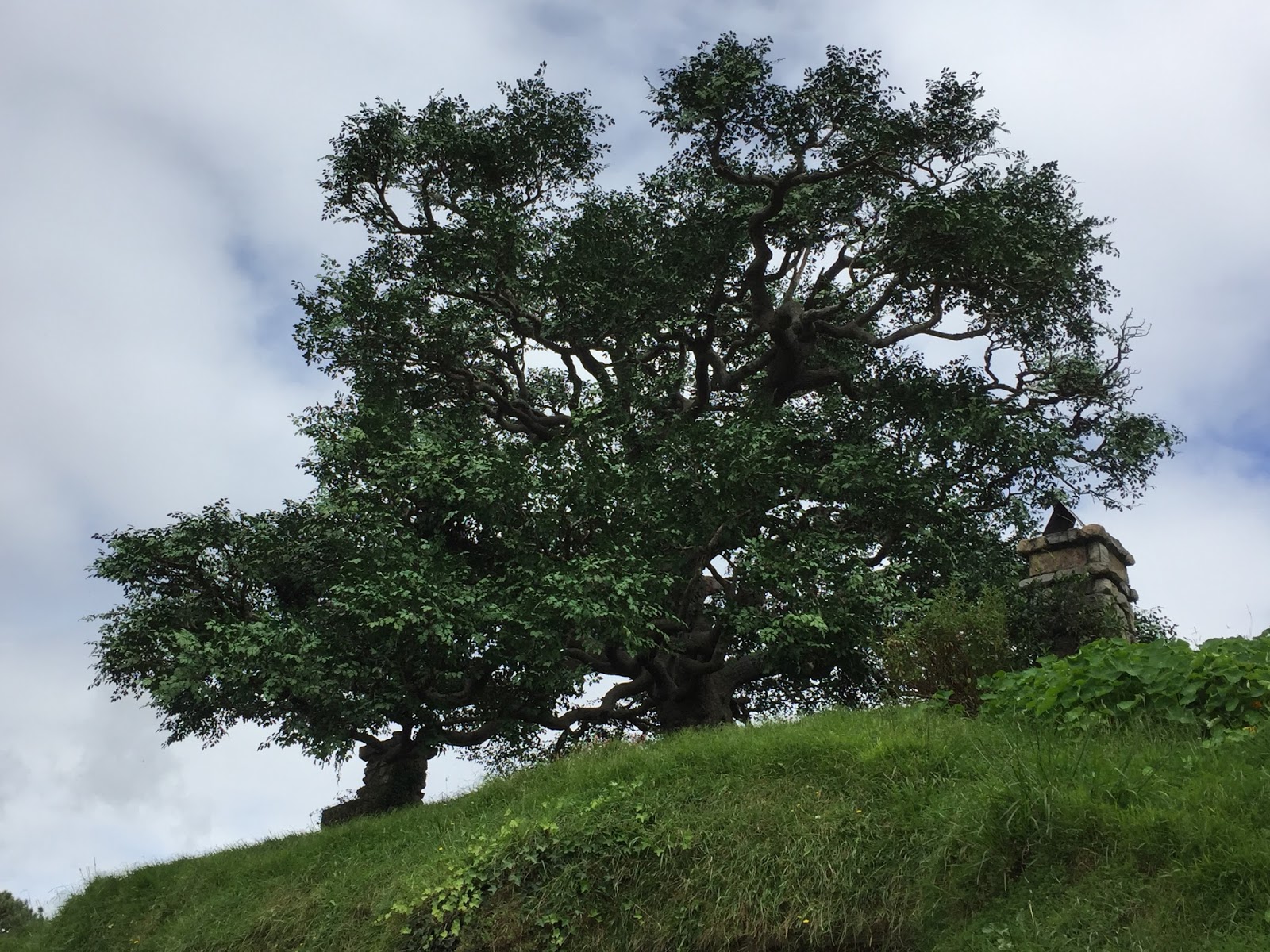
- The current tree at the top of the hill (above Bilbo’s hole) is fake (the only fake tree). Peter Jackson wanted a specific look for that tree so he had it constructed. It is made with steel, foam, rubber bark, and 250K fake leaves. After it was completed he didn’t like the color of the leaves so they hired people to paint each individual leaf a darker shade of green. It took 2 weeks (I think) and the tree was used in the movie for less than 1 minute. 🙂
- The scene where Gandalf and Bilbo sit and watch the sunset was actually a sunrise played in reverse since Bilbo’s hole faces West and not East. We were told that if you watch it slowly enough you can see 2 birds that flew through the shot flying backwards. I haven’t confirmed that one yet but plan to try. Maybe someone can try it and add a comment to the blog. 🙂
“In a Hole in the Ground There Lived a Hobbit” – J.R.R. Tolkien


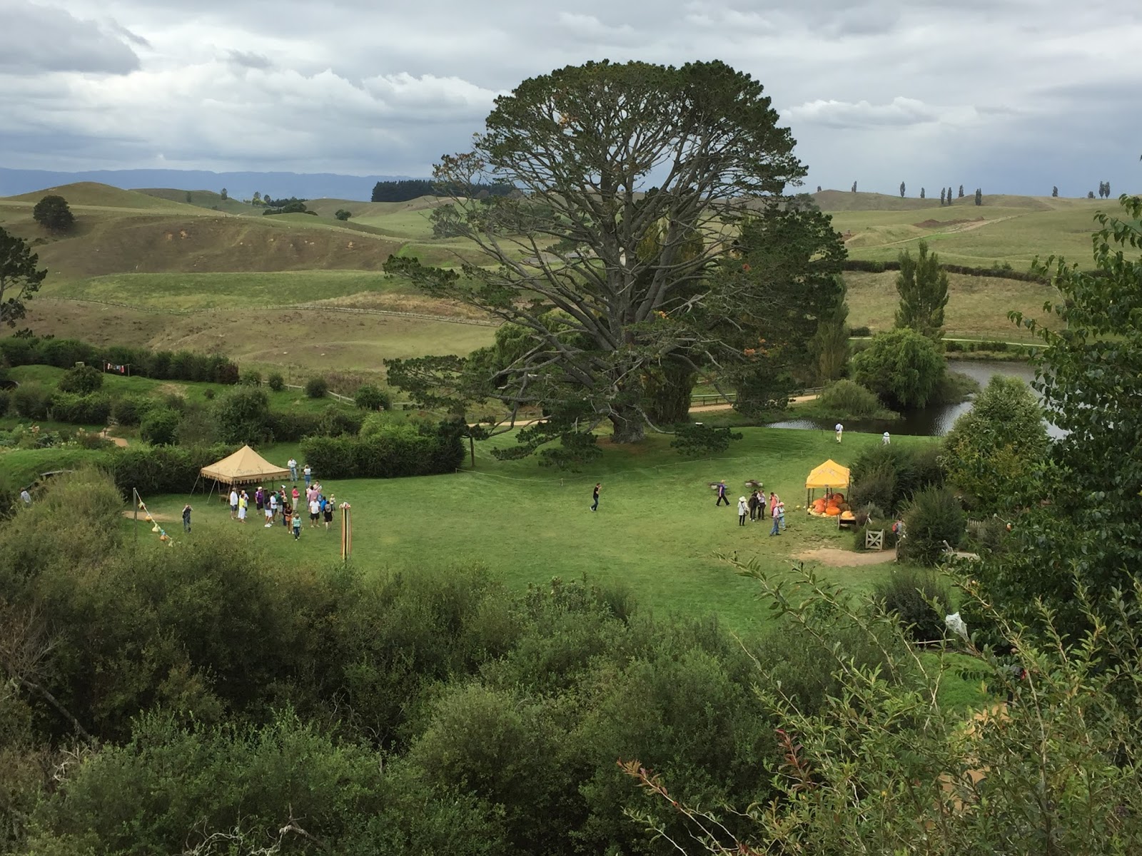


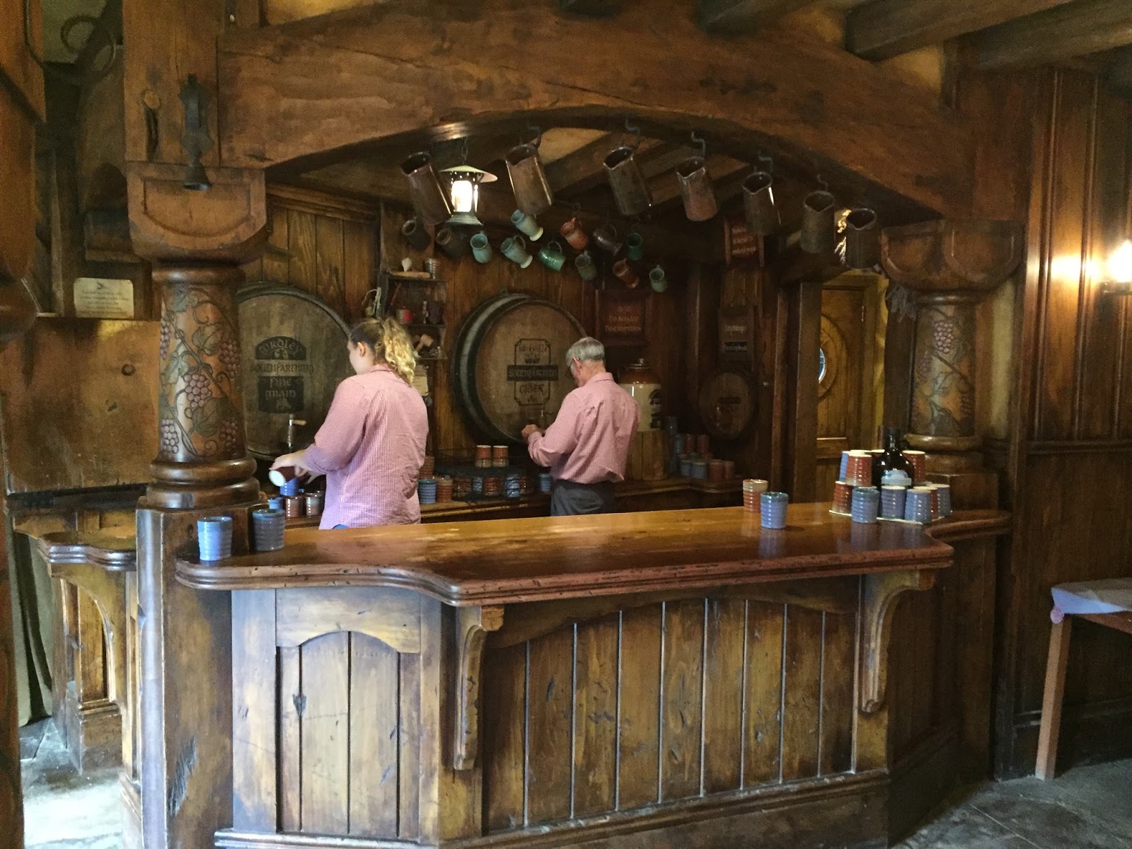
We finished our tour with a complementary Hobbiton beer at the Green Dragon (where Fordo and his mates hung out)….
After 20 minutes or so we made our way back to the bus and returned to the visitors center. I have to say I really enjoyed this and was very glad that I decided to do the Hobbiton tour. I would definitely recommend this to any LOTR fans who find themselves in the vicinity of Matamata New Zealand.
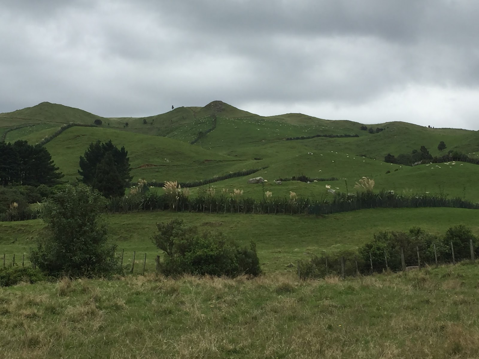
It was a just around 1:30 when I made it back to my car. I knew I had a 2:30 hour drive to my destination for the evening and had no interest in arriving early as it was pretty remote. I had planned to go through Rotorua on the way but in looking at the map I thought it might be cool to go to Tauranga (Google) on the eastern coast and check out the view from Mount Maunganui (Google, Wiki, Images) an extinct volcano. In looking at google maps I estimated that it should only add 1:30-2 hours to the trip so I figured “why not”. So off I went off on another adventure. (The Hobbit).
Although it started raining (I was thankful it did not rain earlier) the drive to outskirts of Tauranga was easy and quick enough. However, as I began to try and get across Tauranga I ran into an unbelievable amount of traffic. I thought for a while I was in NYC rush hour…..it was truly insane. And to make matters worse school was just getting out so there were hundreds (maybe thousands 🙂 of kids running in and out of cars and crossing streets. It took me longer to get across Tauranga to the peninsula where Mt. Maunganui was than it did to go the 53km from Matamata to Tauranga. By the time I reached Mt. Maunganui I was quite late and so frustrated that I barely wanted to get out. When I did get out I found out that there was no direct route to the top and the return hike was going to take 1:30 hours. So, I quickly checked out the beach, snapped a few pictures and headed out of town as quickly as possible….which of course was not quick at all.
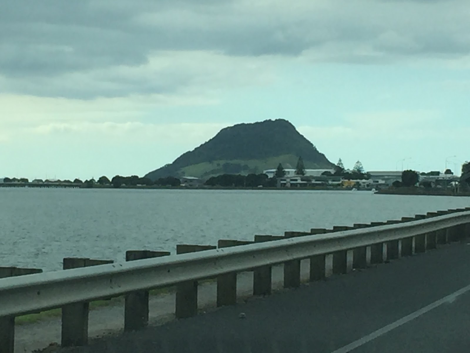 |
| Mount Maunganui |
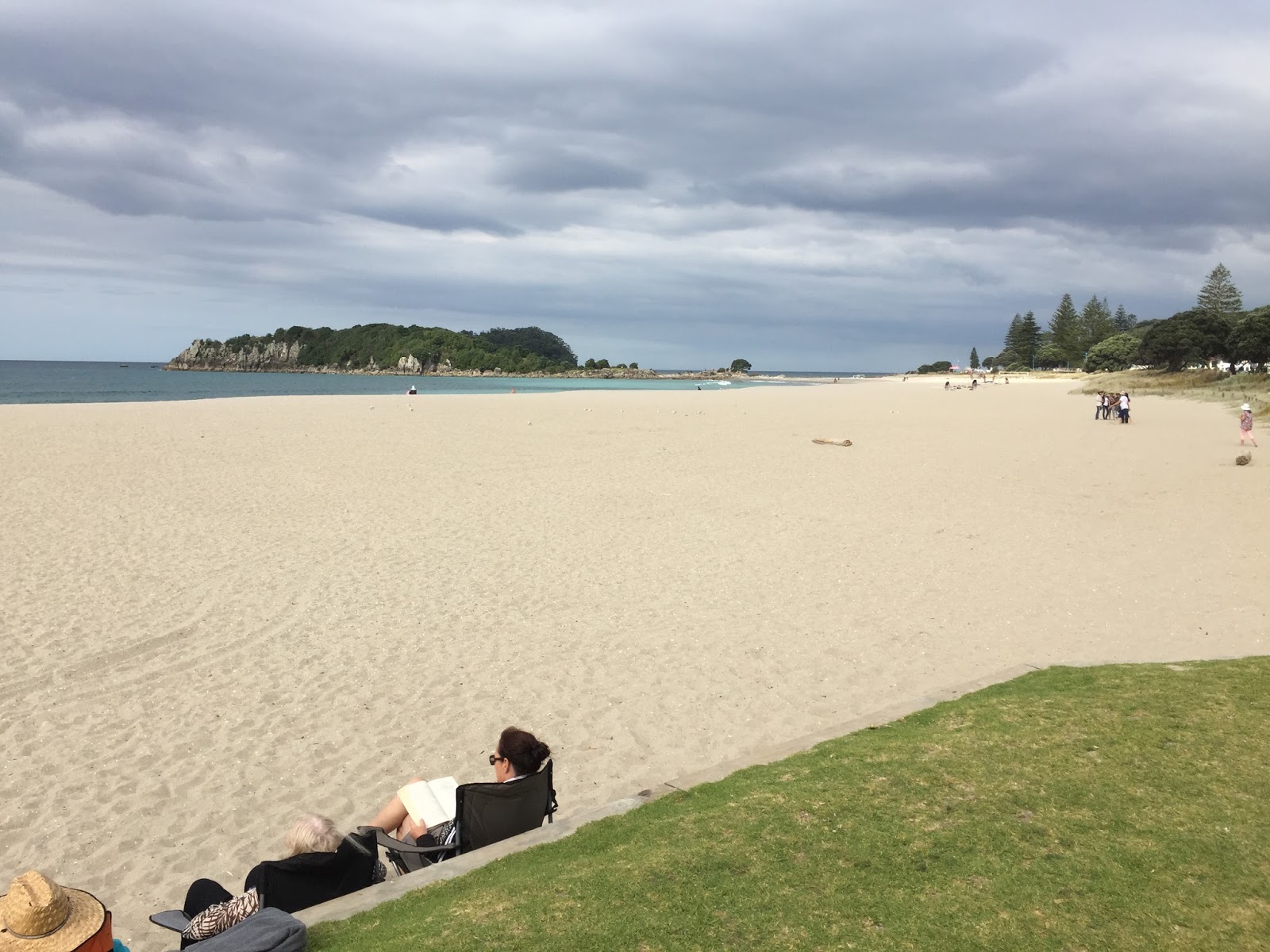 |
| The Main Beach |
Leaving Tauranga was not quite as painful and frustrating as going across it as I was able to go south of town; however, it was still quite slow and painful for about 5 miles. The beach area looked like a nice place to vacation; however, I can say this is one New Zealand town that, based on my very limited experience, I do not care to ever go back to. So I headed south to Rotorua.
If you recall my first blog post from New Zealand (Day 29 – Welcome to New Zealand) I mentioned that the country of New Zealand lies on the Pacific Ring of Fire and I wrote about all of the seismic activity in the South Island, especially around Christchurch. While the Southern Island is known for seismic activity the Northern Island is known for geothermal and volcanic activity….especially in the central part near Rotorua and Taupo, my next 2 destinations (Thermal Activity).
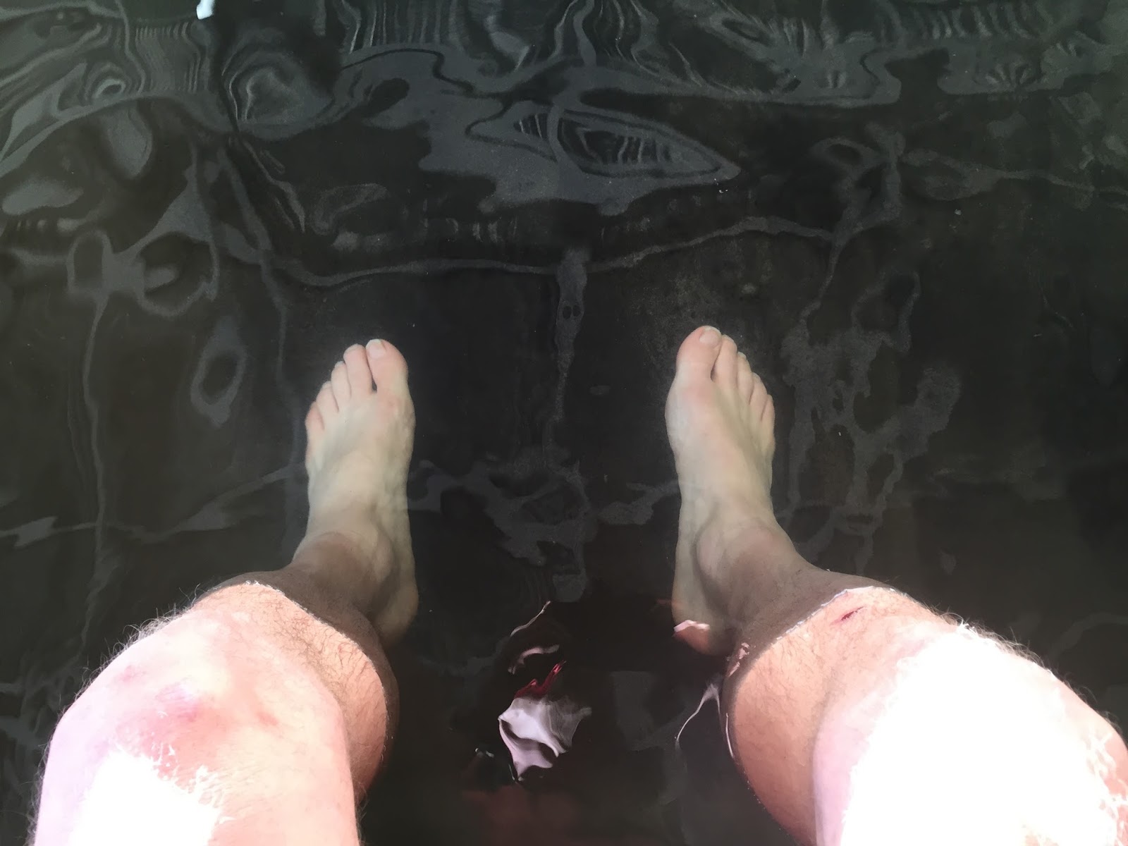
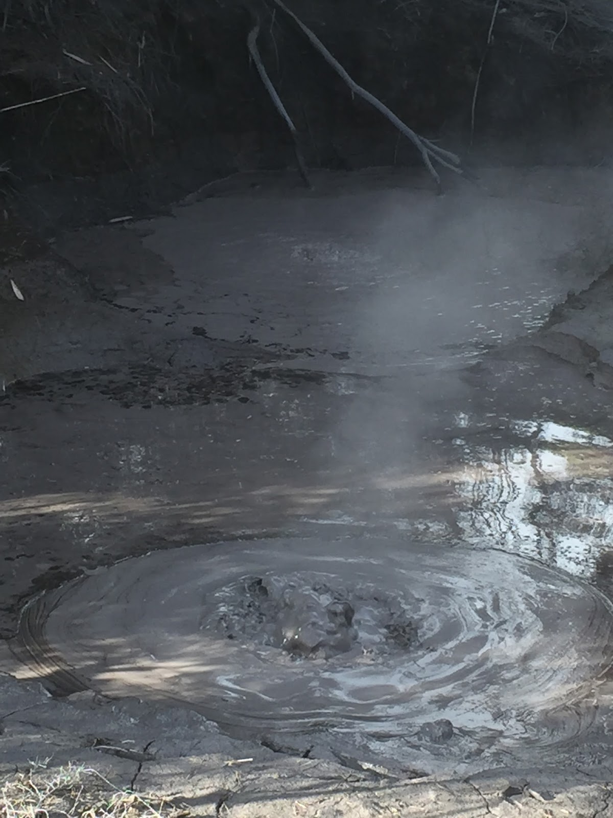
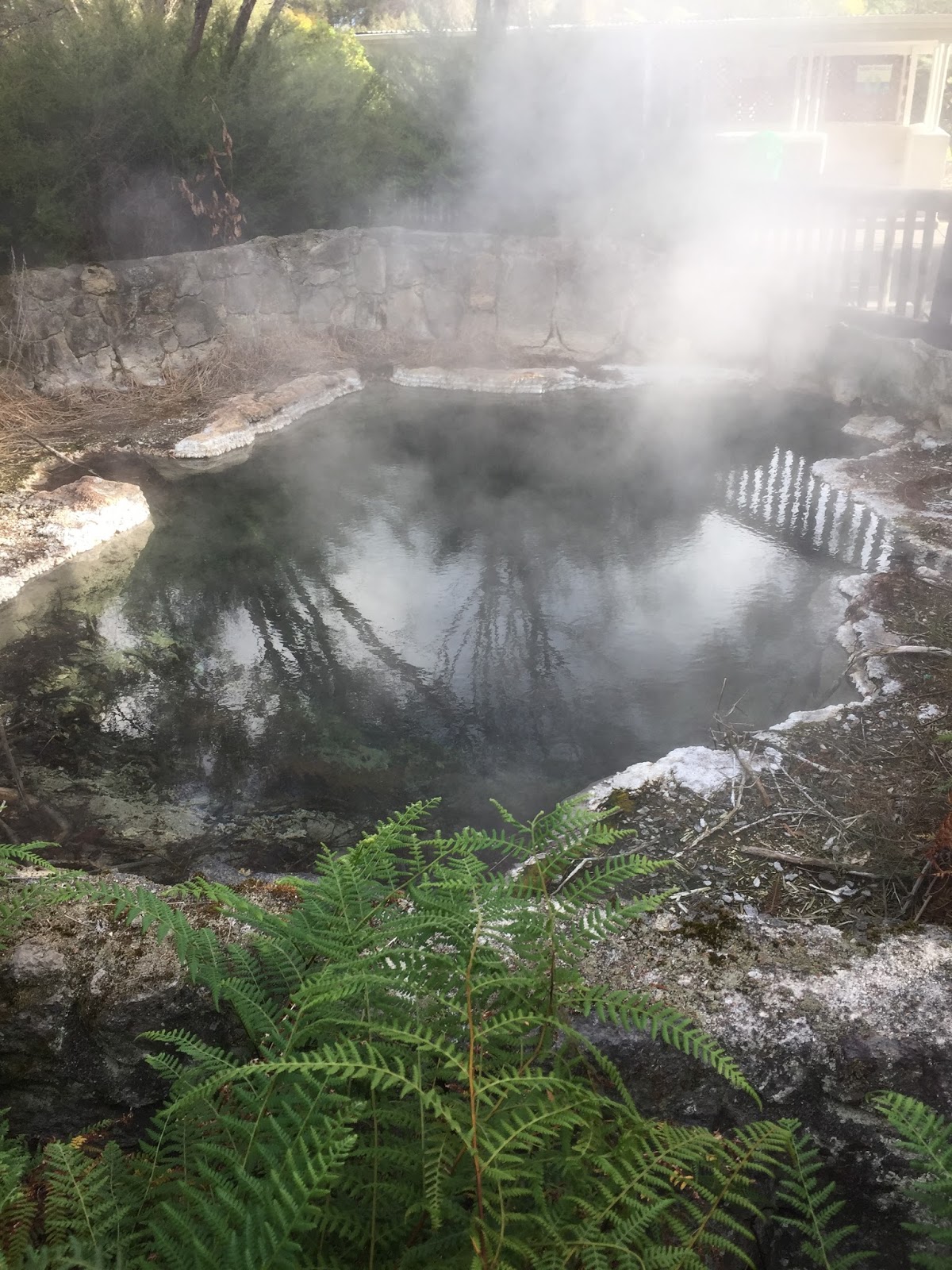
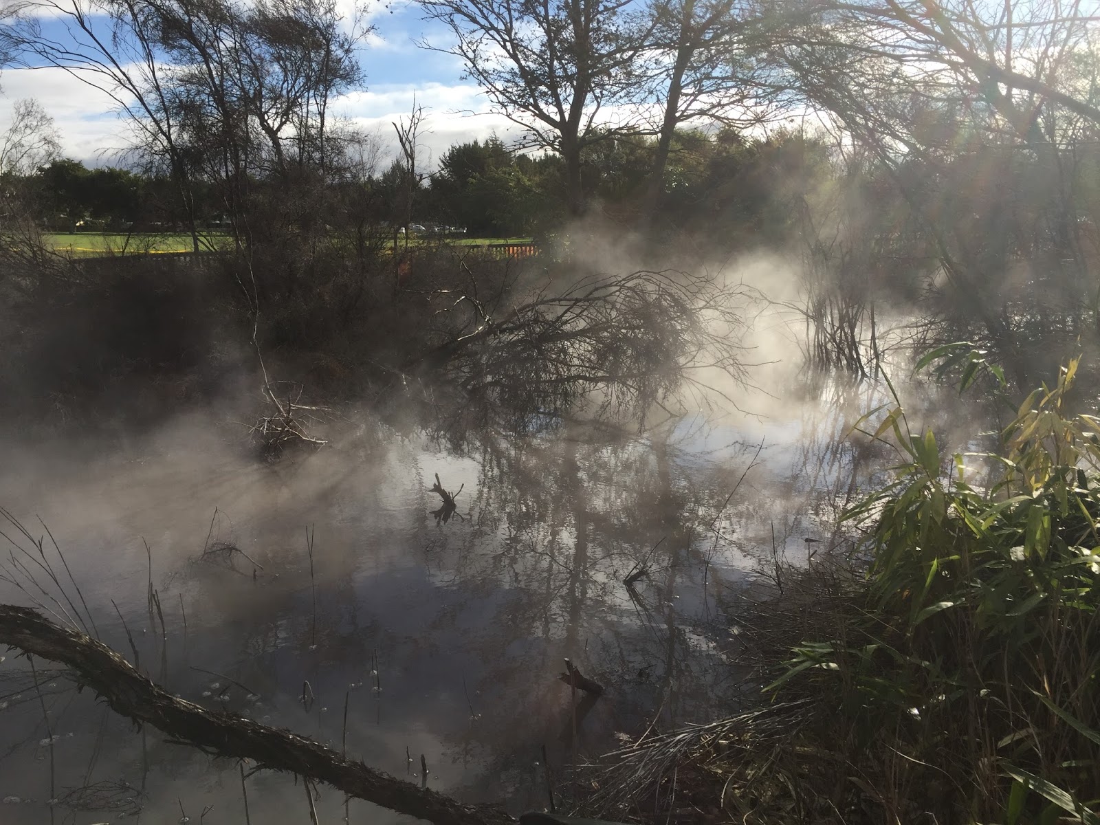
Aside from knowing about the thermal activity and that I wanted to visit the town I’ll admit that I didn’t know much about Rotorua (Google, Web, Images) until I arrived there. I literally drove into town, parked on a street and began to google things to see in Rotorua. And since I had wasted time in Tauranga it was now after 4 and many things would be closing soon. I discovered there was a city park called Kuirau Park (Web, Images) about 4 blocks from me where you could walk around and check out the geothermal activity so I headed over.
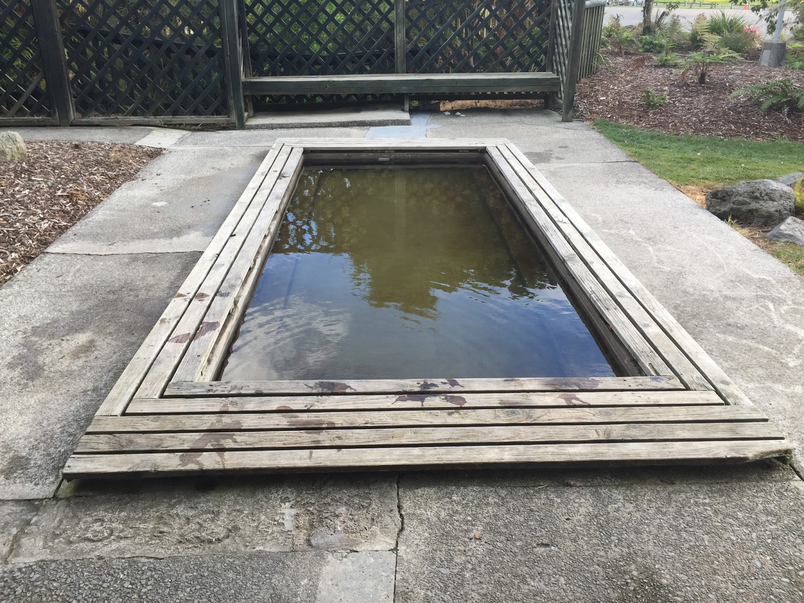
I walked around the park and checked out several of the bubbling mud pools and steaming ponds. Walking around the park reminded me a lot of the La Brea Tar Pits in Los Angeles and the hot mud pools and steam geysers in Yellowstone National Park. They also had two hot water wading pools that are naturally heated by the thermal activity in the park. So I figured, while in Rome, and took a short break for a nice warm foot bath…..

After the park I drove down to the lake….Lake Rotorua (Google) and saw an old style paddle steamboat that is used for dinner cruises around the lake leaving the port. I caused me to remember my childhood growing up in Kentucky when we visited St. Louis and took a cruise on a paddle steamboat on the Mississippi river.

After that I grabbed some takeout Chinese food and headed to a public parking lot on the edge of town beside the Silver Oaks Geyserland Hotel. Well….where do you eat your Chinese food? 😉 Just in case you’re wondering :-)….there is a sizable geyser called the Pohutu Geyser (Google, Images) at a park called Te Puia in Rotorua. Unfortunately the park was now closed…and (more importantly for me) it was quite expensive…..just to see a geyser (I wouldn’t have paid it if the park was open). So in my reading I read that you could actually view the geyser for free (through the fence) in the public parking lot behind the Silver Oaks Geyserland Hotel. So that is why I chose this particular location to eat my takeout Chinese food. 🙂 And while I was there a family showed up….not to eat Chinese takeout 😉 but to also watch the geyser erupt. So I don’t think it’s a big secret….
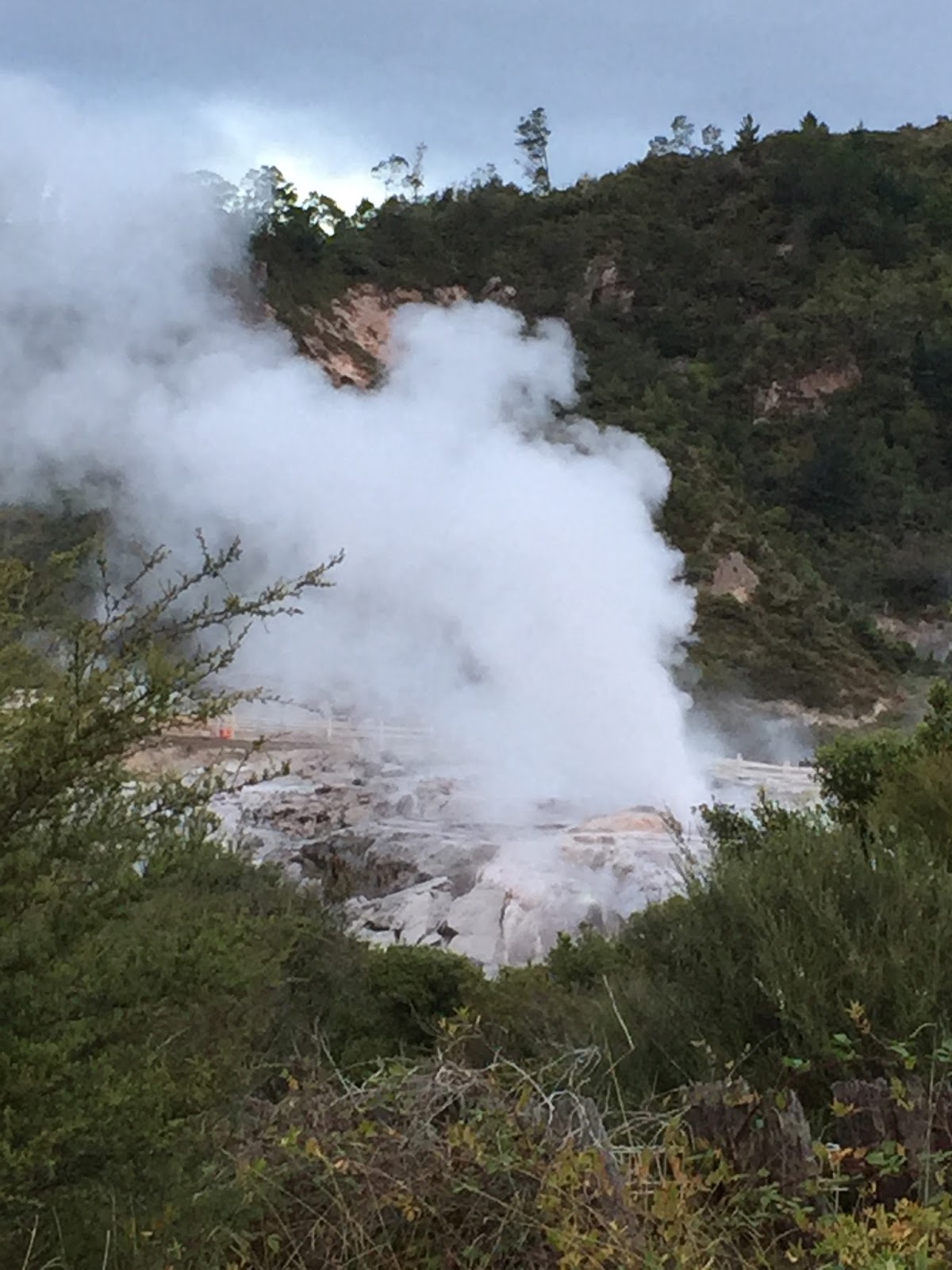
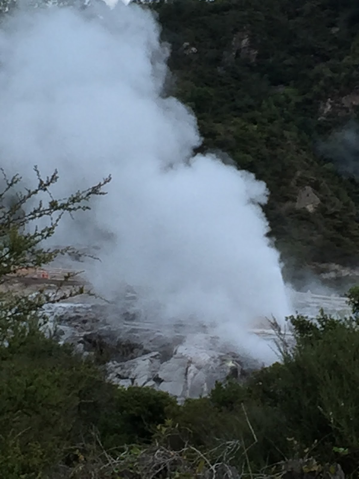
Standing there watching the geyser through the fence (for free) reminded me of the time my good friend Guy DeBellis and I stood outside the fence at Stonehenge in the Cotswolds in England and took the exact same pictures the people standing 5′ from us (on the “paid” side of the fence) were taking for….I can’t recall but I think it was probably $30+ each. 🙂 Rather than “cheap” or “illegal” I like to refer to it as “frugal” and “cost effective”. ha ha Anyway, I finished my Chinese takeout (it was good btw) and hit the road for Owhango, my destination for the evening.
Owhango is very remote and as I was driving through the darkness on the remote winding, mountain roads, with no cell coverage, I was REALLY hoping that the GPS on my phone knew where it was leading me. I have to admit that I questioned it more than a few times….”this can’t be right”….”are you serious”…”this frickin’ thing doesn’t know what it’s talking about or where the *%#$ I am!!!” :-). But in the end I have to give it credit as it led me straight (well, I guess it was straight….for all I know I did circles for an hour) to my Airbnb accommodations for the evening (more on that in tomorrow’s blog).
So for now, good night from Owhango New Zealand.
 |
| Where Am I |
Stephen Price says:
Yeah…travel tip #68….follow the cheapskate to find the good travel deals. ha ha
Guy DeBellis says:
I was thinking about Stonehenge as I was reading your blog, too. It "pays" to know your secret spots!